Enable Location

We need your location to show you interesting places around you

Discover nearby places

Find interesting locations and hidden gems around you

Precise directions

Get accurate directions and distances to places

Your location is never shared with other users. It's only used when you tap the location button.

Logan County

Log in to your account

Start exploring — it's free

Trusted by 65,433 travelers worldwide

Continue with Google
Continue with Apple
or

We will send you a code to connect

By continuing, you accept our Terms and Conditions and our Privacy Policy

Check your inbox

We've sent a pincode in your inbox. Please enter the code below.

Discussion Reviews 1 Photos
9.9k Popularity

Logan County, Administrative county in western Kansas, United States.

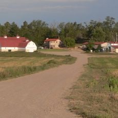
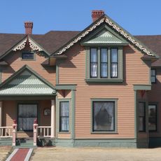
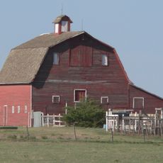
Logan County is an administrative county in western Kansas, made up mostly of farmland, open prairie, and a few small communities spread across a flat landscape. The county seat is Russell Springs, and the area is crossed by Interstate 70 and U.S. Highways 40 and 83, which are the main roads linking the region.

The area was originally called St. John County and was renamed Logan County in 1887 to honor General John Logan, a well-known officer from the Civil War. Settlement in the region grew steadily during the second half of the 1800s as pioneers moved westward across Kansas.

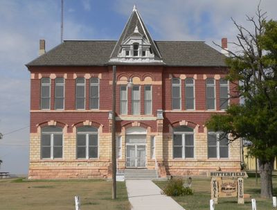
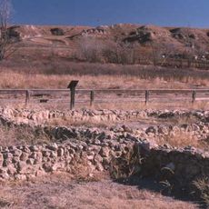
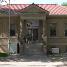
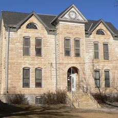
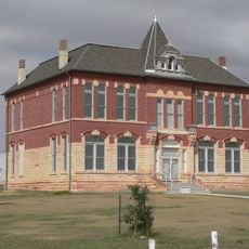
The Butterfield Trail Museum in Russell Springs displays objects and documents from the region's early settlement period. Visitors can get a sense of what daily life looked like for the people who first built communities in this part of Kansas.

The county is mostly rural, so gas stations and shops are few and spread out across long distances. Before heading into remote areas, it is a good idea to fill up on fuel and carry enough food and water for the day.

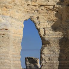
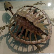
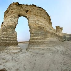
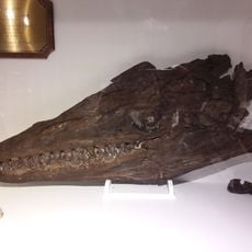
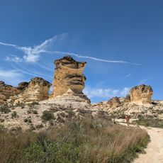
Little Jerusalem Badlands State Park contains chalk formations called the Smoky Hill Chalk Bluffs, which rise more than 100 feet (30 meters) above the Smoky Hill River. These formations date back to the Cretaceous period and have produced some of the most complete marine fossil finds in the Great Plains.

The community of curious travelers

AroundUs brings together thousands of curated places, local tips, and hidden gems, enriched daily by 60,000 contributors worldwide.

Start exploring
Location
Inception
February 24, 1887
Capital city
Oakley
Shares border with
Sherman County, Wichita County, Scott County, Thomas County, Gove County, Wallace County
GPS coordinates
38.90000,-101.13300
Latest update
March 3, 2026 10:12
Around this place
Mount Sunflower
United States of America

Mount Sunflower

79.4 km
Monument Rocks
United States of America

Monument Rocks

34.4 km
Smoky Hill Chalk Member
United States of America

Smoky Hill Chalk Member

19.8 km
Little Jerusalem Badlands State Park
United States of America

Little Jerusalem Badlands State Park

19.8 km
Lake Scott State Park
United States of America

Lake Scott State Park

31.2 km
Minor Sod House
United States of America

Minor Sod House

81.2 km
English Lutheran Church
United States of America

English Lutheran Church

10.6 km
El Quartelejo Ruins
United States of America

El Quartelejo Ruins

31.2 km
Mary Seaman Ennis House
United States of America

Mary Seaman Ennis House

70.6 km
Grainfield Opera House
United States of America

Grainfield Opera House

62.4 km
Oakley High School Stadium
United States of America

Oakley High School Stadium

35.2 km
Pond Creek Station
United States of America

Pond Creek Station

39 km
Goodland City Library
United States of America

Goodland City Library

70.6 km
Thomas County Courthouse
United States of America

Thomas County Courthouse

55.7 km
Beamer Barn
United States of America

Beamer Barn

41.3 km
Ruleton School
United States of America

Ruleton School

81.6 km
Greeley County Courthouse
United States of America

Greeley County Courthouse

71.8 km
Clark–Robidoux House
United States of America

Clark–Robidoux House

40 km
Lane County Community High School
United States of America

Lane County Community High School

74.8 km
Kuhrt Ranch
United States of America

Kuhrt Ranch

78.3 km
William B. and Julia Washington House
United States of America

William B. and Julia Washington House

50.5 km
Oxley Barn
United States of America

Oxley Barn

81.4 km
Old Logan County Courthouse
United States of America

Old Logan County Courthouse

4.2 km
Fick Fossil and History Museum
United States of America

Fick Fossil and History Museum

34.6 km
World's Largest Easel
United States of America

World's Largest Easel

69.4 km
Colby Aquatic Park
United States of America

Colby Aquatic Park

53.4 km
Giant van Gogh Painting
United States of America

Giant van Gogh Painting

69.4 km
Castle Rock Badlands
United States of America

Castle Rock Badlands

83.4 km
Show the full map
Reviews
Share your experience

No review yet

Discussions
Start a discussion...

No discussion yet

Administrative divisions
« Logan County - Administrative county in western Kansas, United States » is provided by Around Us (aroundus.com). Images and texts are derived from Wikimedia project under a Creative Commons license. You are allowed to copy, distribute, and modify copies of this page, under the conditions set by the license, as long as this note is clearly visible.

Discover hidden gems everywhere you go!

From secret cafés to breathtaking viewpoints, skip the crowded tourist spots and find places that match your style. Our app makes it easy with voice search, smart filtering, route optimization, and insider tips from travelers worldwide. Download now for the complete mobile experience.

Around Us App Screenshot

A unique approach to discovering new places

Le Figaro

All the places worth exploring

France Info

A tailor-made excursion in just a few clicks

20 Minutes

Around Us
Travel Guide & Maps
Download

Send to your phone

QR Code
1

Open the camera app on your mobile.

2

Point at the QR code with your camera. A notification will appear.

3

Tap the notification to open the link.