Enable Location

We need your location to show you interesting places around you

Discover nearby places

Find interesting locations and hidden gems around you

Precise directions

Get accurate directions and distances to places

Your location is never shared with other users. It's only used when you tap the location button.

Interstate 73

Log in to your account

Start exploring — it's free

Trusted by 64,027 travelers worldwide

Continue with Google
Continue with Apple
or

We will send you a code to connect

By continuing, you accept our Terms and Conditions and our Privacy Policy

Check your inbox

We've sent a pincode in your inbox. Please enter the code below.

Interstate 73
Discussion Reviews 1 Photos
35.7k Popularity

Interstate 73, Interstate highway in North Carolina, United States

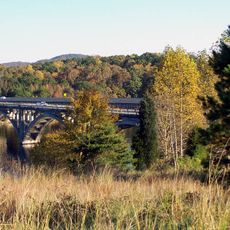
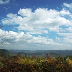
Interstate 73 is a divided highway running through North Carolina from Ellerbe in the south to Stokesdale in the north. The route passes through Greensboro and Asheboro, connecting smaller communities while traversing forested regions and recreational areas.

Planning for Interstate 73 began in 1991 under the Surface Transportation Act as part of a larger corridor proposal. The North Carolina section was developed gradually to improve regional connectivity.

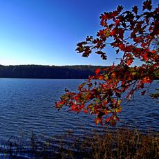
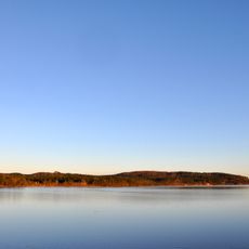
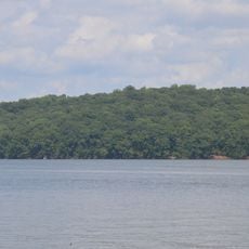
The development of Interstate 73 reflects North Carolina's commitment to connecting communities, with designated sections near the Uwharrie National Forest and Randleman Lake.

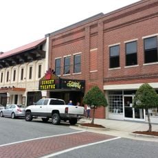
The highway offers multiple exits connecting to state roads and local communities along its length. Drivers can access commercial areas and rest stops with facilities at regular intervals.

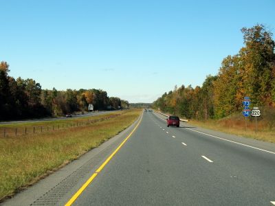
For several miles, Interstate 73 shares its roadway with Interstate 74 under a dual designation system. This overlapping route allows drivers to travel on both highways simultaneously on the same pavement.

The community of curious travelers

AroundUs brings together thousands of curated places, local tips, and hidden gems, enriched daily by 60,000 contributors worldwide.

Start exploring
Location
Inception
1997
GPS coordinates
35.58034,-79.80659
Latest update
December 18, 2025 20:10
Around this place
North Carolina Zoo
United States of America

North Carolina Zoo

6.7 km
Badin Lake
United States of America

Badin Lake

31.5 km
Pisgah Covered Bridge
United States of America

Pisgah Covered Bridge

9 km
Tuckertown Reservoir
United States of America

Tuckertown Reservoir

35.1 km
United States of America

Birkhead Mountains Wilderness

10.7 km
Hardaway Site
United States of America

Hardaway Site

33.7 km
United States of America

North Carolina Aviation Museum

11.2 km
Sunset Theater
United States of America

Sunset Theater

14 km
James B. Garrison Bridge
United States of America

James B. Garrison Bridge

39.1 km
Narrows Dam and Power Plant Complex
United States of America

Narrows Dam and Power Plant Complex

31.6 km
Wilson Kindley Farm and Kindley Mine
United States of America

Wilson Kindley Farm and Kindley Mine

23.7 km
Montgomery County Courthouse
United States of America

Montgomery County Courthouse

26 km
Marley House
United States of America

Marley House

29.5 km
Alexander Kelly House
United States of America

Alexander Kelly House

39.8 km
Liberty Historic District
United States of America

Liberty Historic District

37.3 km
Randolph County Courthouse
United States of America

Randolph County Courthouse

14 km
Moses Hammond House
United States of America

Moses Hammond House

40.2 km
Coleridge Historic District
United States of America

Coleridge Historic District

18.4 km
Siler City Commercial Historic District
United States of America

Siler City Commercial Historic District

34.8 km
James Bryant House
United States of America

James Bryant House

37.6 km
St. Paul's Methodist Episcopal Church South
United States of America

St. Paul's Methodist Episcopal Church South

27 km
Mount Ebal Methodist Protestant Church
United States of America

Mount Ebal Methodist Protestant Church

24.2 km
Randleman Graded School
United States of America

Randleman Graded School

26.5 km
Franklinville Historic District
United States of America

Franklinville Historic District

23.7 km
Shadrach Lambeth House
United States of America

Shadrach Lambeth House

38.1 km
Morrow Mountain State Park
United States of America

Morrow Mountain State Park

32.6 km
House in the Horseshoe
United States of America

House in the Horseshoe

40.3 km
North Carolina Pottery Center
United States of America

North Carolina Pottery Center

5 km
Show the full map
Reviews
Share your experience

No review yet

Discussions
Start a discussion...

No discussion yet

« Interstate 73 - Interstate highway in North Carolina, United States » is provided by Around Us (aroundus.com). Images and texts are derived from Wikimedia project under a Creative Commons license. You are allowed to copy, distribute, and modify copies of this page, under the conditions set by the license, as long as this note is clearly visible.

Discover hidden gems everywhere you go!

From secret cafés to breathtaking viewpoints, skip the crowded tourist spots and find places that match your style. Our app makes it easy with voice search, smart filtering, route optimization, and insider tips from travelers worldwide. Download now for the complete mobile experience.

Around Us App Screenshot

A unique approach to discovering new places

Le Figaro

All the places worth exploring

France Info

A tailor-made excursion in just a few clicks

20 Minutes

Around Us
Travel Guide & Maps
Download

Send to your phone

QR Code
1

Open the camera app on your mobile.

2

Point at the QR code with your camera. A notification will appear.

3

Tap the notification to open the link.