Enable Location

We need your location to show you interesting places around you

Discover nearby places

Find interesting locations and hidden gems around you

Precise directions

Get accurate directions and distances to places

Your location is never shared with other users. It's only used when you tap the location button.

Dewey County

Log in to your account

Start exploring — it's free

Trusted by 61,920 travelers worldwide

Continue with Google
Continue with Apple
or

We will send you a code to connect

By continuing, you accept our Terms and Conditions and our Privacy Policy

Check your inbox

We've sent a pincode in your inbox. Please enter the code below.

Dewey County, Administrative division in South Dakota, United States

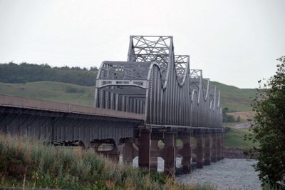
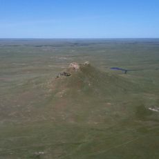
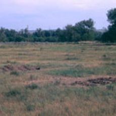
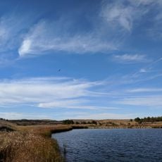
Dewey County is an administrative division in South Dakota with rolling hills that slope toward the southeast into the Missouri River basin. The Moreau River flows east-northeasterly across the landscape before joining the Missouri River, which forms the county's southeastern boundary.

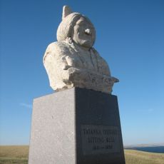
The county was established in 1883 and named after William P. Dewey, who served as Territorial surveyor-general during the 1870s. This naming honored his contributions to the area's early mapping and territorial development.

The area sits within the Cheyenne River Indian Reservation, where tribal traditions and contemporary Native American life shape the community's character. Local towns and gatherings reflect this connection, which influences how people here live and interact with one another.

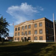
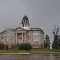
Timber Lake serves as the county seat and houses administrative services and government offices for those needing to conduct county business. Government facilities are located in central places that residents and visitors can easily access.

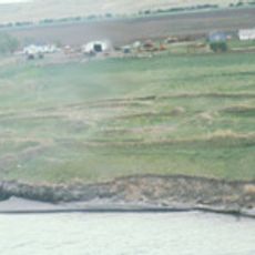
The Moreau River, flowing through the area, takes a distinctive path as it winds toward the Missouri River through changing terrain. This waterway historically shaped how people and resources moved through the region.

The community of curious travelers

AroundUs brings together thousands of curated places, local tips, and hidden gems, enriched daily by 60,000 contributors worldwide.

Start exploring
Location
Inception
1883
Capital city
Timber Lake
Shares border with
Corson County, Walworth County, Potter County, Sully County, Stanley County, Ziebach County, Haakon County
GPS coordinates
45.16000,-100.88000
Latest update
December 8, 2025 13:43
Around this place
Thunder Butte
United States of America

Thunder Butte

80.5 km
Lake Oahe
United States of America

Lake Oahe

87.5 km
Pierre Shale
Canada

Pierre Shale

92.8 km
Sitting Bull Monument
United States of America

Sitting Bull Monument

50.3 km
Fort Pierre Chouteau
United States of America

Fort Pierre Chouteau

94.1 km
Molstad Village
United States of America

Molstad Village

52.8 km
Chicago and North Western Railroad Bridge
United States of America

Chicago and North Western Railroad Bridge

96.4 km
Mobridge Masonic Temple
United States of America

Mobridge Masonic Temple

54.7 km
I. W. Goodner House
United States of America

I. W. Goodner House

96.5 km
Farr House
United States of America

Farr House

97.3 km
G.L. Stocker Blacksmith Shop
United States of America

G.L. Stocker Blacksmith Shop

74.4 km
D.H. and Leah Curran House
United States of America

D.H. and Leah Curran House

75 km
Dakota Club Library
United States of America

Dakota Club Library

33.2 km
Ziebach County Courthouse
United States of America

Ziebach County Courthouse

58.1 km
United States of America

Holy Spirit Chapel

61.2 km
Pierre Masonic Lodge
United States of America

Pierre Masonic Lodge

70.8 km
A. H. Brown Public Library
United States of America

A. H. Brown Public Library

54.7 km
Walworth County Courthouse
United States of America

Walworth County Courthouse

76.6 km
Brink-Wegner House
United States of America

Brink-Wegner House

96.5 km
Laurens Polygonal Hog House
United States of America

Laurens Polygonal Hog House

26.1 km
Sully County Courthouse
United States of America

Sully County Courthouse

81.7 km
George Holland House
United States of America

George Holland House

74.4 km
Potter County Courthouse
United States of America

Potter County Courthouse

74.6 km
L.E. Snyder House
United States of America

L.E. Snyder House

81.8 km
Selby Opera House
United States of America

Selby Opera House

77.7 km
Methodist Episcopal Church
United States of America

Methodist Episcopal Church

97.2 km
Little Moreau State Recreation Area
United States of America

Little Moreau State Recreation Area

27.7 km
Okobojo Point Recreation Area
United States of America

Okobojo Point Recreation Area

71.7 km
Show the full map
Administrative divisions
« Dewey County - Administrative division in South Dakota, United States » is provided by Around Us (aroundus.com). Images and texts are derived from Wikimedia project under a Creative Commons license. You are allowed to copy, distribute, and modify copies of this page, under the conditions set by the license, as long as this note is clearly visible.

Discover hidden gems everywhere you go!

From secret cafés to breathtaking viewpoints, skip the crowded tourist spots and find places that match your style. Our app makes it easy with voice search, smart filtering, route optimization, and insider tips from travelers worldwide. Download now for the complete mobile experience.

Around Us App Screenshot

A unique approach to discovering new places

Le Figaro

All the places worth exploring

France Info

A tailor-made excursion in just a few clicks

20 Minutes

Around Us
Travel Guide & Maps
Download

Send to your phone

QR Code
1

Open the camera app on your mobile.

2

Point at the QR code with your camera. A notification will appear.

3

Tap the notification to open the link.