Enable Location

We need your location to show you interesting places around you

Discover nearby places

Find interesting locations and hidden gems around you

Precise directions

Get accurate directions and distances to places

Your location is never shared with other users. It's only used when you tap the location button.

Monroe County

Log in to your account

Start exploring — it's free

Trusted by 61,864 travelers worldwide

Continue with Google
Continue with Apple
or

We will send you a code to connect

By continuing, you accept our Terms and Conditions and our Privacy Policy

Check your inbox

We've sent a pincode in your inbox. Please enter the code below.

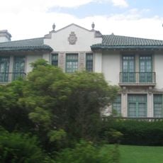
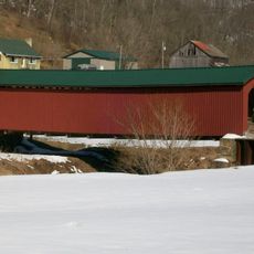
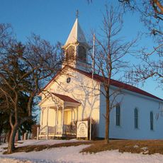
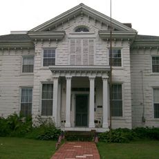
Monroe County, Administrative county in southeastern Ohio, United States

Description

Monroe County is an administrative county in southeastern Ohio characterized by rolling terrain and waterways that flow through sections of the Appalachian Plateau. The landscape features a mix of hills and river valleys that define its topography.

History

The county was established in 1813 and named after James Monroe, who served as Secretary of State at that time. This founding marked the formation of administrative governance in this southeastern region of Ohio.

Culture

The Switzerland of Ohio Local School District manages education across Monroe County, including Monroe Central High School and River High School.

Practical

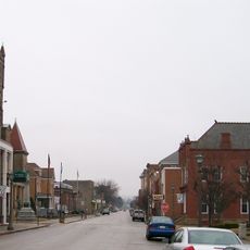
The region is sparsely populated, meaning visitors will find open landscapes and less traffic congestion. Allow extra travel time between locations since distances between destinations can be greater than in more densely developed areas.

Did you know?

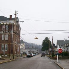
The area ranks among Ohio's least populated counties, offering vast stretches of undeveloped land and rural character. This remoteness preserves a distinctly rustic quality throughout the region.

Location
Inception
January 29, 1813
Capital city
Woodsfield
Reference
MOE
Shares border with
Belmont County, Marshall County, Wetzel County, Tyler County, Washington County, Noble County
GPS coordinates
39.73000,-81.08000
Latest update
December 22, 2025 18:03

AroundUs brings together thousands of curated places, local tips, and hidden gems, enriched daily by 60,000 contributors worldwide. Discover all places nearby (Ohio).

Around this place
Hannibal Locks and Dam
United States of America

Hannibal Locks and Dam

19.6 km
William C. Mooney House
United States of America

William C. Mooney House

4.7 km
New Martinsville Bridge
United States of America

New Martinsville Bridge

20.2 km
Wells Inn
United States of America

Wells Inn

19.8 km
United States of America

Sunfish Creek State Forest

23.2 km
Monroe County Courthouse
United States of America

Monroe County Courthouse

4.8 km
Frederick Kindleberger Stone House and Barn
United States of America

Frederick Kindleberger Stone House and Barn

18.6 km
Knowlton Covered Bridge
United States of America

Knowlton Covered Bridge

15.8 km
Monroe Bank
United States of America

Monroe Bank

4.8 km
E. A. Durham House
United States of America

E. A. Durham House

21 km
Foreaker Covered Bridge
United States of America

Foreaker Covered Bridge

9 km
Salem Church
United States of America

Salem Church

13.2 km
Hollister-Parry House
United States of America

Hollister-Parry House

4.4 km
Wells-Schaff House
United States of America

Wells-Schaff House

20.3 km
North Street Historic District
United States of America

North Street Historic District

21.1 km
United States of America

Wells-Twyford House

20.9 km
Sistersville Historic District
United States of America

Sistersville Historic District

19.7 km
New Martinsville Downtown Historic District
United States of America

New Martinsville Downtown Historic District

21.7 km
Sistersville City Hall
United States of America

Sistersville City Hall

19.7 km
War Memorial Building
United States of America

War Memorial Building

20.8 km
United States of America

Switzerland Lake

15 km
United States of America

Glenn Rocks

21.2 km
United States of America

Wetzel County Museum

20.9 km
United States of America

Sistersville Country Club Golf Course

20.5 km
United States of America

Kiedaisch Point

18.5 km
United States of America

Scenic viewpoint

4.3 km
United States of America

Scenic viewpoint

4.2 km
United States of America

Scenic viewpoint

4.3 km
Show the full map
Administrative divisions
« Monroe County - Administrative county in southeastern Ohio, United States » is provided by Around Us (aroundus.com). Images and texts are derived from Wikimedia project under a Creative Commons license. You are allowed to copy, distribute, and modify copies of this page, under the conditions set by the license, as long as this note is clearly visible.

Discover hidden gems everywhere you go!

From secret cafés to breathtaking viewpoints, skip the crowded tourist spots and find places that match your style. Our app makes it easy with voice search, smart filtering, route optimization, and insider tips from travelers worldwide. Download now for the complete mobile experience.

Around Us App Screenshot

A unique approach to discovering new places

Le Figaro

All the places worth exploring

France Info

A tailor-made excursion in just a few clicks

20 Minutes

Around Us
Travel Guide & Maps
Download

Send to your phone

QR Code
1

Open the camera app on your mobile.

2

Point at the QR code with your camera. A notification will appear.

3

Tap the notification to open the link.