Enable Location

We need your location to show you interesting places around you

Discover nearby places

Find interesting locations and hidden gems around you

Precise directions

Get accurate directions and distances to places

Your location is never shared with other users. It's only used when you tap the location button.

Eaton County

Log in to your account

Start exploring — it's free

Trusted by 62,490 travelers worldwide

Continue with Google
Continue with Apple
or

We will send you a code to connect

By continuing, you accept our Terms and Conditions and our Privacy Policy

Check your inbox

We've sent a pincode in your inbox. Please enter the code below.

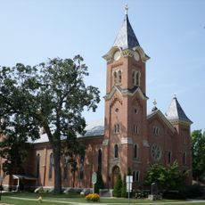
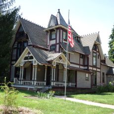
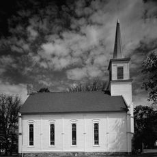
Eaton County, County in south-central Michigan, United States.

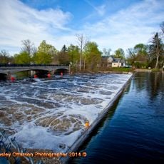
Eaton County spans across south-central Michigan with several major river systems running through its landscape. The Battle Creek, Grand River, and Thornapple River shape the character of the land in this region.

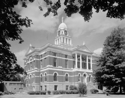
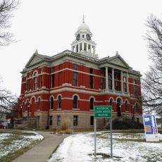
The Michigan Territorial Legislature created it officially on October 29, 1829, naming it after John Eaton, who served as Secretary of War under President Andrew Jackson. This early establishment made it part of the region's development during westward expansion.

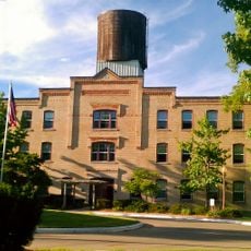
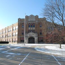
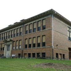
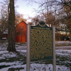
Eaton Rapids takes its name from the river flowing through it and serves as an educational hub for the region. The local school districts reflect the values of the communities that make their homes throughout the county.

The county administration manages online services for residents and visitors seeking information about local government functions. Tax details, election schedules, public meetings, and health department resources are available through the county website.

Three major rivers intersect within the county, creating a distinctive water network that has influenced settlement patterns and local economic development. This river system continues to support agriculture and recreation throughout the region.

The community of curious travelers

AroundUs brings together thousands of curated places, local tips, and hidden gems, enriched daily by 60,000 contributors worldwide.

Start exploring
Location
Inception
1837
Capital city
Charlotte
Shares border with
Clinton County, Calhoun County, Ingham County, Jackson County, Ionia County, Barry County
GPS coordinates
42.59000,-84.85000
Latest update
December 20, 2025 15:56
Around this place
Michigan State Capitol
United States of America

Michigan State Capitol

28.9 km
United States of America

Michigan Women's Hall of Fame

28.5 km
REO Town
United States of America

REO Town

28.1 km
United States of America

Michigan Hall of Justice

28.2 km
Grand Ledge Chair Company Plant
United States of America

Grand Ledge Chair Company Plant

20 km
Walter French Academy
United States of America

Walter French Academy

28.1 km
Emery Houses
United States of America

Emery Houses

28.9 km
First Congregational Church
United States of America

First Congregational Church

3.1 km
Darius B. Moon House
United States of America

Darius B. Moon House

27.7 km
Bellevue Gothic Mill
United States of America

Bellevue Gothic Mill

21.1 km
First Congregational Church
United States of America

First Congregational Church

15 km
Courthouse Square Museum
United States of America

Courthouse Square Museum

3 km
Island City Historic District
United States of America

Island City Historic District

18.2 km
Genesee Street School
United States of America

Genesee Street School

28.7 km
Charlotte Central Historic District
United States of America

Charlotte Central Historic District

3.3 km
Powers Highway-Battle Creek Bridge
United States of America

Powers Highway-Battle Creek Bridge

15.5 km
Isaac N. Reynolds House
United States of America

Isaac N. Reynolds House

18.4 km
Richard and Deborah Glaister House
United States of America

Richard and Deborah Glaister House

28.6 km
Vermontville Chapel and Academy
United States of America

Vermontville Chapel and Academy

14.8 km
Sunfield G. A. R. Hall
United States of America

Sunfield G. A. R. Hall

22.5 km
River Ledge Historic District
United States of America

River Ledge Historic District

19.9 km
Hance House
United States of America

Hance House

17.8 km
Library of Michigan
United States of America

Library of Michigan

28.3 km
Elliott-Larsen Building
United States of America

Elliott-Larsen Building

28.6 km
Lansing Mall Cinema
United States of America

Lansing Mall Cinema

24.7 km
Putnam Public Library Historical Marker
United States of America

Putnam Public Library Historical Marker

20 km
Fitzgerald Park Historical Marker
United States of America

Fitzgerald Park Historical Marker

20.1 km
Arbaugh's Department Store Building
United States of America

Arbaugh's Department Store Building

28.9 km
Show the full map
Administrative divisions
« Eaton County - County in south-central Michigan, United States » is provided by Around Us (aroundus.com). Images and texts are derived from Wikimedia project under a Creative Commons license. You are allowed to copy, distribute, and modify copies of this page, under the conditions set by the license, as long as this note is clearly visible.

Discover hidden gems everywhere you go!

From secret cafés to breathtaking viewpoints, skip the crowded tourist spots and find places that match your style. Our app makes it easy with voice search, smart filtering, route optimization, and insider tips from travelers worldwide. Download now for the complete mobile experience.

Around Us App Screenshot

A unique approach to discovering new places

Le Figaro

All the places worth exploring

France Info

A tailor-made excursion in just a few clicks

20 Minutes

Around Us
Travel Guide & Maps
Download

Send to your phone

QR Code
1

Open the camera app on your mobile.

2

Point at the QR code with your camera. A notification will appear.

3

Tap the notification to open the link.