Marion County

Log in to your account

AroundUs is a community-driven map of interesting places, built by curious explorers like you. It grows with every review, story, and photo you share.
Connect to save your favorite spots, contribute locations, and create personalized routes.
By continuing, you accept our Terms and Conditions and our Privacy Policy
Add to collection
Map
Suggest a change
Share

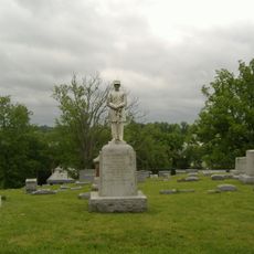
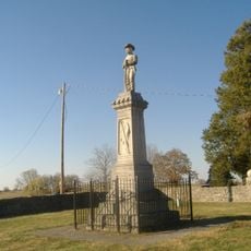
Marion County, Administrative county in Kentucky, US

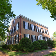
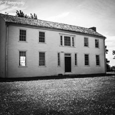
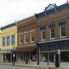
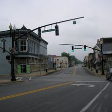
Marion County spans across rolling hills and farmland in central Kentucky, with Lebanon serving as its administrative center. The county is organized into several communities spread throughout the rural landscape.

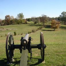
The county was established in 1834 and named after Francis Marion, a military officer from the American Revolutionary War. This naming choice honors an important figure from early American independence.

Lebanon hosts seasonal festivals throughout the year where residents gather to celebrate traditions through music, food, and community activities. These gatherings reflect how local identity is maintained through shared celebrations.

Administration offices in Lebanon are open Monday through Friday and handle essential services for residents and visitors. Planning a visit during business hours ensures you can access any needed services.

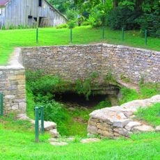
The area maintains several natural conservation areas where visitors can spot native Kentucky wildlife. These spaces offer guided programs that help people discover the local environment.

Location: Kentucky

Inception: January 25, 1834

Capital city: Lebanon

Shares border with: Taylor County, Casey County, Washington County, Boyle County, LaRue County, Nelson County

Website: http://marioncounty.ky.gov

GPS coordinates: 37.55000,-85.27000

Latest update: December 7, 2025 20:25

Photos
Around this place
Show the full map
The Abbey of Our Lady of Gethsemani
United States of America

The Abbey of Our Lady of Gethsemani

26.2 km
My Old Kentucky Home State Park
United States of America

My Old Kentucky Home State Park

32.9 km
Bernheim Forest and  Arboretum
United States of America

Bernheim Forest and Arboretum

10.7 km
Perryville Battlefield State Historic Site
United States of America

Perryville Battlefield State Historic Site

29.9 km
Louisville and Nashville Railroad 152
United States of America

Louisville and Nashville Railroad 152

30.8 km
Mordecai Lincoln House
United States of America

Mordecai Lincoln House

22.7 km
Lincoln Homestead State Park
United States of America

Lincoln Homestead State Park

22.7 km
Louisville and Nashville Combine Car Number 665
United States of America

Louisville and Nashville Combine Car Number 665

30.8 km
Mount Zion Covered Bridge
United States of America

Mount Zion Covered Bridge

31 km
Merchant Tower
United States of America

Merchant Tower

24.2 km
Elmwood Inn
United States of America

Elmwood Inn

30.2 km
St. Thomas Roman Catholic Church and Howard-Flaget House
United States of America

St. Thomas Roman Catholic Church and Howard-Flaget House

30.6 km
Lebanon National Cemetery
United States of America

Lebanon National Cemetery

399 m
Captain Andrew Offutt Monument
United States of America

Captain Andrew Offutt Monument

3.7 km
Confederate Monument in Perryville
United States of America

Confederate Monument in Perryville

29.8 km
Union Monument in Perryville
United States of America

Union Monument in Perryville

29.8 km
St. Dominic's Catholic Church
United States of America

St. Dominic's Catholic Church

15.8 km
Johnson's Chapel AME Church
United States of America

Johnson's Chapel AME Church

15.7 km
Campbellsville Historic Commercial District
United States of America

Campbellsville Historic Commercial District

24.1 km
Perryville Historic District
United States of America

Perryville Historic District

30.2 km
Willisburg Historic District
United States of America

Willisburg Historic District

31.4 km
Farmer's Bank of Mackville
United States of America

Farmer's Bank of Mackville

26.7 km
Washington County Courthouse
United States of America

Washington County Courthouse

15.6 km
Lebanon Historic Commercial District
United States of America

Lebanon Historic Commercial District

2.6 km
Walnut Street Historic District
United States of America

Walnut Street Historic District

15.9 km
William Blackwell House
United States of America

William Blackwell House

15.2 km
Kentucky Railway Museum
United States of America

Kentucky Railway Museum

30.9 km
William C. McChord House
United States of America

William C. McChord House

15.7 km
Show the full map
Reviews

Visited this place? Tap the stars to rate it and share your experience / photos with the community! Try now! You can cancel it anytime.

« Marion County - Administrative county in Kentucky, US » is provided by Around Us (aroundus.com). Images and texts are derived from Wikimedia project under a Creative Commons license. You are allowed to copy, distribute, and modify copies of this page, under the conditions set by the license, as long as this note is clearly visible.

Discover hidden gems everywhere you go!

From secret cafés to breathtaking viewpoints, skip the crowded tourist spots and find places that match your style. Our app makes it easy with voice search, smart filtering, route optimization, and insider tips from travelers worldwide. Download now for the complete mobile experience.

Around Us App Screenshot

A unique approach to discovering new places

Le Figaro

All the places worth exploring

France Info

A tailor-made excursion in just a few clicks

20 Minutes