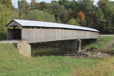
Mount Zion Covered Bridge, Covered bridge in Washington County, Kentucky, United States.
Mount Zion Covered Bridge spans across Little Beech Fork using wooden construction with a Burr truss design measuring about 211 feet in length. The structure is approximately 16 feet wide, allowing passage for wagons and vehicles typical of the era.
Builders H.I. and William F. Barnes from Mount Washington completed this structure in 1871. Fire destroyed the bridge in March 2021, after it had served for over 150 years as a multi-span crossing.
This bridge demonstrates the engineering methods used in rural Kentucky during the 1800s, when wooden structures like this one connected isolated communities across streams. The design reflects practical problem-solving of the era.
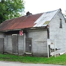
This bridge is located near Mooresville along Kentucky Route 458, making it easy to find if you follow local road signs. Visitors should be aware that the structure no longer stands due to the fire damage.
This bridge held the distinction of being Kentucky's longest multi-span wooden crossing for many years. The Burr truss design was an advanced engineering solution that allowed builders to span longer distances without intermediate supports.
The community of curious travelers
AroundUs brings together thousands of curated places, local tips, and hidden gems, enriched daily by 60,000 contributors worldwide.