Washington County

Log in to your account

AroundUs is a community-driven map of interesting places, built by curious explorers like you. It grows with every review, story, and photo you share.
Connect to save your favorite spots, contribute locations, and create personalized routes.
Continue with Google
Continue with Apple
Continue with X
Continue with Facebook
Continue with email
By continuing, you accept our Terms and Conditions and our Privacy Policy
Create an account
Add to collection
Map
Suggest a change
Share

Washington County, Administrative county in Kentucky, United States

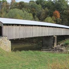
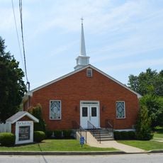
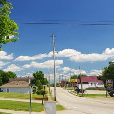
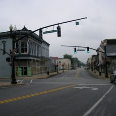
Washington County is an administrative division in Kentucky that encompasses farmland, residential neighborhoods, and the city of Springfield. The landscape combines rural and settled areas into a mixed geography typical of the region.

The county was established on June 22, 1792, making it the first administrative division created after Kentucky became independent from Virginia. This founding moment marked the beginning of the state's separate governmental structure.

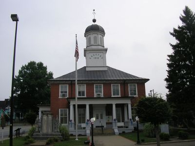
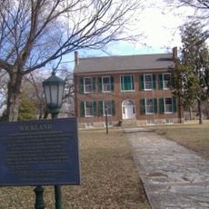
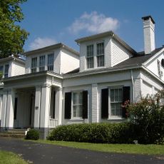
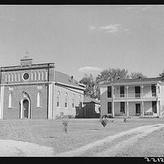
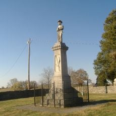
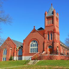
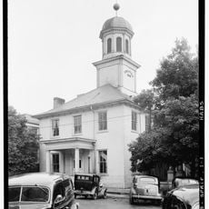
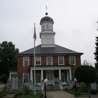
The courthouse building serves as a gathering place where residents and visitors can observe local governance and public life. The structure remains deeply connected to the community's sense of continuity and shared identity.

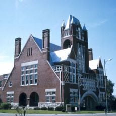
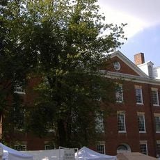
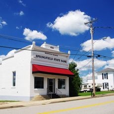
Springfield functions as the administrative center where residents can access government services and public facilities. Visitors should plan to visit the town for any official business or to see the main courthouse building.

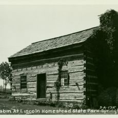
An 1806 marriage record documents the wedding of Thomas Lincoln and Nancy Hanks, parents of President Abraham Lincoln. This document remains preserved in the county archives, connecting the area to one of American history's most significant families.

Location: Kentucky

Inception: June 22, 1792

Capital city: Springfield

Shares border with: Anderson County, Boyle County, Mercer County, Marion County, Nelson County

Website: http://washingtoncountyky.com

GPS coordinates: 37.75000,-85.17000

Latest update: December 7, 2025 20:42

Photos
Around this place
My Old Kentucky Home State Park
United States of America

My Old Kentucky Home State Park

25.8 km
Perryville Battlefield State Historic Site
United States of America

Perryville Battlefield State Historic Site

19.5 km
Basilica of St. Joseph Proto-Cathedral
United States of America

Basilica of St. Joseph Proto-Cathedral

27.4 km
Mordecai Lincoln House
United States of America

Mordecai Lincoln House

3.5 km
Lincoln Homestead State Park
United States of America

Lincoln Homestead State Park

3.5 km
Civil War Museum
United States of America

Civil War Museum

26.6 km
Wickland
United States of America

Wickland

25.9 km
Bardstown Historic District
United States of America

Bardstown Historic District

26.9 km
Ben Johnson House
United States of America

Ben Johnson House

27 km
Oscar Getz Museum of Whiskey History
United States of America

Oscar Getz Museum of Whiskey History

27.4 km
Cobblestone Path
United States of America

Cobblestone Path

26.6 km
Mount Zion Covered Bridge
United States of America

Mount Zion Covered Bridge

11.5 km
Bardstown Historical Museum
United States of America

Bardstown Historical Museum

27.4 km
St. Thomas Roman Catholic Church and Howard-Flaget House
United States of America

St. Thomas Roman Catholic Church and Howard-Flaget House

27.7 km
United States of America

Lebanon National Cemetery

23.5 km
Captain Andrew Offutt Monument
United States of America

Captain Andrew Offutt Monument

20.6 km
Confederate Monument in Perryville
United States of America

Confederate Monument in Perryville

19.4 km
Confederate Monument of Bardstown
United States of America

Confederate Monument of Bardstown

26.9 km
Newell B. McClaskey House
United States of America

Newell B. McClaskey House

21.3 km
Union Monument in Perryville
United States of America

Union Monument in Perryville

19.4 km
St. Dominic's Catholic Church
United States of America

St. Dominic's Catholic Church

8.5 km
Johnson's Chapel AME Church
United States of America

Johnson's Chapel AME Church

8.4 km
Willisburg Historic District
United States of America

Willisburg Historic District

7.6 km
Farmer's Bank of Mackville
United States of America

Farmer's Bank of Mackville

9.4 km
Washington County Courthouse
United States of America

Washington County Courthouse

8.5 km
Lebanon Historic Commercial District
United States of America

Lebanon Historic Commercial District

21.4 km
Walnut Street Historic District
United States of America

Walnut Street Historic District

8.3 km
William Blackwell House
United States of America

William Blackwell House

9 km
Show the full map
Reviews

Visited this place? Tap the stars to rate it and share your experience / photos with the community! Try now! You can cancel it anytime.

Administrative divisions
« Washington County - Administrative county in Kentucky, United States » is provided by Around Us (aroundus.com). Images and texts are derived from Wikimedia project under a Creative Commons license. You are allowed to copy, distribute, and modify copies of this page, under the conditions set by the license, as long as this note is clearly visible.

Discover hidden gems everywhere you go!

From secret cafés to breathtaking viewpoints, skip the crowded tourist spots and find places that match your style. Our app makes it easy with voice search, smart filtering, route optimization, and insider tips from travelers worldwide. Download now for the complete mobile experience.

Around Us App Screenshot

A unique approach to discovering new places

Le Figaro

All the places worth exploring

France Info

A tailor-made excursion in just a few clicks

20 Minutes