Chest opened
+${chestReward.xp} XP
Explorer
NOUVEAU ×${chestReward.collectible.quantity}
tapez pour fermer
Chest locked

Open chests in the app

Around Us is built for your phone — chests unlock when you walk, explore and capture nearby places.

Enable Location

We need your location to show you interesting places around you

Discover nearby places

Find interesting locations and hidden gems around you

Precise directions

Get accurate directions and distances to places

Your location is never shared with other users. It's only used when you tap the location button.

Browns Mills

Log in to your account

Start exploring — it's free

Trusted by 72,888 travelers worldwide

Continue with Google
Continue with Apple
or

We will send you a code to connect

By continuing, you accept our Terms and Conditions and our Privacy Policy

Check your inbox

We've sent a pincode in your inbox. Please enter the code below.

Discussion Reviews 1 Photos
15.5k Popularity

Browns Mills, Census-designated place in Burlington County, New Jersey

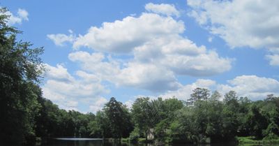
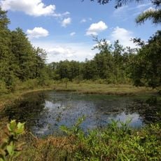
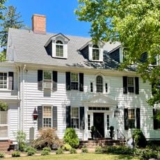
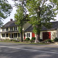
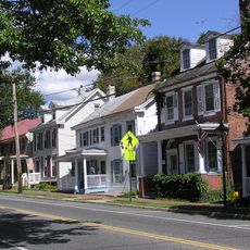
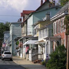
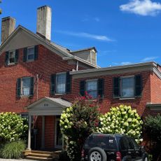
Browns Mills is a residential community in Pemberton Township, New Jersey, situated between pine forests and small lakes. The area consists of different neighborhoods separated by wooded spaces and open green areas.

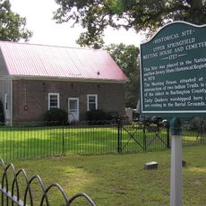
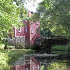
The settlement began around a mill operation established by Charles Brown, from which the place takes its name. During the 20th century, it transformed from an industrial site into a residential area.

The community maintains a diverse population of over 10,000 residents, representing various ethnic backgrounds including White, African American, and Asian communities.

The place is accessible by bus service that connects to nearby cities. Since the area is spread out across neighborhoods, having a car makes it easier to explore the different parts of the community.

The Deborah Heart and Lung Center stands as the primary medical facility in Browns Mills, serving patients with cardiovascular and pulmonary conditions.

The community of curious travelers

AroundUs brings together thousands of curated places, local tips, and hidden gems, enriched daily by 60,000 contributors worldwide.

Start exploring
Elevation above the sea
20 m
GPS coordinates
39.97350,-74.56950
Latest update
December 7, 2025 19:30
Around this place
Nitro
United States of America

Nitro

20.9 km
Jersey Devil Coaster
United States of America

Jersey Devil Coaster

20.9 km
BOMARC Missile Accident Site
United States of America

BOMARC Missile Accident Site

12.8 km
Skull Mountain
United States of America

Skull Mountain

21 km
Harley Quinn Crazy Train
United States of America

Harley Quinn Crazy Train

21.1 km
Road Runner Railway
United States of America

Road Runner Railway

20.9 km
United States Air Force Expeditionary Center
United States of America

United States Air Force Expeditionary Center

5.1 km
Brendan T. Byrne State Forest
United States of America

Brendan T. Byrne State Forest

9.2 km
New Egypt Speedway
United States of America

New Egypt Speedway

13.8 km
Burlington County Prison
United States of America

Burlington County Prison

19 km
Smithville, Burlington County, New Jersey
United States of America

Smithville, Burlington County, New Jersey

15.3 km
Colliers Mills Wildlife Management Area
United States of America

Colliers Mills Wildlife Management Area

17.1 km
United States of America

Burlington County Courthouse

18.8 km
Zurbrugg Mansion
United States of America

Zurbrugg Mansion

10.1 km
First Presbyterian Church
United States of America

First Presbyterian Church

18.6 km
Shinn Curtis Log House
United States of America

Shinn Curtis Log House

18.4 km
Peachfield
United States of America

Peachfield

21 km
Old Upper Springfield Friends Burying Ground
United States of America

Old Upper Springfield Friends Burying Ground

10 km
Bishop-Irick Farmstead
United States of America

Bishop-Irick Farmstead

15.5 km
Brainerd School
United States of America

Brainerd School

18.6 km
Morris Mansion and Mill
United States of America

Morris Mansion and Mill

9.8 km
Kirby's Mill
United States of America

Kirby's Mill

21.2 km
Fernbrook Historic District
United States of America

Fernbrook Historic District

17.2 km
Chatsworth Lake
United States of America

Chatsworth Lake

17.3 km
Arneytown Historic District
United States of America

Arneytown Historic District

14.3 km
Pemberton Historic District
United States of America

Pemberton Historic District

9.7 km
Mount Holly Historic District
United States of America

Mount Holly Historic District

18.8 km
Recklesstown Historic District
United States of America

Recklesstown Historic District

16.6 km
Show the full map
Reviews
Share your experience

No review yet

Discussions
Start a discussion...

No discussion yet

« Browns Mills - Census-designated place in Burlington County, New Jersey » is provided by Around Us (aroundus.com). Images and texts are derived from Wikimedia project under a Creative Commons license. You are allowed to copy, distribute, and modify copies of this page, under the conditions set by the license, as long as this note is clearly visible.

Discover hidden gems everywhere you go!

From secret cafés to breathtaking viewpoints, skip the crowded tourist spots and find places that match your style. Our app makes it easy with voice search, smart filtering, route optimization, and insider tips from travelers worldwide. Download now for the complete mobile experience.

Around Us App Screenshot

A unique approach to discovering new places

Le Figaro

All the places worth exploring

France Info

A tailor-made excursion in just a few clicks

20 Minutes

Around Us
Travel Guide & Maps
Download

Send to your phone

QR Code
1

Open the camera app on your mobile.

2

Point at the QR code with your camera. A notification will appear.

3

Tap the notification to open the link.