Chest opened
+${chestReward.xp} XP
Explorer
NOUVEAU ×${chestReward.collectible.quantity}
tapez pour fermer
Chest locked

Open chests in the app

Around Us is built for your phone — chests unlock when you walk, explore and capture nearby places.

Enable Location

We need your location to show you interesting places around you

Discover nearby places

Find interesting locations and hidden gems around you

Precise directions

Get accurate directions and distances to places

Your location is never shared with other users. It's only used when you tap the location button.

Log in to your account

Start exploring — it's free

Trusted by 72,886 travelers worldwide

Continue with Google
Continue with Apple
or

We will send you a code to connect

By continuing, you accept our Terms and Conditions and our Privacy Policy

Check your inbox

We've sent a pincode in your inbox. Please enter the code below.

Columbia Point
Discussion Reviews Photo
11.2k Popularity

Columbia Point, Residential neighborhood in Dorchester, Boston, US

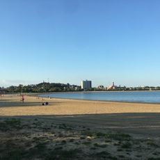
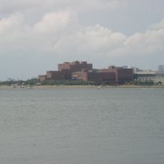
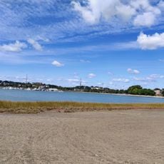
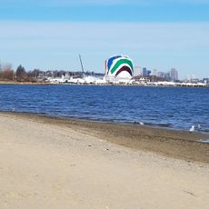
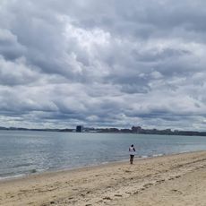
Columbia Point is a peninsula in Dorchester that extends into Dorchester Bay and features residential areas, educational institutions, and the John F. Kennedy Presidential Library. The neighborhood combines housing with public spaces and cultural facilities along the waterfront.

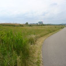
The area began as a 14-acre Native American settlement called Mattaponnock. Extensive landfill operations transformed it into a 350-acre peninsula by 1900, completely reshaping the geography and opening it for new development.

The neighborhood is home to the first community health center established in the United States, founded in the 1960s by medical professionals from Tufts University. This center shaped how communities approach medical care and remains a symbol of grassroots healthcare innovation.

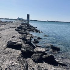
The JFK/UMass MBTA station provides rail connections to downtown Boston, making it easy to reach from other parts of the city. The Boston Harborwalk runs along the peninsula and offers waterfront paths for walking at your own pace.

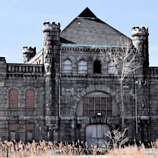
The Calf Pasture Pumping Station, built in 1884, introduced modern sewage treatment methods to the area. This early engineering achievement remained operational for nearly a century and demonstrates how infrastructure shaped urban development.

The community of curious travelers

AroundUs brings together thousands of curated places, local tips, and hidden gems, enriched daily by 60,000 contributors worldwide.

Start exploring
Location
GPS coordinates
42.31372,-71.03344
Latest update
March 5, 2026 21:06
Around this place
John F. Kennedy Presidential Library and Museum
United States of America

John F. Kennedy Presidential Library and Museum

15 m
Edward M. Kennedy Institute for the United States Senate
United States of America

Edward M. Kennedy Institute for the United States Senate

205 m
Dorchester Heights
United States of America

Dorchester Heights

2.4 km
James Blake House
United States of America

James Blake House

2.3 km
Carson Beach, South Boston
United States of America

Carson Beach, South Boston

1.8 km
Squantum Point Park
United States of America

Squantum Point Park

1.6 km
Calf Pasture Pumping Station Complex
United States of America

Calf Pasture Pumping Station Complex

45 m
Monan Park
United States of America

Monan Park

771 m
Dorchester North Burying Ground
United States of America

Dorchester North Burying Ground

2.5 km
William Monroe Trotter House
United States of America

William Monroe Trotter House

2.4 km
Cathedral of St. George Historic District
United States of America

Cathedral of St. George Historic District

2.5 km
Statue of Edward Everett
United States of America

Statue of Edward Everett

2.3 km
Captain Lemuel Clap House
United States of America

Captain Lemuel Clap House

2.1 km
Clapp Houses
United States of America

Clapp Houses

2.1 km
William Clapp House
United States of America

William Clapp House

2.1 km
Harrison Loring House
United States of America

Harrison Loring House

2.4 km
Savin Hill Beach
United States of America

Savin Hill Beach

1.6 km
Fields Corner Municipal Building
United States of America

Fields Corner Municipal Building

2.6 km
Marina Bay
United States of America

Marina Bay

1.5 km
Tenean Beach
United States of America

Tenean Beach

2.4 km
Massachusetts Archives & Commonwealth Museum
United States of America

Massachusetts Archives & Commonwealth Museum

118 m
Nickerson Beach
United States of America

Nickerson Beach

2.1 km
L Street Beach
United States of America

L Street Beach

1.7 km
United States of America

Ryan Playground gateway

2 km
United States of America

Edward Everett Statue

2.3 km
United States of America

Clapp Favorite Pear

2.4 km
United States of America

Work of art, sculpture

2.4 km
United States of America

Scenic viewpoint

1.5 km
Show the full map
Reviews
Share your experience

No review yet

Discussions
Start a discussion...

No discussion yet

« Columbia Point - Residential neighborhood in Dorchester, Boston, US » is provided by Around Us (aroundus.com). Images and texts are derived from Wikimedia project under a Creative Commons license. You are allowed to copy, distribute, and modify copies of this page, under the conditions set by the license, as long as this note is clearly visible.

Discover hidden gems everywhere you go!

From secret cafés to breathtaking viewpoints, skip the crowded tourist spots and find places that match your style. Our app makes it easy with voice search, smart filtering, route optimization, and insider tips from travelers worldwide. Download now for the complete mobile experience.

Around Us App Screenshot

A unique approach to discovering new places

Le Figaro

All the places worth exploring

France Info

A tailor-made excursion in just a few clicks

20 Minutes

Around Us
Travel Guide & Maps
Download

Send to your phone

QR Code
1

Open the camera app on your mobile.

2

Point at the QR code with your camera. A notification will appear.

3

Tap the notification to open the link.