Chest opened
+${chestReward.xp} XP
Explorer
NOUVEAU ×${chestReward.collectible.quantity}
tapez pour fermer
Chest locked

Open chests in the app

Around Us is built for your phone — chests unlock when you walk, explore and capture nearby places.

Enable Location

We need your location to show you interesting places around you

Discover nearby places

Find interesting locations and hidden gems around you

Precise directions

Get accurate directions and distances to places

Your location is never shared with other users. It's only used when you tap the location button.

Hazard

Log in to your account

Start exploring — it's free

Trusted by 72,889 travelers worldwide

Continue with Google
Continue with Apple
or

We will send you a code to connect

By continuing, you accept our Terms and Conditions and our Privacy Policy

Check your inbox

We've sent a pincode in your inbox. Please enter the code below.

Discussion Reviews 4 Photos
58.6k Popularity

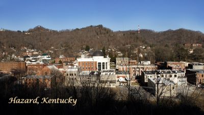
Hazard, County seat in Perry County, Kentucky, United States.

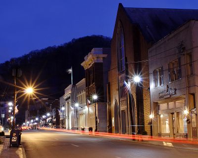
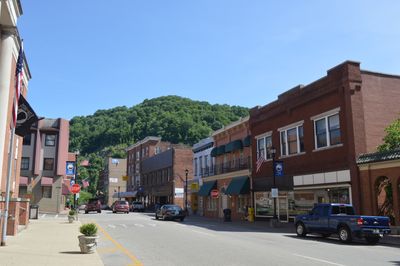
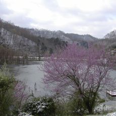
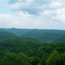
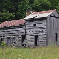
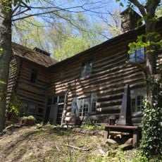
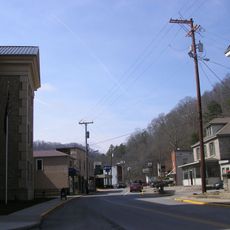
Hazard sits along the North Fork Kentucky River, enclosed by rolling Cumberland foothills, about 190 kilometers (118 miles) southeast of Lexington. The town spreads along the river valley, where several roads follow the water course and climb toward the surrounding hills.

The settlement received its name in 1821 honoring a naval officer and became officially incorporated as a town in 1884. During the late 1880s, the area experienced local conflicts between feuding families that deeply marked community life.

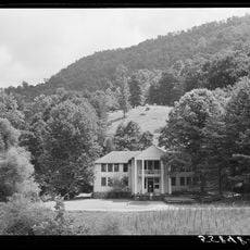
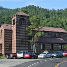
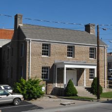
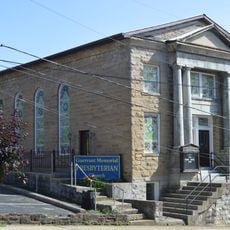
The settlement takes its name from a naval commander of the early 19th century, visible today in street signs and official documents throughout town. Local residents gather at public facilities near the river for regional events that shape everyday life in southeastern Kentucky.

The Coal Fields Industrial Park near Wendell H. Ford Airport offers employment through manufacturing and commercial operations relevant to visitors and locals alike. Several facilities line the main roads through the river valley, providing a good starting point for exploring the wider region.

In the late 1880s, local family feuds led to a confrontation that claimed twelve lives and remains alive in regional storytelling today. This event shaped the collective memory of the area and often surfaces in local histories.

The community of curious travelers

AroundUs brings together thousands of curated places, local tips, and hidden gems, enriched daily by 60,000 contributors worldwide.

Start exploring
Location
GPS coordinates
37.24860,-83.19500
Latest update
December 19, 2025 21:51
Around this place
United States of America

Kingdom Come State Park

34 km
United States of America

Hindman Settlement School

21.6 km
Pine Mountain Settlement School
United States of America

Pine Mountain Settlement School

33.4 km
United States of America

Buckhorn Lake

26.4 km
Carr Creek Lake
United States of America

Carr Creek Lake

17.1 km
United States of America

Buckhorn Lake State Resort Park

22.5 km
Carr Creek State Park
United States of America

Carr Creek State Park

17.2 km
Robinson Forest
United States of America

Robinson Forest

25.4 km
United States of America

Big Lovely Mountain

31.2 km
John Shell Cabin
United States of America

John Shell Cabin

32.3 km
Wendover, Kentucky
United States of America

Wendover, Kentucky

20.2 km
Buckhorn Presbyterian Church and the Greer Gymnasium
United States of America

Buckhorn Presbyterian Church and the Greer Gymnasium

27.2 km
Breathitt County Jail
United States of America

Breathitt County Jail

37.8 km
M.E. Church, South
United States of America

M.E. Church, South

37.8 km
United States of America

Hiram and Art Stamper House

25.2 km
United States of America

Wolfpen

24 km
Wooton Presbyterian Center
United States of America

Wooton Presbyterian Center

12.1 km
Hindman Historic District
United States of America

Hindman Historic District

21.3 km
Bolen Building
United States of America

Bolen Building

21.1 km
Jackson Commercial District
United States of America

Jackson Commercial District

37.9 km
United States of America

Perry County Park

3.2 km
United States of America

Redbird Wildlife Management Area

31.2 km
Stacey Hotel
United States of America

Stacey Hotel

37.8 km
United States of America

Bullock Overlook

33.5 km

Amphitheater

321 m
United States of America

Creech Overlook

33.9 km
United States of America

Halcomb Overlook

33.5 km
United States of America

12 O'Clock Overlook

33.6 km
Show the full map
Reviews
Share your experience

No review yet

Discussions
Start a discussion...

No discussion yet

« Hazard - County seat in Perry County, Kentucky, United States » is provided by Around Us (aroundus.com). Images and texts are derived from Wikimedia project under a Creative Commons license. You are allowed to copy, distribute, and modify copies of this page, under the conditions set by the license, as long as this note is clearly visible.

Discover hidden gems everywhere you go!

From secret cafés to breathtaking viewpoints, skip the crowded tourist spots and find places that match your style. Our app makes it easy with voice search, smart filtering, route optimization, and insider tips from travelers worldwide. Download now for the complete mobile experience.

Around Us App Screenshot

A unique approach to discovering new places

Le Figaro

All the places worth exploring

France Info

A tailor-made excursion in just a few clicks

20 Minutes

Around Us
Travel Guide & Maps
Download

Send to your phone

QR Code
1

Open the camera app on your mobile.

2

Point at the QR code with your camera. A notification will appear.

3

Tap the notification to open the link.