Enable Location

We need your location to show you interesting places around you

Discover nearby places

Find interesting locations and hidden gems around you

Precise directions

Get accurate directions and distances to places

Your location is never shared with other users. It's only used when you tap the location button.

Greenwood Lake

Log in to your account

Start exploring — it's free

Trusted by 63,017 travelers worldwide

Continue with Google
Continue with Apple
or

We will send you a code to connect

By continuing, you accept our Terms and Conditions and our Privacy Policy

Check your inbox

We've sent a pincode in your inbox. Please enter the code below.

Greenwood Lake
Discussion Reviews 1 Photos
19.4k Popularity

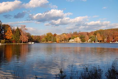
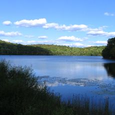
Greenwood Lake, Interstate reservoir in New Jersey and New York, United States

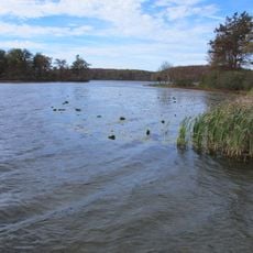
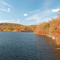
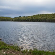
Greenwood Lake is a reservoir on the border between New Jersey and New York that stretches across two states in a long, winding shape. The water sits in a forested valley landscape and is framed by gentle hills that rise on both shores.

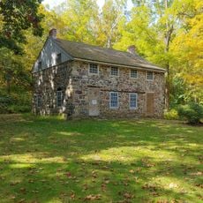
Settlers built a dam in the mid-18th century and turned a natural lake into a larger reservoir for water supply. The Ryerson family raised the dam in the 1830s, which lifted the water level and flooded farmland.

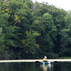
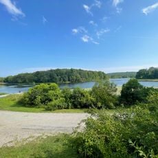
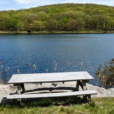
The name comes from the wooded shoreline that settlers saw when they began renaming features in the area. Local residents now use docks along the waterfront communities to fish, swim, and launch small motorboats throughout the warm months.

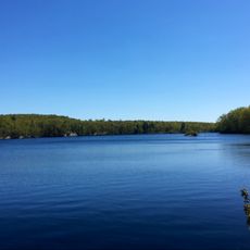
The area works best in summer or early fall when water temperature is comfortable for swimming and boat ramps are accessible. Several public docks and trails provide access to different sections of the shore.

Tree stumps still stick out of the water in the southern part, left over from farms flooded before the dam was raised. These weathered remains are easiest to see when the water level drops, and they mark the drowned fields.

The community of curious travelers

AroundUs brings together thousands of curated places, local tips, and hidden gems, enriched daily by 60,000 contributors worldwide.

Start exploring
Location
Elevation above the sea
190 m
GPS coordinates
41.17950,-74.33000
Latest update
December 5, 2025 22:29
Around this place
Skylands
United States of America

Skylands

9.9 km
Ringwood State Park
United States of America

Ringwood State Park

7.8 km
Wawayanda State Park
United States of America

Wawayanda State Park

8.2 km
Sterling Forest State Park
United States of America

Sterling Forest State Park

6.5 km
Ringwood Manor
United States of America

Ringwood Manor

7.6 km
St. Mary's-in-Tuxedo
United States of America

St. Mary's-in-Tuxedo

12.2 km
Abram S. Hewitt State Forest
United States of America

Abram S. Hewitt State Forest

700 m
Sloat House
United States of America

Sloat House

11.8 km
Warwick Village Historic District
United States of America

Warwick Village Historic District

8.9 km
Clove Furnace Ruin
United States of America

Clove Furnace Ruin

18.3 km
High Breeze Farm
United States of America

High Breeze Farm

8.5 km
Jacob Sloat House
United States of America

Jacob Sloat House

11.7 km
General John Hathorn Stone House
United States of America

General John Hathorn Stone House

8.1 km
The Boulders
United States of America

The Boulders

1.7 km
St. Elizabeth's Memorial Chapel, Tuxedo
United States of America

St. Elizabeth's Memorial Chapel, Tuxedo

9 km
Sterling Mountain Fire Observation Tower and Observer's Cabin
United States of America

Sterling Mountain Fire Observation Tower and Observer's Cabin

4.7 km
Southfield Furnace Ruin
United States of America

Southfield Furnace Ruin

14.9 km
Fury Brook Farm
United States of America

Fury Brook Farm

16.8 km
Jeremiah Morehouse House
United States of America

Jeremiah Morehouse House

8 km
Wawayanda Lake
United States of America

Wawayanda Lake

8.7 km
Long Pond Ironworks State Park
United States of America

Long Pond Ironworks State Park

4.6 km
Monksville Reservoir
United States of America

Monksville Reservoir

6.9 km
Long Pond Ironworks
United States of America

Long Pond Ironworks

4.6 km
Wawayanda Beach
United States of America

Wawayanda Beach

8.4 km
New Sebago Beach
United States of America

New Sebago Beach

17 km
Old Sebago Beach
United States of America

Old Sebago Beach

16.7 km
Ramapo Mountain State Forest
United States of America

Ramapo Mountain State Forest

12.2 km
Pinwheel Vista
United States of America

Pinwheel Vista

10.4 km
Show the full map
Reviews
Share your experience

No review yet

Discussions
Start a discussion...

No discussion yet

« Greenwood Lake - Interstate reservoir in New Jersey and New York, United States » is provided by Around Us (aroundus.com). Images and texts are derived from Wikimedia project under a Creative Commons license. You are allowed to copy, distribute, and modify copies of this page, under the conditions set by the license, as long as this note is clearly visible.

Discover hidden gems everywhere you go!

From secret cafés to breathtaking viewpoints, skip the crowded tourist spots and find places that match your style. Our app makes it easy with voice search, smart filtering, route optimization, and insider tips from travelers worldwide. Download now for the complete mobile experience.

Around Us App Screenshot

A unique approach to discovering new places

Le Figaro

All the places worth exploring

France Info

A tailor-made excursion in just a few clicks

20 Minutes

Around Us
Travel Guide & Maps
Download

Send to your phone

QR Code
1

Open the camera app on your mobile.

2

Point at the QR code with your camera. A notification will appear.

3

Tap the notification to open the link.