Enable Location

We need your location to show you interesting places around you

Discover nearby places

Find interesting locations and hidden gems around you

Precise directions

Get accurate directions and distances to places

Your location is never shared with other users. It's only used when you tap the location button.

Abram S. Hewitt State Forest

Log in to your account

Start exploring — it's free

Trusted by 62,441 travelers worldwide

Continue with Google
Continue with Apple
or

We will send you a code to connect

By continuing, you accept our Terms and Conditions and our Privacy Policy

Check your inbox

We've sent a pincode in your inbox. Please enter the code below.

Abram S. Hewitt State Forest, Protected forest in West Milford, New Jersey, United States.

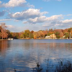
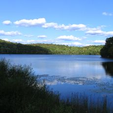
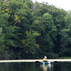
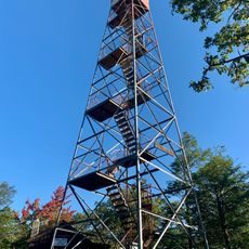
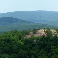
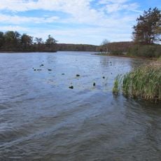
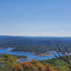
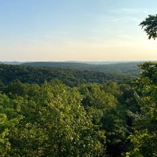
Abram S. Hewitt State Forest is a protected forest in West Milford that covers terrain across Bearfort Mountain between two lakes. The landscape features rock formations, wetlands, and streams that create a varied natural environment for visitors to explore.

The forest was established in 1951 by the New Jersey Department of Environmental Protection to preserve natural areas. This creation reflected the state's commitment to protecting such landscapes for the future.

The forest incorporates a section of the Appalachian Trail, connecting hikers to the extensive path that stretches from Maine to Georgia.

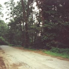
Four marked hiking trails are available within the forest, ranging from shorter walks to longer backcountry routes. Conditions are most favorable during drier months, particularly in fall and spring when the terrain is easier to navigate.

The forest contains unusual rock formations made of conglomerate stone along Bearfort Mountain, creating distinctive geological features. These formations add visual interest to the hiking experience and offer visitors unexpected views.

The community of curious travelers

AroundUs brings together thousands of curated places, local tips, and hidden gems, enriched daily by 60,000 contributors worldwide.

Start exploring
Location
Inception
1951
Elevation above the sea
405 m
Operator
New Jersey Department of Environmental Protection - Division of Parks and Forestry
GPS coordinates
41.18570,-74.33137
Latest update
December 14, 2025 11:43
Around this place
Action Park
United States of America

Action Park

14.8 km
Greenwood Lake
United States of America

Greenwood Lake

700 m
Skylands
United States of America

Skylands

10.4 km
Ringwood State Park
United States of America

Ringwood State Park

8.4 km
Wawayanda State Park
United States of America

Wawayanda State Park

8.2 km
Sterling Forest State Park
United States of America

Sterling Forest State Park

6.4 km
Ringwood Manor
United States of America

Ringwood Manor

8 km
United States of America

Wanaque Reservoir

13.4 km
Norvin Green State Forest
United States of America

Norvin Green State Forest

13 km
St. Mary's-in-Tuxedo
United States of America

St. Mary's-in-Tuxedo

12.2 km
Pochuck Mountain
United States of America

Pochuck Mountain

16.9 km
Wawayanda Mountain
United States of America

Wawayanda Mountain

10.6 km
Sloat House
United States of America

Sloat House

12.1 km
Warwick Village Historic District
United States of America

Warwick Village Historic District

8.2 km
High Breeze Farm
United States of America

High Breeze Farm

8.1 km
Jacob Sloat House
United States of America

Jacob Sloat House

11.9 km
General John Hathorn Stone House
United States of America

General John Hathorn Stone House

7.4 km
The Boulders
United States of America

The Boulders

1.6 km
St. Elizabeth's Memorial Chapel, Tuxedo
United States of America

St. Elizabeth's Memorial Chapel, Tuxedo

9.3 km
Sterling Mountain Fire Observation Tower and Observer's Cabin
United States of America

Sterling Mountain Fire Observation Tower and Observer's Cabin

4.6 km
Jeremiah Morehouse House
United States of America

Jeremiah Morehouse House

7.3 km
Wawayanda Lake
United States of America

Wawayanda Lake

8.6 km
Long Pond Ironworks State Park
United States of America

Long Pond Ironworks State Park

5.3 km
Wyanokie High Point
United States of America

Wyanokie High Point

13.9 km
Monksville Reservoir
United States of America

Monksville Reservoir

7.5 km
Long Pond Ironworks
United States of America

Long Pond Ironworks

5.3 km
Ramapo Mountain State Forest
United States of America

Ramapo Mountain State Forest

12.7 km
Torne Mountain
United States of America

Torne Mountain

15.9 km
Show the full map
« Abram S. Hewitt State Forest - Protected forest in West Milford, New Jersey, United States » is provided by Around Us (aroundus.com). Images and texts are derived from Wikimedia project under a Creative Commons license. You are allowed to copy, distribute, and modify copies of this page, under the conditions set by the license, as long as this note is clearly visible.

Discover hidden gems everywhere you go!

From secret cafés to breathtaking viewpoints, skip the crowded tourist spots and find places that match your style. Our app makes it easy with voice search, smart filtering, route optimization, and insider tips from travelers worldwide. Download now for the complete mobile experience.

Around Us App Screenshot

A unique approach to discovering new places

Le Figaro

All the places worth exploring

France Info

A tailor-made excursion in just a few clicks

20 Minutes

Around Us
Travel Guide & Maps
Download

Send to your phone

QR Code
1

Open the camera app on your mobile.

2

Point at the QR code with your camera. A notification will appear.

3

Tap the notification to open the link.