Andrews

Log in to your account

AroundUs is a community-driven map of interesting places, built by curious explorers like you. It grows with every review, story, and photo you share.
Connect to save your favorite spots, contribute locations, and create personalized routes.
By continuing, you accept our Terms and Conditions and our Privacy Policy
Add to collection
Map
Suggest a change
Share

Andrews, Administrative division in North Carolina, United States.

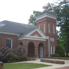
Andrews is a town in North Carolina that serves as the local administrative center for its surrounding region. It manages public services and coordinates cooperation between residents and authorities at the state and county levels.

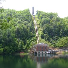
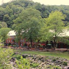
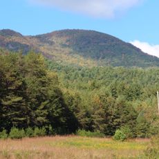
Andrews was established as an administrative center to serve the needs of the growing population in North Carolina's mountain region. It developed into a regional hub connecting Cherokee County and surrounding communities.

Regular town meetings in Andrews demonstrate the American tradition of local democracy, where residents participate in discussions about community matters.

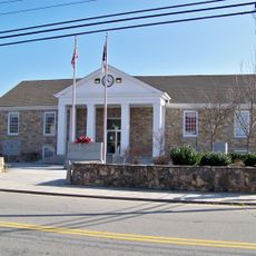
The best way to learn about the town is to visit the town hall, where information about local services and permits is available. The town sits in a hilly area, so comfortable footwear and time to explore the surroundings are helpful.

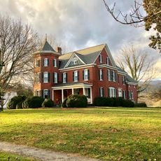
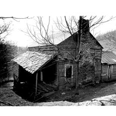
The town is named after a historical Native American family that lived in this mountain region for generations. This reflects the deep connection between the place and indigenous history.

GPS coordinates: 35.20175,-83.82407

Latest update: December 7, 2025 20:25

Photos
Around this place
Nantahala National Forest
United States of America

Nantahala National Forest

24.3 km
Fontana Lake
United States of America

Fontana Lake

28 km
Cheoah Dam
United States of America

Cheoah Dam

29.3 km
Chatuge Lake
United States of America

Chatuge Lake

23.7 km
Joyce Kilmer Memorial Forest
United States of America

Joyce Kilmer Memorial Forest

23.6 km
John C. Campbell Folk School
United States of America

John C. Campbell Folk School

22.5 km
Track Rock
United States of America

Track Rock

35.9 km
Joyce Kilmer-Slickrock Wilderness
United States of America

Joyce Kilmer-Slickrock Wilderness

23.6 km
Calderwood Dam
United States of America

Calderwood Dam

35.3 km
Citico Creek Wilderness
United States of America

Citico Creek Wilderness

30.5 km
Santeetlah Dam
United States of America

Santeetlah Dam

20.1 km
Southern Nantahala Wilderness
United States of America

Southern Nantahala Wilderness

32.9 km
Shuckstack
United States of America

Shuckstack

31.6 km
Fred Hamilton Rhododendron Garden
United States of America

Fred Hamilton Rhododendron Garden

20.7 km
Tapoco Lodge Historic District
United States of America

Tapoco Lodge Historic District

28.7 km
John Franklin Cobb House
United States of America

John Franklin Cobb House

32.5 km
Spikebuck Town Mound and Village Site
United States of America

Spikebuck Town Mound and Village Site

17.4 km
Robert Lafayette Cooper House
United States of America

Robert Lafayette Cooper House

22.7 km
Cherokee County Courthouse
United States of America

Cherokee County Courthouse

22.9 km
First Baptist Church
United States of America

First Baptist Church

251 m
Bull Cove Falls
United States of America

Bull Cove Falls

33.8 km
Franklin Pierce Cover House
United States of America

Franklin Pierce Cover House

285 m
Graham County Courthouse
United States of America

Graham County Courthouse

13.5 km
Young Harris College Historic District
United States of America

Young Harris College Historic District

30 km
Clay County Courthouse
United States of America

Clay County Courthouse

17.4 km
Charles Noden George House
United States of America

Charles Noden George House

14.4 km
Hightower Bald
United States of America

Hightower Bald

30.6 km
Lake Santeetlah
United States of America

Lake Santeetlah

17.3 km
Show the full map
Reviews

Visited this place? Tap the stars to rate it and share your experience / photos with the community! Try now! You can cancel it anytime.

« Andrews - Administrative division in North Carolina, United States » is provided by Around Us (aroundus.com). Images and texts are derived from Wikimedia project under a Creative Commons license. You are allowed to copy, distribute, and modify copies of this page, under the conditions set by the license, as long as this note is clearly visible.

Discover hidden gems everywhere you go!

From secret cafés to breathtaking viewpoints, skip the crowded tourist spots and find places that match your style. Our app makes it easy with voice search, smart filtering, route optimization, and insider tips from travelers worldwide. Download now for the complete mobile experience.

Around Us App Screenshot

A unique approach to discovering new places

Le Figaro

All the places worth exploring

France Info

A tailor-made excursion in just a few clicks

20 Minutes