Enable Location

We need your location to show you interesting places around you

Discover nearby places

Find interesting locations and hidden gems around you

Precise directions

Get accurate directions and distances to places

Your location is never shared with other users. It's only used when you tap the location button.

Santeetlah Dam

Log in to your account

Start exploring — it's free

Trusted by 61,789 travelers worldwide

Continue with Google
Continue with Apple
or

We will send you a code to connect

By continuing, you accept our Terms and Conditions and our Privacy Policy

Check your inbox

We've sent a pincode in your inbox. Please enter the code below.

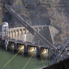
Santeetlah Dam, Hydroelectric dam in Graham County, United States

Description

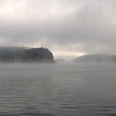
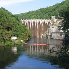
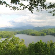
Santeetlah Dam is a hydroelectric structure on the Cheoah River in North Carolina that creates a large reservoir for power generation. The construction uses concrete and Classical Revival forms that were typical of early 20th-century water power facilities.

History

The facility was completed in 1928 by the Tallassee Power Company and pioneered the application of vibratory damping techniques for concrete construction. This innovation contributed to improving structural durability.

Culture

The National Register of Historic Places recognized the dam in 2004 for its role in early hydroelectric development and Classical Revival architectural elements.

Practical

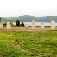
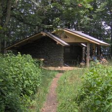
The area around the facility is accessible, but offers limited viewpoints from public areas. Visitors should note that the surroundings are mostly private or used for operational purposes.

Did you know?

The powerhouse sits on the left bank of the reservoir, several miles upstream from another dam on the river. This arrangement enabled more efficient use of the river drop for electricity generation.

Location
Architectural style
neoclassicism
GPS coordinates
35.37750,-83.87630
Latest update
December 11, 2025 18:06

AroundUs brings together thousands of curated places, local tips, and hidden gems, enriched daily by 60,000 contributors worldwide. Discover all places nearby (Graham County).

Around this place
Fontana Lake
United States of America

Fontana Lake

11.4 km
Cheoah Dam
United States of America

Cheoah Dam

9.6 km
Joyce Kilmer Memorial Forest
United States of America

Joyce Kilmer Memorial Forest

9 km
Chota
United States of America

Chota

30.4 km
Abrams Falls Trail
United States of America

Abrams Falls Trail

23.8 km
Tuckaleechee Caverns
United States of America

Tuckaleechee Caverns

32.6 km
Gregory Bald
United States of America

Gregory Bald

15.9 km
Joyce Kilmer-Slickrock Wilderness
United States of America

Joyce Kilmer-Slickrock Wilderness

9 km
Calderwood Dam
United States of America

Calderwood Dam

15.9 km
Silers Bald
United States of America

Silers Bald

35.1 km
Citico Creek Wilderness
United States of America

Citico Creek Wilderness

16 km
Shuckstack
United States of America

Shuckstack

13.3 km
Tapoco Lodge Historic District
United States of America

Tapoco Lodge Historic District

9.1 km
Hall Cabin
United States of America

Hall Cabin

23.9 km
Robert Lafayette Cooper House
United States of America

Robert Lafayette Cooper House

35.3 km
First Baptist Church
United States of America

First Baptist Church

20.3 km
Franklin Pierce Cover House
United States of America

Franklin Pierce Cover House

20.1 km
Graham County Courthouse
United States of America

Graham County Courthouse

8.8 km
Charles Noden George House
United States of America

Charles Noden George House

19.1 km
Cades Cove Missionary Baptist Church
United States of America

Cades Cove Missionary Baptist Church

26.1 km
Look Rock Observation Tower
United States of America

Look Rock Observation Tower

29 km
Cades Cove Methodist Church
United States of America

Cades Cove Methodist Church

26.1 km
Cades Cove Primitive Baptist Church
United States of America

Cades Cove Primitive Baptist Church

25.6 km
Cades Cove Visitor Center
United States of America

Cades Cove Visitor Center

23.3 km
Carter Shields Cabin
United States of America

Carter Shields Cabin

24.6 km
Elijah Oliver Place
United States of America

Elijah Oliver Place

24.6 km
Derrick Knob Shelter
United States of America

Derrick Knob Shelter

29.9 km
Lake Santeetlah
United States of America

Lake Santeetlah

2.9 km
Show the full map
« Santeetlah Dam - Hydroelectric dam in Graham County, United States » is provided by Around Us (aroundus.com). Images and texts are derived from Wikimedia project under a Creative Commons license. You are allowed to copy, distribute, and modify copies of this page, under the conditions set by the license, as long as this note is clearly visible.

Discover hidden gems everywhere you go!

From secret cafés to breathtaking viewpoints, skip the crowded tourist spots and find places that match your style. Our app makes it easy with voice search, smart filtering, route optimization, and insider tips from travelers worldwide. Download now for the complete mobile experience.

Around Us App Screenshot

A unique approach to discovering new places

Le Figaro

All the places worth exploring

France Info

A tailor-made excursion in just a few clicks

20 Minutes

Around Us
Travel Guide & Maps
Download

Send to your phone

QR Code
1

Open the camera app on your mobile.

2

Point at the QR code with your camera. A notification will appear.

3

Tap the notification to open the link.