Chest opened
+${chestReward.xp} XP
Explorer
NOUVEAU ×${chestReward.collectible.quantity}
tapez pour fermer
Chest locked

Open chests in the app

Around Us is built for your phone — chests unlock when you walk, explore and capture nearby places.

Enable Location

We need your location to show you interesting places around you

Discover nearby places

Find interesting locations and hidden gems around you

Precise directions

Get accurate directions and distances to places

Your location is never shared with other users. It's only used when you tap the location button.

Log in to your account

Start exploring — it's free

Trusted by 72,881 travelers worldwide

Continue with Google
Continue with Apple
or

We will send you a code to connect

By continuing, you accept our Terms and Conditions and our Privacy Policy

Check your inbox

We've sent a pincode in your inbox. Please enter the code below.

Republic of Indian Stream
Discussion Reviews Photo
50.9k Popularity

Republic of Indian Stream, Historical unrecognized state in northern New Hampshire, United States.

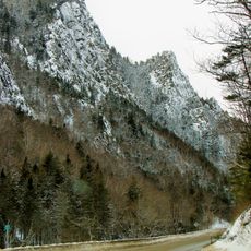
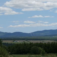
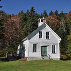
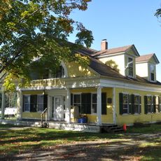
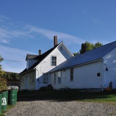
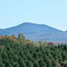
The Republic of Indian Stream was a small independent territory in northern New Hampshire covering around 200,000 acres near the Connecticut River headwaters along the Canadian border. The region was home to settlers who established their own governmental institutions separate from both the United States and British Canada.

Between 1832 and 1835, settlers in the Indian Stream region established their own republic with a constitution and court system due to unclear territorial claims from both the United States and British Canada. The boundary dispute ended in 1842 when the Webster-Ashburton Treaty formally assigned the area to the United States.

The settlers developed their own governmental and social structures, reflecting how frontier communities created local institutions to serve their needs. These early attempts at self-governance show how isolated populations managed their affairs when neither Britain nor the United States exerted clear control.

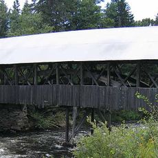
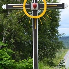
A historical marker commemorates the former republic at the intersection of Route 3 and Back Lake Road in present-day Pittsburg in the region. The location is accessible to visitors seeking to learn more about this unusual chapter in American history.

The settlement became a curious buffer zone where a few hundred residents maintained independence between two larger powers for a brief period. This tiny experiment in self-governance remains largely overlooked in broader American history.

The community of curious travelers

AroundUs brings together thousands of curated places, local tips, and hidden gems, enriched daily by 60,000 contributors worldwide.

Start exploring
Location
Inception
1832
Capital city
Pittsburg
GPS coordinates
45.15000,-71.33330
Latest update
December 18, 2025 11:41
Around this place
Dixville Notch State Park
United States of America

Dixville Notch State Park

32.2 km
Pittsburg–Clarksville Covered Bridge
United States of America

Pittsburg–Clarksville Covered Bridge

12.1 km
Coleman State Park
United States of America

Coleman State Park

23 km
United States of America

Beaver Brook Falls Wayside

27.6 km
Montagne des Lignes
Canada

Montagne des Lignes

15.7 km
Saint-Isidore-d'Auckland
Canada

Saint-Isidore-d'Auckland

19.2 km
Indian Stream Schoolhouse
United States of America

Indian Stream Schoolhouse

14.5 km
Alice M. Ward Library
United States of America

Alice M. Ward Library

23.6 km
Benjamin Aldrich Homestead
United States of America

Benjamin Aldrich Homestead

27.2 km
Mount D'Urban
United States of America

Mount D'Urban

24.1 km
Église Saint-Herménégilde de Saint-Herménégilde
Canada

Église Saint-Herménégilde de Saint-Herménégilde

27.3 km
Site du patrimoine de l'église de Saint-Venant-de-Paquette
Canada

Site du patrimoine de l'église de Saint-Venant-de-Paquette

10.5 km
Académie d'Eaton Corner
Canada

Académie d'Eaton Corner

31.6 km
Église d'Eaton Corner
Canada

Église d'Eaton Corner

31.7 km
Site du patrimoine du canton de Sainte-Edwidge-de-Clifton
Canada

Site du patrimoine du canton de Sainte-Edwidge-de-Clifton

28 km
Church of St Joseph
Canada

Church of St Joseph

28.8 km
Église de Saint-Venant-de-Paquette
Canada

Église de Saint-Venant-de-Paquette

10.6 km
Forest Access Road bridge over the Connecticut River
United States of America

Forest Access Road bridge over the Connecticut River

8.9 km
Croix de chemin du Village de Saint-Edwidge
Canada

Croix de chemin du Village de Saint-Edwidge

27.9 km
Croix de chemin Scalabrini
Canada

Croix de chemin Scalabrini

29.2 km
Scott Brook Road bridge over the Connecticut River
United States of America

Scott Brook Road bridge over the Connecticut River

12.8 km
U.S. Route 3 Bridge over the Connecticut River
United States of America

U.S. Route 3 Bridge over the Connecticut River

12.1 km
Croix de chemin Lemire
Canada

Croix de chemin Lemire

27.5 km
Site du patrimoine d'Eaton Corner
Canada

Site du patrimoine d'Eaton Corner

31.6 km
Magalloway Road Bridge over the Connecticut River
United States of America

Magalloway Road Bridge over the Connecticut River

10.4 km
Croix de chemin paroissiale
Canada

Croix de chemin paroissiale

29.8 km
MEC Connecticut River Bridge
United States of America

MEC Connecticut River Bridge

22.7 km
Second Connecticut Lake
United States of America

Second Connecticut Lake

12.7 km
Show the full map
Reviews
Share your experience

No review yet

Discussions
Start a discussion...

No discussion yet

« Republic of Indian Stream - Historical unrecognized state in northern New Hampshire, United States » is provided by Around Us (aroundus.com). Images and texts are derived from Wikimedia project under a Creative Commons license. You are allowed to copy, distribute, and modify copies of this page, under the conditions set by the license, as long as this note is clearly visible.

Discover hidden gems everywhere you go!

From secret cafés to breathtaking viewpoints, skip the crowded tourist spots and find places that match your style. Our app makes it easy with voice search, smart filtering, route optimization, and insider tips from travelers worldwide. Download now for the complete mobile experience.

Around Us App Screenshot

A unique approach to discovering new places

Le Figaro

All the places worth exploring

France Info

A tailor-made excursion in just a few clicks

20 Minutes

Around Us
Travel Guide & Maps
Download

Send to your phone

QR Code
1

Open the camera app on your mobile.

2

Point at the QR code with your camera. A notification will appear.

3

Tap the notification to open the link.