Chest opened
+${chestReward.xp} XP
Explorer
NOUVEAU ×${chestReward.collectible.quantity}
tapez pour fermer
Chest locked

Open chests in the app

Around Us is built for your phone — chests unlock when you walk, explore and capture nearby places.

Enable Location

We need your location to show you interesting places around you

Discover nearby places

Find interesting locations and hidden gems around you

Precise directions

Get accurate directions and distances to places

Your location is never shared with other users. It's only used when you tap the location button.

Log in to your account

Start exploring — it's free

Trusted by 73,076 travelers worldwide

Continue with Google
Continue with Apple
or

We will send you a code to connect

By continuing, you accept our Terms and Conditions and our Privacy Policy

Check your inbox

We've sent a pincode in your inbox. Please enter the code below.

Territory of Sagadahock
Discussion Reviews Photo
2.5k Popularity

Territory of Sagadahock, Former colonial territory in eastern Maine, United States.

The Territory of Sagadahock was a region in eastern Maine that stretched from the Kennebec River eastward along the Atlantic coast. It covered a substantial portion of what is now the midcoast area and served as an early focal point for English settlement in New England.

English settlers established their first presence in this area between 1608 and 1609. By 1691, the territory merged with Massachusetts through a royal charter, forming a unified administrative structure for the New England colonies.

The territory represented a meeting point between English colonial interests and Native American communities, leading to complex interactions and territorial negotiations.

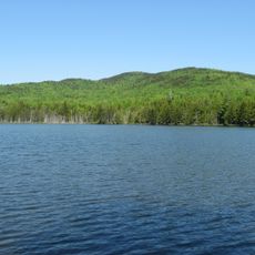
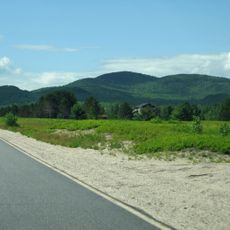
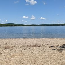
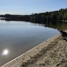
The territory sat along a rugged coastline with natural harbors that were favorable for maritime commerce and shipbuilding. Its location also provided access to valuable resources such as fishing grounds and inland forests.

The area was known by two different names in its early colonial years: Sagadahock and New Castle. This dual naming reflected the overlapping and competing claims made by different English founders of settlements.

The community of curious travelers

AroundUs brings together thousands of curated places, local tips, and hidden gems, enriched daily by 60,000 contributors worldwide.

Start exploring
Location
GPS coordinates
45.00000,-68.00000
Latest update
December 12, 2025 17:40
Around this place
Sunkhaze Meadows National Wildlife Refuge
United States of America

Sunkhaze Meadows National Wildlife Refuge

44.1 km
United States of America

Black Cap Mountain

52.4 km
St. Anne's Church and Mission Site
United States of America

St. Anne's Church and Mission Site

51.8 km
Ruggles House
United States of America

Ruggles House

44.2 km
Cherryfield Historic District
United States of America

Cherryfield Historic District

45.1 km
Gen. Alexander Campbell House
United States of America

Gen. Alexander Campbell House

45.2 km
William M. Nash House
United States of America

William M. Nash House

44.8 km
Bear Brook Watershed in Maine
United States of America

Bear Brook Watershed in Maine

17.5 km
Robertson Quarry Galamander
United States of America

Robertson Quarry Galamander

51.3 km
Jonesboro Union Church
United States of America

Jonesboro Union Church

50.6 km
United States of America

Union Church

44.1 km
Columbia House
United States of America

Columbia House

44.1 km
David W. Campbell House
United States of America

David W. Campbell House

44.9 km
Patten Building
United States of America

Patten Building

45.1 km
Cherryfield Academy
United States of America

Cherryfield Academy

44.7 km
Archibald-Adams House
United States of America

Archibald-Adams House

44.3 km
Whitneyville Congregational Church
United States of America

Whitneyville Congregational Church

50.2 km
Frank Campbell House
United States of America

Frank Campbell House

45.2 km
Col. Samuel Campbell House
United States of America

Col. Samuel Campbell House

45.1 km
East Eddington Public Hall
United States of America

East Eddington Public Hall

51.7 km
Gallison Memorial Library
United States of America

Gallison Memorial Library

44.9 km
Jonesboro Grange No. 357
United States of America

Jonesboro Grange No. 357

50.5 km
District No. 2 School
United States of America

District No. 2 School

52.5 km
Johnson Brook Trail
United States of America

Johnson Brook Trail

40.8 km
Lead Mountain
United States of America

Lead Mountain

17.3 km
National Wreaths Across America Headquarters
United States of America

National Wreaths Across America Headquarters

44.2 km
Schoodic Beach
United States of America

Schoodic Beach

48 km
Dawn Marie Beach
United States of America

Dawn Marie Beach

20.1 km
Show the full map
Reviews
Share your experience

No review yet

Discussions
Start a discussion...

No discussion yet

« Territory of Sagadahock - Former colonial territory in eastern Maine, United States » is provided by Around Us (aroundus.com). Images and texts are derived from Wikimedia project under a Creative Commons license. You are allowed to copy, distribute, and modify copies of this page, under the conditions set by the license, as long as this note is clearly visible.

Discover hidden gems everywhere you go!

From secret cafés to breathtaking viewpoints, skip the crowded tourist spots and find places that match your style. Our app makes it easy with voice search, smart filtering, route optimization, and insider tips from travelers worldwide. Download now for the complete mobile experience.

Around Us App Screenshot

A unique approach to discovering new places

Le Figaro

All the places worth exploring

France Info

A tailor-made excursion in just a few clicks

20 Minutes

Around Us
Travel Guide & Maps
Download

Send to your phone

QR Code
1

Open the camera app on your mobile.

2

Point at the QR code with your camera. A notification will appear.

3

Tap the notification to open the link.