Chest opened
+${chestReward.xp} XP
Explorer
NOUVEAU ×${chestReward.collectible.quantity}
tapez pour fermer
Chest locked

Open chests in the app

Around Us is built for your phone — chests unlock when you walk, explore and capture nearby places.

Enable Location

We need your location to show you interesting places around you

Discover nearby places

Find interesting locations and hidden gems around you

Precise directions

Get accurate directions and distances to places

Your location is never shared with other users. It's only used when you tap the location button.

Log in to your account

Start exploring — it's free

Trusted by 73,017 travelers worldwide

Continue with Google
Continue with Apple
or

We will send you a code to connect

By continuing, you accept our Terms and Conditions and our Privacy Policy

Check your inbox

We've sent a pincode in your inbox. Please enter the code below.

Brushy Creek State Recreation Area
Discussion Reviews Photo
3.4k Popularity

Brushy Creek State Recreation Area, State recreation area in Webster County, Iowa, United States.

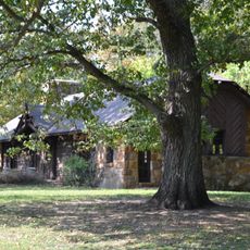
Brushy Creek State Recreation Area is a protected outdoor space in Webster County, Iowa, with native prairie, wooded sections, and a large lake. The area offers access to natural habitats and a long stretch of shoreline along the lake.

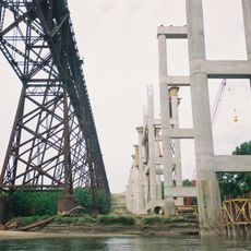
The area was planned from the 1960s onward after long discussions about reshaping a forested valley. Those efforts eventually led to the creation of the lake and the recreation area as it stands today.

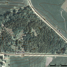
The place serves riders, hikers, and cyclists who share miles of pathways through diverse landscapes. These trails connect people with open grasslands, wooded areas, and water features in daily outdoor recreation.

The area has camping options for tents, RVs, and horse trailers, some with electrical hookups. It is worth deciding which section fits your planned activities before you arrive, as the grounds cover a wide area.

The grounds are one of the few places in Iowa where horse riding, cycling, and hiking share the same trail network. Fishing tournaments take place on the lake regularly, drawing competitors from across the state.

The community of curious travelers

AroundUs brings together thousands of curated places, local tips, and hidden gems, enriched daily by 60,000 contributors worldwide.

Start exploring
Location
GPS coordinates
42.39140,-93.98420
Latest update
March 3, 2026 13:59
Around this place
Kate Shelley High Bridge
United States of America

Kate Shelley High Bridge

37 km
Dolliver Memorial State Park
United States of America

Dolliver Memorial State Park

8.2 km
Oakland Cemetery
United States of America

Oakland Cemetery

21 km
Pilot Mound State Forest
United States of America

Pilot Mound State Forest

26.6 km
Webster County Courthouse
United States of America

Webster County Courthouse

21 km
Oleson Park Music Pavilion
United States of America

Oleson Park Music Pavilion

18.9 km
William J. and Hattie J. Zitterell House
United States of America

William J. and Hattie J. Zitterell House

15.6 km
Kendall Young Public Library
United States of America

Kendall Young Public Library

15.8 km
Boone County Courthouse
United States of America

Boone County Courthouse

37.6 km
William Oakland Round Barn
United States of America

William Oakland Round Barn

30.7 km
Webster City Post Office
United States of America

Webster City Post Office

16 km
Boone Bridge 2
United States of America

Boone Bridge 2

36.6 km
Stoll Bottling Works
United States of America

Stoll Bottling Works

37.4 km
Alonzo J. and Flora Barkley House
United States of America

Alonzo J. and Flora Barkley House

37.9 km
Champlin Memorial Masonic Temple
United States of America

Champlin Memorial Masonic Temple

37.7 km
Hamilton County Courthouse
United States of America

Hamilton County Courthouse

15.5 km
First National Bank Building
United States of America

First National Bank Building

21 km
Schultz Brothers Drug Store
United States of America

Schultz Brothers Drug Store

37.7 km
Albright Bridge
United States of America

Albright Bridge

14.4 km
Eagle Grove Public Library
United States of America

Eagle Grove Public Library

31.1 km
Tremaine Bridge
United States of America

Tremaine Bridge

14.4 km
Vincent House
United States of America

Vincent House

20.7 km
J.H. Riekenberg House
United States of America

J.H. Riekenberg House

38.1 km
Ericson Public Library
United States of America

Ericson Public Library

37.5 km
Oak Hill Historic District
United States of America

Oak Hill Historic District

20.6 km
Perrigo-Holmes House
United States of America

Perrigo-Holmes House

37.4 km
Lorenzo S. Coffin Burial Plot
United States of America

Lorenzo S. Coffin Burial Plot

26 km
Squaw Creek Bridge 2
United States of America

Squaw Creek Bridge 2

27.8 km
Show the full map
Reviews
Share your experience

No review yet

Discussions
Start a discussion...

No discussion yet

« Brushy Creek State Recreation Area - State recreation area in Webster County, Iowa, United States » is provided by Around Us (aroundus.com). Images and texts are derived from Wikimedia project under a Creative Commons license. You are allowed to copy, distribute, and modify copies of this page, under the conditions set by the license, as long as this note is clearly visible.

Discover hidden gems everywhere you go!

From secret cafés to breathtaking viewpoints, skip the crowded tourist spots and find places that match your style. Our app makes it easy with voice search, smart filtering, route optimization, and insider tips from travelers worldwide. Download now for the complete mobile experience.

Around Us App Screenshot

A unique approach to discovering new places

Le Figaro

All the places worth exploring

France Info

A tailor-made excursion in just a few clicks

20 Minutes

Around Us
Travel Guide & Maps
Download

Send to your phone

QR Code
1

Open the camera app on your mobile.

2

Point at the QR code with your camera. A notification will appear.

3

Tap the notification to open the link.