Enable Location

We need your location to show you interesting places around you

Discover nearby places

Find interesting locations and hidden gems around you

Precise directions

Get accurate directions and distances to places

Your location is never shared with other users. It's only used when you tap the location button.

Oakland Cemetery

Log in to your account

Start exploring — it's free

Trusted by 62,875 travelers worldwide

Continue with Google
Continue with Apple
or

We will send you a code to connect

By continuing, you accept our Terms and Conditions and our Privacy Policy

Check your inbox

We've sent a pincode in your inbox. Please enter the code below.

Oakland Cemetery, cemetery in Fort Dodge, Iowa

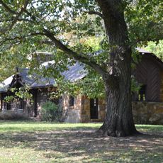
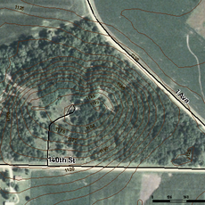
Oakland Cemetery is a 40-acre burial ground in Fort Dodge with old trees, gently rolling terrain, and graves scattered across naturally winding paths. The grounds feature historic headstones and monuments set among the natural landscape.

The cemetery was established in 1859 and designed by architect Egbert Bagg from New York, who shaped the paths to follow the natural hills and creeks. It holds graves of Civil War veterans, town founders, and prominent figures from Iowa's early period.

The cemetery shows how the community honors its dead and remembers its past. Visitors can see families placing flowers and spending quiet moments at the graves, reflecting the deep connection residents have to this place.

The cemetery is centrally located on North 15th Street and open year-round to visitors. Well-maintained paths allow easy walking, and trees provide shade during warmer months.

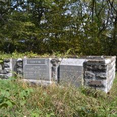
The cemetery holds graves of two black Civil War soldiers, Joseph Kinner and Joseph A. Palmer, whose headstones were provided by the government. These markers are decorated with flags and remember the contributions these soldiers made to national history.

The community of curious travelers

AroundUs brings together thousands of curated places, local tips, and hidden gems, enriched daily by 60,000 contributors worldwide.

Start exploring
Location
Inception
1859
GPS coordinates
42.51250,-94.17972
Latest update
February 9, 2026 08:20
Around this place
Dolliver Memorial State Park
United States of America

Dolliver Memorial State Park

16.1 km
Pilot Mound State Forest
United States of America

Pilot Mound State Forest

42.4 km
Webster County Courthouse
United States of America

Webster County Courthouse

1.1 km
Oleson Park Music Pavilion
United States of America

Oleson Park Music Pavilion

2.7 km
William J. and Hattie J. Zitterell House
United States of America

William J. and Hattie J. Zitterell House

29.6 km
Humboldt County Courthouse
United States of America

Humboldt County Courthouse

23.6 km
Kendall Young Public Library
United States of America

Kendall Young Public Library

30 km
Wright County Courthouse
United States of America

Wright County Courthouse

44.1 km
Calhoun County Courthouse
United States of America

Calhoun County Courthouse

39.6 km
Boone River Bridge
United States of America

Boone River Bridge

42.9 km
William Oakland Round Barn
United States of America

William Oakland Round Barn

44.9 km
Humboldt Public Library
United States of America

Humboldt Public Library

23.4 km
Webster City Post Office
United States of America

Webster City Post Office

30 km
Corydon Brown House
United States of America

Corydon Brown House

23.6 km
Berkhimer Bridge
United States of America

Berkhimer Bridge

25.9 km
Hamilton County Courthouse
United States of America

Hamilton County Courthouse

30.7 km
First National Bank Building
United States of America

First National Bank Building

1.1 km
Renwick Generating Plant
United States of America

Renwick Generating Plant

38.9 km
Albright Bridge
United States of America

Albright Bridge

32.6 km
Tremaine Bridge
United States of America

Tremaine Bridge

33.5 km
Eagle Grove Public Library
United States of America

Eagle Grove Public Library

28.1 km
Vincent House
United States of America

Vincent House

1.2 km
Oak Hill Historic District
United States of America

Oak Hill Historic District

1.2 km
Stephen Harris Taft House
United States of America

Stephen Harris Taft House

23.6 km
Goldfield Bridge
United States of America

Goldfield Bridge

32.6 km
Lorenzo S. Coffin Burial Plot
United States of America

Lorenzo S. Coffin Burial Plot

5.3 km
Perry C. and Mattie Forrest Holdoegel House
United States of America

Perry C. and Mattie Forrest Holdoegel House

40 km
Humboldt Family Aquatic Center
United States of America

Humboldt Family Aquatic Center

23.3 km
Show the full map
« Oakland Cemetery - cemetery in Fort Dodge, Iowa » is provided by Around Us (aroundus.com). Images and texts are derived from Wikimedia project under a Creative Commons license. You are allowed to copy, distribute, and modify copies of this page, under the conditions set by the license, as long as this note is clearly visible.

Discover hidden gems everywhere you go!

From secret cafés to breathtaking viewpoints, skip the crowded tourist spots and find places that match your style. Our app makes it easy with voice search, smart filtering, route optimization, and insider tips from travelers worldwide. Download now for the complete mobile experience.

Around Us App Screenshot

A unique approach to discovering new places

Le Figaro

All the places worth exploring

France Info

A tailor-made excursion in just a few clicks

20 Minutes

Around Us
Travel Guide & Maps
Download

Send to your phone

QR Code
1

Open the camera app on your mobile.

2

Point at the QR code with your camera. A notification will appear.

3

Tap the notification to open the link.