Chest opened
+${chestReward.xp} XP
Explorer
NOUVEAU ×${chestReward.collectible.quantity}
tapez pour fermer
Chest locked

Open chests in the app

Around Us is built for your phone — chests unlock when you walk, explore and capture nearby places.

Enable Location

We need your location to show you interesting places around you

Discover nearby places

Find interesting locations and hidden gems around you

Precise directions

Get accurate directions and distances to places

Your location is never shared with other users. It's only used when you tap the location button.

Log in to your account

Start exploring — it's free

Trusted by 72,919 travelers worldwide

Continue with Google
Continue with Apple
or

We will send you a code to connect

By continuing, you accept our Terms and Conditions and our Privacy Policy

Check your inbox

We've sent a pincode in your inbox. Please enter the code below.

Chouteau Island
Discussion Reviews Photo
5.6k Popularity

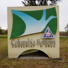
Chouteau Island, River island in Madison County, Illinois.

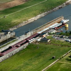
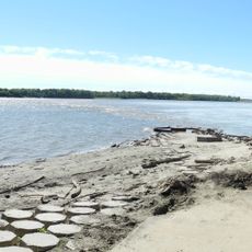
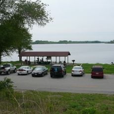
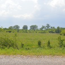
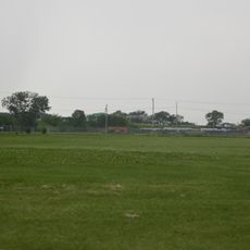
Chouteau Island is a river island in Illinois, located between the Mississippi River and the Chain of Rocks Canal, just north of St. Louis. It forms part of a three-island group and features wooded sections alongside open stretches of riverbank.

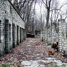
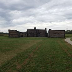
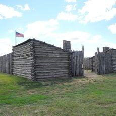
French settlers founded their first community in what is now Madison County on this island during the 18th century. That early outpost was among the first European settlements along this part of the Mississippi.

Every January, bald eagles gather along this stretch of the Mississippi, and local events give visitors a chance to watch them from the riverbank. The river here stays free of barge traffic, so the water is quieter than most sections downstream.

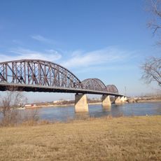
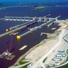
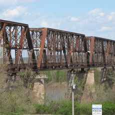
The island can be reached from Illinois via the Canal Bridge or from Missouri via the Old Chain of Rocks Bridge, which is open to walkers and cyclists. The most convenient crossing depends on which side of the river you start from.

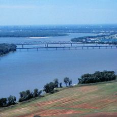
The section of the Mississippi running alongside the island is the only natural stretch free of barge traffic between St. Paul and New Orleans. That detail draws attention from conservation groups who study river ecosystems.

The community of curious travelers

AroundUs brings together thousands of curated places, local tips, and hidden gems, enriched daily by 60,000 contributors worldwide.

Start exploring
Location
GPS coordinates
38.76860,-90.14640
Latest update
March 3, 2026 10:08
Around this place
Chain of Rocks Bridge
United States of America

Chain of Rocks Bridge

2.8 km
Cementland
United States of America

Cementland

7.1 km
Chain of Rocks Lock
United States of America

Chain of Rocks Lock

7.9 km
McKinley Bridge
United States of America

McKinley Bridge

12 km
New Chain of Rocks Bridge
United States of America

New Chain of Rocks Bridge

2.4 km
Wainwright Tomb
United States of America

Wainwright Tomb

11.2 km
Melvin Price Locks and Dam
United States of America

Melvin Price Locks and Dam

11.2 km
Jones-Confluence Point State Park
United States of America

Jones-Confluence Point State Park

5.9 km
Fort Belle Fontaine
United States of America

Fort Belle Fontaine

8.9 km
Columbia Bottom Conservation Area
United States of America

Columbia Bottom Conservation Area

4.4 km
Horseshoe Lake State Park
United States of America

Horseshoe Lake State Park

10.3 km
O'Fallon Park
United States of America

O'Fallon Park

11.7 km
Confluence Tower
United States of America

Confluence Tower

6.2 km
Fort Belle Fontaine County Park
United States of America

Fort Belle Fontaine County Park

8.9 km
Horseshoe Lake Mound and Village Site
United States of America

Horseshoe Lake Mound and Village Site

9.9 km
Mitchell Archaeological Site
United States of America

Mitchell Archaeological Site

9.9 km
Bissell Water Tower
United States of America

Bissell Water Tower

12.1 km
Lewis Bridge
United States of America

Lewis Bridge

11.3 km
Bellefontaine Bridge
United States of America

Bellefontaine Bridge

11.4 km
Granite City YMCA
United States of America

Granite City YMCA

7.5 km
Emmert-Zippel House
United States of America

Emmert-Zippel House

6.4 km
Colonel George H. Blasé Park
United States of America

Colonel George H. Blasé Park

5.6 km
Gen. Daniel Bissell House
United States of America

Gen. Daniel Bissell House

6.8 km
Holy Trinity Bulgarian Eastern Orthodox Church, Madison Illinois
United States of America

Holy Trinity Bulgarian Eastern Orthodox Church, Madison Illinois

8.7 km
Lewis & Clark Interpretive Center
United States of America

Lewis & Clark Interpretive Center

5.4 km
Chain of Rocks Water Purification Plant
United States of America

Chain of Rocks Water Purification Plant

3.8 km
Lewis and Clark State Historic Site
United States of America

Lewis and Clark State Historic Site

5.4 km
General Daniel Bissell house
United States of America

General Daniel Bissell house

6.9 km
Show the full map
Reviews
Share your experience

No review yet

Discussions
Start a discussion...

No discussion yet

« Chouteau Island - River island in Madison County, Illinois » is provided by Around Us (aroundus.com). Images and texts are derived from Wikimedia project under a Creative Commons license. You are allowed to copy, distribute, and modify copies of this page, under the conditions set by the license, as long as this note is clearly visible.

Discover hidden gems everywhere you go!

From secret cafés to breathtaking viewpoints, skip the crowded tourist spots and find places that match your style. Our app makes it easy with voice search, smart filtering, route optimization, and insider tips from travelers worldwide. Download now for the complete mobile experience.

Around Us App Screenshot

A unique approach to discovering new places

Le Figaro

All the places worth exploring

France Info

A tailor-made excursion in just a few clicks

20 Minutes

Around Us
Travel Guide & Maps
Download

Send to your phone

QR Code
1

Open the camera app on your mobile.

2

Point at the QR code with your camera. A notification will appear.

3

Tap the notification to open the link.