Cowbane Prairie Natural Area Preserve

Log in to your account

AroundUs is a community-driven map of interesting places, built by curious explorers like you. It grows with every review, story, and photo you share.
Connect to save your favorite spots, contribute locations, and create personalized routes.
By continuing, you accept our Terms and Conditions and our Privacy Policy

Cowbane Prairie Natural Area Preserve

Add to collection
Map
Suggest a change
Share

Cowbane Prairie Natural Area Preserve, Natural preserve along the Blue Ridge in Shenandoah Valley, Virginia.

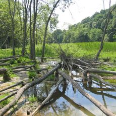
Cowbane Prairie Natural Area Preserve is a 156-acre protected area along the South River in Augusta County that combines wet prairies, drier grasslands, and spring marshes fed by limestone springs. The landscape sits between the Blue Ridge foothills and the valley floor, creating varied growing conditions across the site.

The Shenandoah Valley once supported extensive prairie and wetland environments that were gradually converted to farmland and urban areas over the past 200 years. This preserve was established to protect one of the few remaining examples of these native plant communities before they disappeared entirely.

The preserve protects plant communities that have largely disappeared from Virginia's landscape due to past land use changes. Walking through it, you experience what the region's natural prairie environments once looked like before human development.

Access requires advance coordination with the Virginia Department of Conservation and Recreation and the site's land steward to ensure proper management of visitor flow. Plan your visit during late spring or summer when trails are easier to navigate and plants are most visible.

The preserve contains queen-of-the-prairie and blueflag iris, plant species more common to Midwestern ecosystems but found here due to the site's unique limestone spring conditions. Their presence demonstrates how local geology creates growing conditions unlike anywhere else in Virginia.

Location: Virginia

GPS coordinates: 38.02230,-79.05820

Latest update: December 13, 2025 17:03

Photos
Around this place
Western State Hospital
United States of America

Western State Hospital

13.7 km
Woodrow Wilson Presidential Library
United States of America

Woodrow Wilson Presidential Library

14.3 km
Shenandoah Acres
United States of America

Shenandoah Acres

3.8 km
Saint Mary's Wilderness
United States of America

Saint Mary's Wilderness

12.8 km
Staunton National Cemetery
United States of America

Staunton National Cemetery

13.2 km
Tinkling Spring Presbyterian Church
United States of America

Tinkling Spring Presbyterian Church

9.6 km
Folly Mills Creek Fen Natural Area Preserve
United States of America

Folly Mills Creek Fen Natural Area Preserve

10.9 km
Trinity Episcopal Church
United States of America

Trinity Episcopal Church

14.1 km
Breezy Hill
United States of America

Breezy Hill

14.2 km
Valley Railroad Stone Bridge
United States of America

Valley Railroad Stone Bridge

7.6 km
Augusta County Courthouse
United States of America

Augusta County Courthouse

14.1 km
Stuart House
United States of America

Stuart House

14 km
Bethel Green
United States of America

Bethel Green

10.6 km
Beverley Historic District
United States of America

Beverley Historic District

14.2 km
National Valley Bank
United States of America

National Valley Bank

14.2 km
Mt. Torry Furnace
United States of America

Mt. Torry Furnace

11.9 km
Arista Hoge House
United States of America

Arista Hoge House

14.1 km
Sears House
United States of America

Sears House

13.8 km
Harper House
United States of America

Harper House

3.9 km
Bare House and Mill
United States of America

Bare House and Mill

3.2 km
James Alexander House
United States of America

James Alexander House

14.3 km
Clover Mount
United States of America

Clover Mount

13.1 km
Middlebrook Historic District
United States of America

Middlebrook Historic District

14.1 km
Chapel Hill
United States of America

Chapel Hill

5.1 km
Wharf Area Historic District
United States of America

Wharf Area Historic District

14 km
Thomas J. Michie House
United States of America

Thomas J. Michie House

14.2 km
Frontier Culture Museum of Virginia
United States of America

Frontier Culture Museum of Virginia

11.4 km
Dixie Theater
United States of America

Dixie Theater

14.2 km
Show the full map
Reviews

Visited this place? Tap the stars to rate it and share your experience / photos with the community! Try now! You can cancel it anytime.

« Cowbane Prairie Natural Area Preserve - Natural preserve along the Blue Ridge in Shenandoah Valley, Virginia » is provided by Around Us (aroundus.com). Images and texts are derived from Wikimedia project under a Creative Commons license. You are allowed to copy, distribute, and modify copies of this page, under the conditions set by the license, as long as this note is clearly visible.

Discover hidden gems everywhere you go!

From secret cafés to breathtaking viewpoints, skip the crowded tourist spots and find places that match your style. Our app makes it easy with voice search, smart filtering, route optimization, and insider tips from travelers worldwide. Download now for the complete mobile experience.

Around Us App Screenshot

A unique approach to discovering new places

Le Figaro

All the places worth exploring

France Info

A tailor-made excursion in just a few clicks

20 Minutes