Enable Location

We need your location to show you interesting places around you

Discover nearby places

Find interesting locations and hidden gems around you

Precise directions

Get accurate directions and distances to places

Your location is never shared with other users. It's only used when you tap the location button.

Criss Cross

Log in to your account

Start exploring — it's free

Trusted by 62,462 travelers worldwide

Continue with Google
Continue with Apple
or

We will send you a code to connect

By continuing, you accept our Terms and Conditions and our Privacy Policy

Check your inbox

We've sent a pincode in your inbox. Please enter the code below.

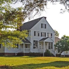
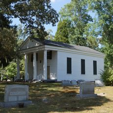
Criss Cross, human settlement in Virginia, United States of America

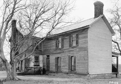
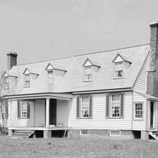
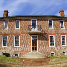
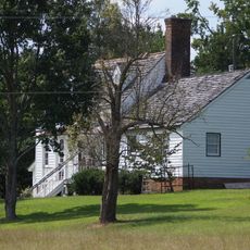
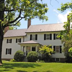
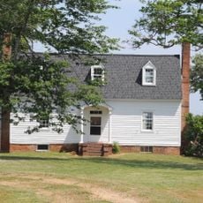
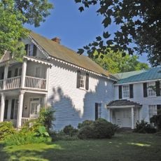
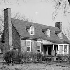
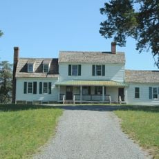
Criss Cross is a brick dwelling in rural New Kent County, Virginia dating to around 1690 and built for George Poindexter. The structure features a story-and-a-half design with a distinctive two-story entrance projection, and a rear wing was added around 1790 that likely replaced an earlier staircase tower.

Built around 1690, the house exemplifies Stuart-period architecture from when Virginia was a British colony, featuring simple English-inspired designs without elaborate ornament. The brickwork irregularities and the rear wing added around 1790 document how the structure evolved through renovations across centuries.

The house takes its name from its distinctive cross-shaped floor plan, a design choice that shaped how it was understood and remembered. Visitors can recognize this unusual layout from the exterior and see how early settlers named their homes based on practical architectural features.

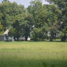
The house is a private residence not open for interior tours, but can be viewed from the road nearby. Visitors should respect the owners' privacy and observe the structure from a distance while appreciating its exterior features.

The interior preserves rare early-period features including exposed wooden beams and decorative details that reveal craftsmanship from centuries past. These elements allow visitors to glimpse the daily life of settlers who built and inhabited the structure, offering tangible connections to colonial construction methods.

The community of curious travelers

AroundUs brings together thousands of curated places, local tips, and hidden gems, enriched daily by 60,000 contributors worldwide.

Start exploring
Location
GPS coordinates
37.50280,-77.02720
Latest update
February 9, 2026 08:21
Around this place
Sherwood Forest Plantation
United States of America

Sherwood Forest Plantation

19.8 km
Greenway Plantation
United States of America

Greenway Plantation

17.8 km
Elsing Green
United States of America

Elsing Green

11.3 km
Piney Grove at Southall's Plantation
United States of America

Piney Grove at Southall's Plantation

15.1 km
Glendale National Cemetery
United States of America

Glendale National Cemetery

19.8 km
Pamunkey Indian Tribe Museum
United States of America

Pamunkey Indian Tribe Museum

8.4 km
Chericoke
United States of America

Chericoke

16.6 km
Woodburn
United States of America

Woodburn

18 km
Sweet Hall
United States of America

Sweet Hall

13.3 km
Chelsea
United States of America

Chelsea

20.3 km
George W. Watkins Elementary School
United States of America

George W. Watkins Elementary School

6.9 km
Emmaus Baptist Church
United States of America

Emmaus Baptist Church

5.8 km
Windsor Shades
United States of America

Windsor Shades

12.8 km
Former New Kent High School
United States of America

Former New Kent High School

10.6 km
Charles City County Courthouse
United States of America

Charles City County Courthouse

18.4 km
Olivet Presbyterian Church
United States of America

Olivet Presbyterian Church

4.1 km
Spring Hill (Providence Forge, Virginia)
United States of America

Spring Hill (Providence Forge, Virginia)

5.8 km
Cumberland
United States of America

Cumberland

6 km
United States of America

Lott Cary Birth Site

14 km
Spring Green (Mechanicsville, Virginia)
United States of America

Spring Green (Mechanicsville, Virginia)

19.1 km
West Point Historic District
United States of America

West Point Historic District

20.6 km
Marl Hill
United States of America

Marl Hill

4.3 km
Poplar Springs
United States of America

Poplar Springs

14.8 km
Nance-Major House and Store
United States of America

Nance-Major House and Store

18.1 km
Glebe of Westover Parish
United States of America

Glebe of Westover Parish

15.9 km
Cedar Lane
United States of America

Cedar Lane

3.3 km
Lanesville Christadelphian Church
United States of America

Lanesville Christadelphian Church

13.1 km
Royal New Kent Golf Club
United States of America

Royal New Kent Golf Club

3.3 km
Show the full map
« Criss Cross - human settlement in Virginia, United States of America » is provided by Around Us (aroundus.com). Images and texts are derived from Wikimedia project under a Creative Commons license. You are allowed to copy, distribute, and modify copies of this page, under the conditions set by the license, as long as this note is clearly visible.

Discover hidden gems everywhere you go!

From secret cafés to breathtaking viewpoints, skip the crowded tourist spots and find places that match your style. Our app makes it easy with voice search, smart filtering, route optimization, and insider tips from travelers worldwide. Download now for the complete mobile experience.

Around Us App Screenshot

A unique approach to discovering new places

Le Figaro

All the places worth exploring

France Info

A tailor-made excursion in just a few clicks

20 Minutes

Around Us
Travel Guide & Maps
Download

Send to your phone

QR Code
1

Open the camera app on your mobile.

2

Point at the QR code with your camera. A notification will appear.

3

Tap the notification to open the link.