Chest opened
+${chestReward.xp} XP
Explorer
NOUVEAU ×${chestReward.collectible.quantity}
tapez pour fermer

See the monuments around you in AR Open chests in the app

Around Us is built for your phone — point your camera at the streets and discover the monuments and places around you in augmented reality. Around Us is built for your phone — chests unlock when you walk, explore and capture nearby places.

Enable Location

We need your location to show you interesting places around you

Discover nearby places

Find interesting locations and hidden gems around you

Precise directions

Get accurate directions and distances to places

Your location is never shared with other users. It's only used when you tap the location button.

Cross Ledge Light

Log in to your account

Start exploring — it's free

Trusted by 86,244 travelers worldwide

Continue with Google
Continue with Apple
or

We will send you a code to connect

By continuing, you accept our Terms and Conditions and our Privacy Policy

Check your inbox

We've sent a pincode in your inbox. Please enter the code below.

Cross Ledge Light
Discussion Reviews 1 Photos
1.5k Popularity

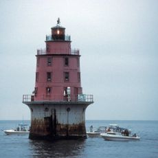
Cross Ledge Light, Maritime lighthouse in Delaware Bay, United States.

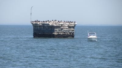
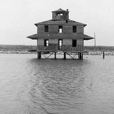
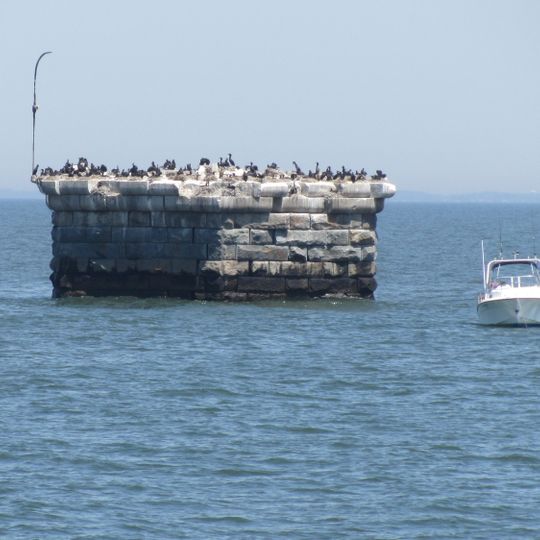
Cross Ledge Light is a lighthouse that once stood on a granite pier foundation in Delaware Bay. The structure featured an octagonal wooden tower that rose above the water to guide ships through the bay's shipping lanes.

Construction of the lighthouse began in 1856 but was interrupted by ice damage to the pier. The structure served as an important navigation aid during the late 1800s for vessels moving through the bay.

The lighthouse served as a critical navigation point for commercial ships traversing the northern boundary of Delaware Bay's shipping channel.

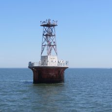
The pier ruins are visible only from a distance today and appear on nautical charts as an abandoned light station. Visitors can only view the remains from the water, and the site serves as a navigation warning for passing vessels.

After falling out of use, the lighthouse was eventually abandoned and left to decay, only to find a second purpose during wartime. Military aircraft used the deteriorating structure as a bombing practice target during World War II.

The community of curious travelers

AroundUs brings together thousands of curated places, local tips, and hidden gems, enriched daily by 60,000 contributors worldwide.
Start exploring
Inception
1875
GPS coordinates
39.20400,-75.23070
Latest update
September 12, 2026 06:59
Around this place
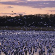
Bombay Hook National Wildlife Refuge
United States of America

Bombay Hook National Wildlife Refuge

13.6 mi
Air Mobility Command Museum
United States of America

Air Mobility Command Museum

13.5 mi
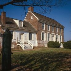
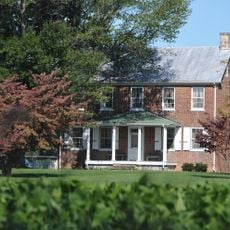
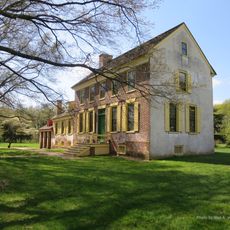
John Dickinson House
United States of America

John Dickinson House

13.7 mi
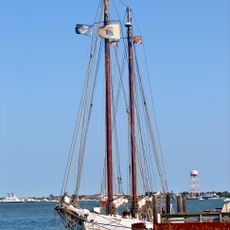
A. J. Meerwald
United States of America

A. J. Meerwald

10.9 mi
East Point Light
United States of America

East Point Light

10.9 mi
Ship John Shoal Light
United States of America

Ship John Shoal Light

10.5 mi
Fourteen Foot Bank Light
United States of America

Fourteen Foot Bank Light

11.1 mi
Elbow of Cross Ledge Light
United States of America

Elbow of Cross Ledge Light

2.5 mi
Miah Maull Shoal Light
United States of America

Miah Maull Shoal Light

5.5 mi
Town Point
United States of America

Town Point

13.6 mi
St. Paul's by-the-sea Protestant Episcopal Church
United States of America

St. Paul's by-the-sea Protestant Episcopal Church

12 mi
Caesar Hoskins Log Cabin
United States of America

Caesar Hoskins Log Cabin

13.8 mi
Bivalve Oyster Packing Houses and Docks
United States of America

Bivalve Oyster Packing Houses and Docks

10.8 mi
David Compton House
United States of America

David Compton House

13.9 mi
Saxton United Methodist Church
United States of America

Saxton United Methodist Church

13.7 mi
East Point Lighthouse
United States of America

East Point Lighthouse

10.9 mi
Little Creek Methodist Church
United States of America

Little Creek Methodist Church

11.9 mi
Captain Isaac Peterson House
United States of America

Captain Isaac Peterson House

13.9 mi
Abraham and Ann Hoy House
United States of America

Abraham and Ann Hoy House

13.8 mi
United States of America

Macomb Farm

13.3 mi
Jonathan Woodley House
United States of America

Jonathan Woodley House

11.9 mi
Old Stone Tavern
United States of America

Old Stone Tavern

11.9 mi
Mifflin-Marim Agricultural Complex
United States of America

Mifflin-Marim Agricultural Complex

14.5 mi
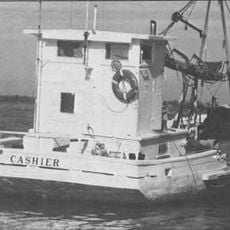
Cashier
United States of America

Cashier

10.7 mi
Mahon River Light
United States of America

Mahon River Light

9.2 mi
John Dickinson Plantation
United States of America

John Dickinson Plantation

13.7 mi
Mauricetown Historic District
United States of America

Mauricetown Historic District

13.8 mi
Mauricetown Bridge
United States of America

Mauricetown Bridge

14 mi
Show the full map
Reviews
Share your experience

No review yet

Discussions
Start a discussion...

No discussion yet

« Cross Ledge Light - Maritime lighthouse in Delaware Bay, United States » is provided by Around Us (aroundus.com). Images and texts are derived from Wikimedia project under a Creative Commons license. You are allowed to copy, distribute, and modify copies of this page, under the conditions set by the license, as long as this note is clearly visible.

Discover hidden gems everywhere you go!

From secret cafés to breathtaking viewpoints, skip the crowded tourist spots and find places that match your style. Our app makes it easy with voice search, smart filtering, route optimization, and insider tips from travelers worldwide. Download now for the complete mobile experience.
Around Us App Screenshot

A unique approach to discovering new places

Le Figaro

All the places worth exploring

France Info

A tailor-made excursion in just a few clicks

20 Minutes

Around Us
Travel Guide & Maps
Download

Send to your phone

QR Code
1

Open the camera app on your mobile.

2

Point at the QR code with your camera. A notification will appear.

3

Tap the notification to open the link.