Enable Location

We need your location to show you interesting places around you

Discover nearby places

Find interesting locations and hidden gems around you

Precise directions

Get accurate directions and distances to places

Your location is never shared with other users. It's only used when you tap the location button.

Decatur Island

Log in to your account

Start exploring — it's free

Trusted by 67,436 travelers worldwide

Continue with Google
Continue with Apple
or

We will send you a code to connect

By continuing, you accept our Terms and Conditions and our Privacy Policy

Check your inbox

We've sent a pincode in your inbox. Please enter the code below.

Decatur Island
Discussion Reviews 1 Photos
8.9k Popularity

Decatur Island, Island in San Juan County, United States

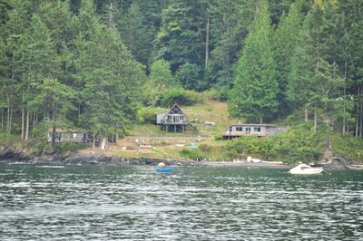
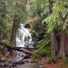
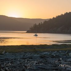
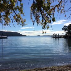
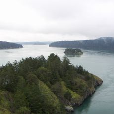
Decatur Island sits between Lopez and Blakely islands in Washington, featuring forested areas mixed with open landscapes and a small population. The island contains privately owned properties and natural shorelines that make up its character.

The Wilkes Expedition named the island in 1841 to honor American naval officer Stephen Decatur. A post office operated there from 1891 to 1969, marking a period of established settlement.

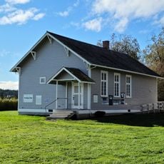
The island's one-room schoolhouse teaches children from kindergarten through eighth grade, serving as a social hub for the tight-knit community. Education here balances remote location challenges with contemporary learning resources.

The island is accessible by private boat, passenger ferry from Anacortes, or air service from Bellingham, since no public ferry runs there. Plan visits with advance arrangements as transportation options require coordination.

Feral sheep descended from early settlers roam the island and are sheared annually to help manage vegetation. These animals have become part of the island's identity and ecological balance.

The community of curious travelers

AroundUs brings together thousands of curated places, local tips, and hidden gems, enriched daily by 60,000 contributors worldwide.

Start exploring
Location
GPS coordinates
48.50296,-122.80833
Latest update
December 10, 2025 15:59
Around this place
Deception Pass Bridge
United States of America

Deception Pass Bridge

16.2 km
Mount Constitution
United States of America

Mount Constitution

19.5 km
San Juan Island National Historical Park
United States of America

San Juan Island National Historical Park

15.4 km
Moran State Park
United States of America

Moran State Park

17.8 km
Mount Erie
United States of America

Mount Erie

14.6 km
United States of America

Department of Safety

14.4 km
University of Washington Friday Harbor Laboratories
United States of America

University of Washington Friday Harbor Laboratories

15.8 km
Bay View State Park
United States of America

Bay View State Park

24.1 km
Spencer Spit State Park
United States of America

Spencer Spit State Park

5.2 km
Obstruction Pass State Park
United States of America

Obstruction Pass State Park

11.4 km
Rosario
United States of America

Rosario

16.5 km
WT Preston
United States of America

WT Preston

14.8 km
United States of America

Joseph Whidbey State Park

21.2 km
Burrows Island Light
United States of America

Burrows Island Light

7.5 km
Cattle Point Light
United States of America

Cattle Point Light

12.8 km
Blind Island Marine State Park
United States of America

Blind Island Marine State Park

13.1 km
Smith Island Light
United States of America

Smith Island Light

20.6 km
Port Stanley School
United States of America

Port Stanley School

5.6 km
Emmanuel Episcopal Church
United States of America

Emmanuel Episcopal Church

22.5 km
Mount Constitution Lookout Tower
United States of America

Mount Constitution Lookout Tower

19.5 km
San Juan Island Museum of Art
United States of America

San Juan Island Museum of Art

16 km
Island Theatre
United States of America

Island Theatre

14.5 km
Deception Pass State Park
United States of America

Deception Pass State Park

16.9 km
American Camp
United States of America

American Camp

15.4 km
Anacortes Cinemas
United States of America

Anacortes Cinemas

14.4 km
Eagle Cliff
United States of America

Eagle Cliff

12.7 km
Empire Theater
United States of America

Empire Theater

14.5 km
Bowman Bay Picnic Shelter
United States of America

Bowman Bay Picnic Shelter

14.8 km
Show the full map
Reviews
Share your experience

No review yet

Discussions
Start a discussion...

No discussion yet

« Decatur Island - Island in San Juan County, United States » is provided by Around Us (aroundus.com). Images and texts are derived from Wikimedia project under a Creative Commons license. You are allowed to copy, distribute, and modify copies of this page, under the conditions set by the license, as long as this note is clearly visible.

Discover hidden gems everywhere you go!

From secret cafés to breathtaking viewpoints, skip the crowded tourist spots and find places that match your style. Our app makes it easy with voice search, smart filtering, route optimization, and insider tips from travelers worldwide. Download now for the complete mobile experience.

Around Us App Screenshot

A unique approach to discovering new places

Le Figaro

All the places worth exploring

France Info

A tailor-made excursion in just a few clicks

20 Minutes

Around Us
Travel Guide & Maps
Download

Send to your phone

QR Code
1

Open the camera app on your mobile.

2

Point at the QR code with your camera. A notification will appear.

3

Tap the notification to open the link.