Enable Location

We need your location to show you interesting places around you

Discover nearby places

Find interesting locations and hidden gems around you

Precise directions

Get accurate directions and distances to places

Your location is never shared with other users. It's only used when you tap the location button.

Almendralejo

Log in to your account

Start exploring — it's free

Trusted by 62,058 travelers worldwide

Continue with Google
Continue with Apple
or

We will send you a code to connect

By continuing, you accept our Terms and Conditions and our Privacy Policy

Check your inbox

We've sent a pincode in your inbox. Please enter the code below.

Almendralejo, Agricultural municipality in Badajoz Province, Spain

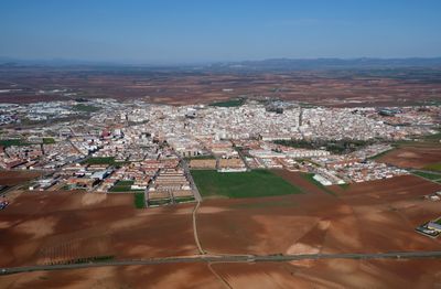
Almendralejo is a municipality in Badajoz Province, located in southwestern Spain within the Tierra de Barros region of Extremadura. The town sits at 337 meters altitude, surrounded by rolling farmland and vineyards that stretch across the gently sloping terrain.

The area has been inhabited since Roman times, as evidenced by a silver platter from the fourth century discovered here. During the medieval period the settlement grew through agriculture and winemaking, developing into a regional production center.

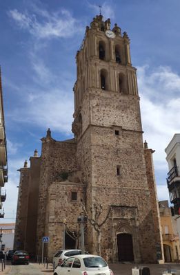
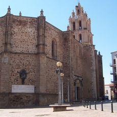
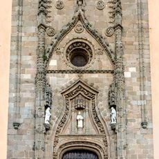
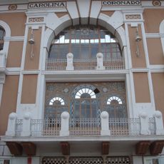
The Gothic-style Church of Purification, completed in 1515, features a balanced tower and contains a seventeenth-century altarpiece displaying local religious heritage.

Access is straightforward via well-maintained roads that cross the agricultural plain, making orientation easy. Visiting is possible year-round, though autumn brings harvest activities related to wine production that add interest to a stay.

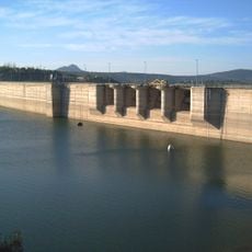
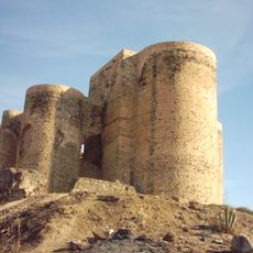
An eighteenth-century rubble-masonry dam was built here to harness waterpower and irrigate fields, stretching more than 120 meters in length. The structure represents one of the earliest examples of this type of engineering work on the Iberian Peninsula.

The community of curious travelers

AroundUs brings together thousands of curated places, local tips, and hidden gems, enriched daily by 60,000 contributors worldwide.

Start exploring
Capital city
Almendralejo
Elevation above the sea
337 m
Part of
Mancomunitat d'Aigües de los embalses de Jaime Ozores y Feria espanyol
Shares border with
Aceuchal, Alange, Mérida, Solana de los Barros, Torremejía, Villafranca de los Barros, La Zarza, Fuente del Maestre
GPS coordinates
38.68306,-6.40917
Latest update
December 13, 2025 19:46
« Almendralejo - Agricultural municipality in Badajoz Province, Spain » is provided by Around Us (aroundus.com). Images and texts are derived from Wikimedia project under a Creative Commons license. You are allowed to copy, distribute, and modify copies of this page, under the conditions set by the license, as long as this note is clearly visible.

Discover hidden gems everywhere you go!

From secret cafés to breathtaking viewpoints, skip the crowded tourist spots and find places that match your style. Our app makes it easy with voice search, smart filtering, route optimization, and insider tips from travelers worldwide. Download now for the complete mobile experience.

Around Us App Screenshot

A unique approach to discovering new places

Le Figaro

All the places worth exploring

France Info

A tailor-made excursion in just a few clicks

20 Minutes

Around Us
Travel Guide & Maps
Download

Send to your phone

QR Code
1

Open the camera app on your mobile.

2

Point at the QR code with your camera. A notification will appear.

3

Tap the notification to open the link.