Arnedo

Log in to your account

AroundUs is a community-driven map of interesting places, built by curious explorers like you. It grows with every review, story, and photo you share.
Connect to save your favorite spots, contribute locations, and create personalized routes.
Continue with Google
Continue with Apple
Continue with X
Continue with Facebook
Continue with email
By continuing, you accept our Terms and Conditions and our Privacy Policy
Create an account
Add to collection
Map
Suggest a change
Share

Arnedo, Industrial municipality in La Rioja, Spain

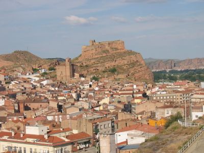
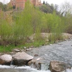
Arnedo is an industrial municipality in La Rioja situated in the Cidacos River valley at approximately 550 meters elevation and spanning about 85 square kilometers. The settlement is surrounded by rocky and sandstone mountains and has historically developed around footwear manufacturing.

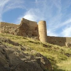
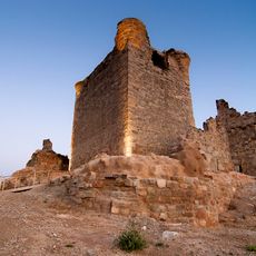
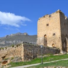
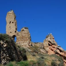
The settlement traces its roots to the Neolithic period, with Romans constructing fortifications in the 2nd century BC that were later occupied by Moors in the 8th century. During the Reconquista, a castle was built on Roman foundations to serve as a regional defensive structure.

The Shoe Museum displays traditional footwear craftsmanship and manufacturing equipment that has shaped the town's economy since the early 1900s. The collection tells the story of a skilled trade passed down through generations in this community.

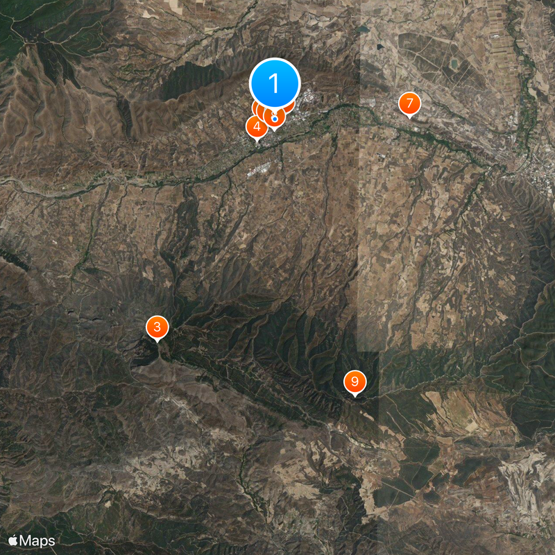
The town is accessible via the LR-134 road and lies about 17 kilometers from Calahorra and approximately 49 kilometers from the regional capital Logroño. The central valley location provides convenient access from both larger cities.

The castle was built in the 9th century during the Reconquista on earlier Roman foundations and served as one of the region's key defensive fortifications. The ruins still show the construction style from that era and provide insight into medieval defensive techniques.

Location: La Rioja

Inception: 9 century

Capital city: Arnedo

Elevation above the sea: 550 m

Part of: Mancomunitat de Municipis de la Cuenca del Cidacos

Shares border with: Muro de Aguas, Préjano, Herce, Bergasillas Bajera, Bergasa, Tudelilla, El Villar de Arnedo, Pradejón, Quel, Villarroya

Website: https://arnedo.com

GPS coordinates: 42.22778,-2.10000

Latest update: December 20, 2025 13:56

Photos
Reviews

Visited this place? Tap the stars to rate it and share your experience / photos with the community! Try now! You can cancel it anytime.

« Arnedo - Industrial municipality in La Rioja, Spain » is provided by Around Us (aroundus.com). Images and texts are derived from Wikimedia project under a Creative Commons license. You are allowed to copy, distribute, and modify copies of this page, under the conditions set by the license, as long as this note is clearly visible.

Discover hidden gems everywhere you go!

From secret cafés to breathtaking viewpoints, skip the crowded tourist spots and find places that match your style. Our app makes it easy with voice search, smart filtering, route optimization, and insider tips from travelers worldwide. Download now for the complete mobile experience.

Around Us App Screenshot

A unique approach to discovering new places

Le Figaro

All the places worth exploring

France Info

A tailor-made excursion in just a few clicks

20 Minutes