Serra Calderona, Mountain range and nature reserve near Valencia, Spain
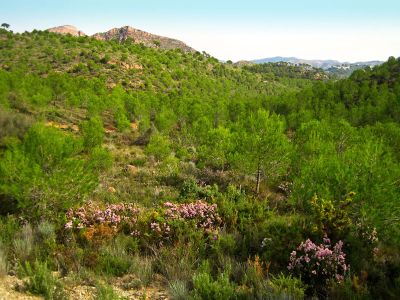
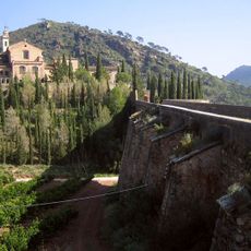
Serra Calderona is a mountain range and nature reserve spanning the Valencian Community with diverse landscapes including limestone cliffs, pine forests, and Mediterranean plants. The area contains multiple marked trails connecting seventeen municipalities throughout the region.
The mountain range took its name in the 17th century from María Calderón, a companion of King Philip IV who sought refuge in these mountains. This naming connects the landscape to a notable figure in Spanish royal history.
Local communities cultivate olive trees using traditional methods and produce certified oils recognized in international heritage food listings. These farming practices remain deeply rooted in the everyday life of the region.
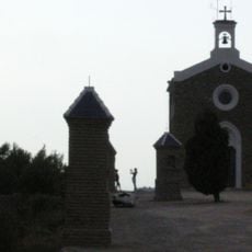
The nature reserve is most easily accessed between Puçol and Nàquera where the main entrance is located. Visitors should wear sturdy footwear and follow marked trails to navigate safely through the varied terrain.
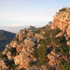
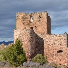
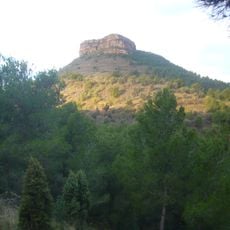
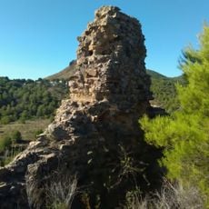
The karstic geology of the area has shaped numerous caves and river gorges that form some of the region's most intriguing geological features. At 907 meters elevation, the highest point offers views toward the Mediterranean, highlighting the geographical variety of the place.
Location: Valencian Community
Elevation above the sea: 907 m
Website: https://parquesnaturales.gva.es/va/web/pn-serra-calderona
GPS coordinates: 39.72917,-0.49278
Latest update: December 11, 2025 11:06
Serra Calderona Natural Park
0 m
Cartuja de Porta Coeli
5.4 km
Monastery of Sancti Spiritu, Gilet
14.1 km
Castell de Serra
8.5 km
Castillo de Beselga
10.8 km
Castell d'Ali Maimo
2.7 km
Església del Crist de les Mercés
8.4 kmLa Baronía
12.1 km
Castell de Torres Torres
12 km
Banys àrabs de Torres Torres
11.9 km
Castle Palace, Albalat dels Tarongers
13.6 km
La Dehesa
15.9 km
Palacio de Sot de Ferrer
10.9 km
Ermita de Sant Francesc, Nàquera
10.2 km
Church of the Immaculate
10.9 km
Tower Olla
1.1 km
Església de la Immaculada de Segart
11.4 km
Campanario de la Iglesia Parroquial de San Miguel Arcángel
11.3 km
Mola de Segart
11.6 km
Segart Castle
11.5 km
Hermitage of Saint Anthony
11.3 km
El Castell
4.6 km
Church of San Miguel Arcángel, Soneja
11.3 km
Gilet Tower
15.7 km
Castell del Piló
13.8 km
Antiga torre defensiva d'Algar
12.1 km
Church of San Mateo, Azuébar
15.9 km
Torre del Senyor de la Vila
7.4 kmVisited this place? Tap the stars to rate it and share your experience / photos with the community! Try now! You can cancel it anytime.
Discover hidden gems everywhere you go!
From secret cafés to breathtaking viewpoints, skip the crowded tourist spots and find places that match your style. Our app makes it easy with voice search, smart filtering, route optimization, and insider tips from travelers worldwide. Download now for the complete mobile experience.
A unique approach to discovering new places❞
— Le Figaro
All the places worth exploring❞
— France Info
A tailor-made excursion in just a few clicks❞
— 20 Minutes