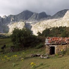
Peña Ubiña, Mountain summit in Cordillera Cantabrica, Spain.
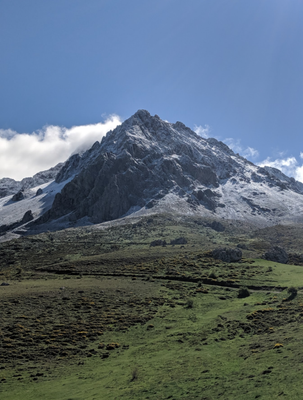
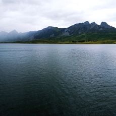
Peña Ubiña is a peak in the Cordillera Cantabrica that reaches 2,417 meters and forms a natural border between Asturias and Castile and León. The summit sits within a complex mountain range with steep slopes and ridge lines that challenge hikers and climbers.
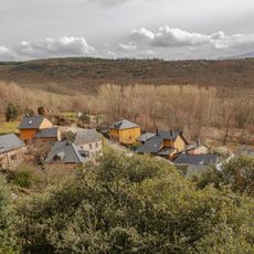
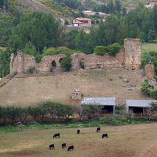
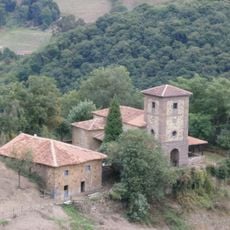
Medieval Spanish kings traveled through the Babia region around this peak, establishing its place in the region's history. The phrase 'estar en Babia' in Spanish derives from royal visits and the remote nature of this mountain area.
The name possibly comes from 'ovina', reflecting ancient sheep herding routes that crossed these peaks. Shepherds moving flocks through the passes left their mark on the local landscape and traditions.
The ascent starts with a roughly 50-minute hike to Meicín refuge, then continues with technical climbing that needs handholds but no ropes. Visitors should have mountain experience and wear proper boots to handle the steep and sometimes slippery sections safely.
The peak stands out for having about 1,122 meters of prominence above surrounding terrain, making it geologically distinct within its region. This elevation difference above nearby passes creates the technical difficulty that sets apart from standard mountain hikes.
GPS coordinates: 43.01833,-5.95673
Latest update: December 10, 2025 15:56
Reservoir of Barrios de Luna
17.9 km
Santa Cristina de Lena
16.8 km
Somiedo Natural Park
22.2 km
Engineer Carlos Fernández Casado Bridge
14.7 km
Bermiego Yew
20.4 km
Las Ubiñas-La Mesa
10.9 km
Parque de la prehistoria de Teverga
16.5 km
Sanctuary of the Virgen de Bendueños
13.9 km
Collegiate of Saint Mary of Arbas
17.5 km
Church of Santa Eulalia de Ujo
24.7 km
Los Valles de Omaña y Luna Biosphere Reserve
13.2 km
Santuario de la Virgen de la Asunción del Cébrano, Teverga.
19 km
Agro-Silvo-Pastoral System of the León Mountains
22.8 km
Castle of Benal
26.2 km
Church of San Pedro, Arrojo
17.4 km
Church of Santa María de Villanueva
20.8 km
Santuario de los mártires Cosme y Damián
25.6 km
Upper palace of Cenera (palacio de arriba)
24.9 km
Casares Reservoir
18.5 km
Casa natal de Vital Aza
18.7 km
Lower palace of Cenera (palacio de abajoAsturias)
24.9 km
Rectory, chapel and bridge of Fierros
16.6 km
Field of church of Santa Eulalia de Pirueño
21.3 km
Torre de Torre de Babia
12.9 km
Presa de Barrios de Luna
20.3 km
Castillete del pozo Montsacro
25.9 km
Castillete del pozo San Antonio
24.2 km
Torre de extracción del pozo Santiago
24 kmVisited this place? Tap the stars to rate it and share your experience / photos with the community! Try now! You can cancel it anytime.
Discover hidden gems everywhere you go!
From secret cafés to breathtaking viewpoints, skip the crowded tourist spots and find places that match your style. Our app makes it easy with voice search, smart filtering, route optimization, and insider tips from travelers worldwide. Download now for the complete mobile experience.
A unique approach to discovering new places❞
— Le Figaro
All the places worth exploring❞
— France Info
A tailor-made excursion in just a few clicks❞
— 20 Minutes