Peña del Oso, Mountain summit in Sierra de Guadarrama, Spain.
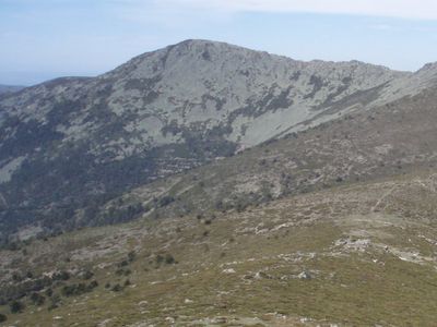
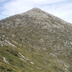
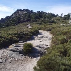
Peña del Oso is a summit in the Sierra de Guadarrama reaching about 2,196 meters (7,205 feet) in Segovia province. The peak rises as a granite formation within the central range, accessible through various trails that wind through the mountain landscape.
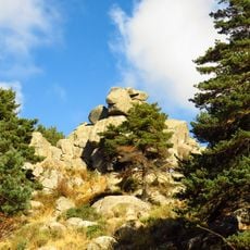
The summit formed from granite geology that has been exploited since past centuries. A quarry on the southern face supplied local communities with stone for buildings and construction throughout history.
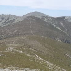
The summit is part of the La Mujer Muerta chain, where the silhouette resembles crossed hands when viewed from the Segovia plain. This visual identity has shaped how locals and visitors perceive the surrounding landscape.
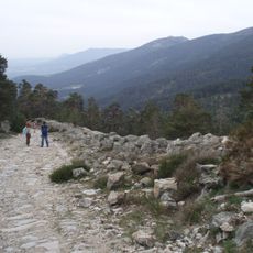
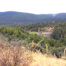
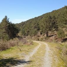
The easiest access starts from Navas de Riofrío, where trails climb through forest and open terrain toward the peak. Weather can shift quickly at this elevation, so sturdy footwear and appropriate clothing help ensure a safe and comfortable hike.
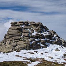
The summit displays a granite sculpture of a bear, a local landmark that catches visitors by surprise. The northern face contains one of the largest boulder fields in the entire mountain range, a geological feature that sets it apart.
GPS coordinates: 40.80415,-4.10418
Latest update: December 14, 2025 17:03
Royal Palace of Riofrío
8.7 km
Palace of Valsain
10.4 km
Fuenfría Roman road
4.1 km
Montón de Trigo
2.8 km
Waterfall of Ducha de los Alemanes
4.7 km
La Pinareja
1.1 km
Cerro de los Almadenes
9.8 km
Alto del Telégrafo
7.9 km
Reservoir of Puente Alta
6.5 km
Sierra Norte de Guadarrama Natural Park
10.3 km
Peñas del Arcipreste de Hita
9.2 km
Church of San Juan Evangelista, La Losa
7.6 km
Centro de Visitantes del Valle de la Fuenfría
5.9 km
Hermitage of Our Lady of Soto, Revenga
8.5 km
Iglesia de San Sebastián, Revenga
7.9 km
Iglesia de San Sebastián, Cercedilla
7.9 km
Town Hall of Los Molinos
10.3 km
Hermitage of San Roque, Otero de Herreros
8.7 km
Bridge of Descalzo
4.5 km
Preserve or Forest of Riofrío
9 km
Residencia de Navacerrada
8.8 km
Iglesia de la Concepción de Nuestra Señora, Los Molinos
10.3 km
Plaza de toros de Cercedilla
8.4 km
Real Sitio de San Ildefonso-El Espinar
1.6 km
Biblioteca Municipal de Cercedilla
8.1 km
Vado de las Cabras dam
1.7 km
Siete Picos
6.5 km
El Espinar Reservoir
1.6 kmVisited this place? Tap the stars to rate it and share your experience / photos with the community! Try now! You can cancel it anytime.
Discover hidden gems everywhere you go!
From secret cafés to breathtaking viewpoints, skip the crowded tourist spots and find places that match your style. Our app makes it easy with voice search, smart filtering, route optimization, and insider tips from travelers worldwide. Download now for the complete mobile experience.
A unique approach to discovering new places❞
— Le Figaro
All the places worth exploring❞
— France Info
A tailor-made excursion in just a few clicks❞
— 20 Minutes