Enable Location

We need your location to show you interesting places around you

Discover nearby places

Find interesting locations and hidden gems around you

Precise directions

Get accurate directions and distances to places

Your location is never shared with other users. It's only used when you tap the location button.

Pont-en-Royans

Log in to your account

Start exploring — it's free

Trusted by 62,407 travelers worldwide

Continue with Google
Continue with Apple
or

We will send you a code to connect

By continuing, you accept our Terms and Conditions and our Privacy Policy

Check your inbox

We've sent a pincode in your inbox. Please enter the code below.

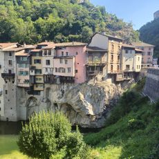
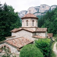
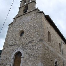
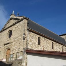
Pont-en-Royans, Medieval commune in Isère, France

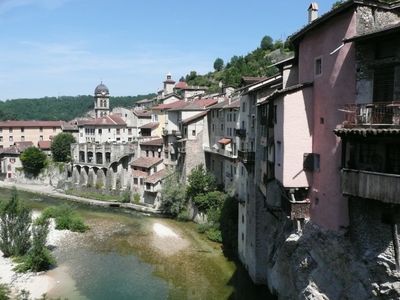
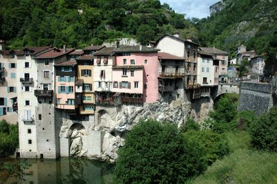
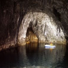
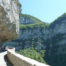
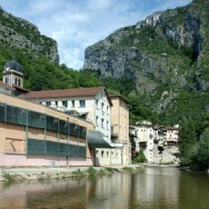
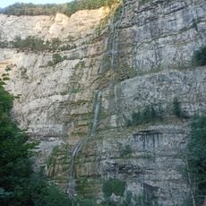
Pont-en-Royans is a commune at the gateway to the Vercors Regional Natural Park where the Bourne and Vernaison rivers converge at approximately 210 meters elevation. Houses in the settlement extend directly into the cliff faces along these river courses.

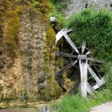
In the sixteenth century, local residents built multi-level houses directly into the cliff faces along the Bourne river. This distinctive construction approach emerged from the need to create living spaces in this mountainous terrain.

The Water Museum showcases an international collection of around 900 different water bottles and teaches visitors about water resources through interactive displays and demonstrations.

The best time to explore is during fair weather, as the rock paths and walkways can become slippery. The settlement is easily navigable on foot and offers several natural rest spots overlooking the rivers.

The houses rest on wooden beams and stone foundations integrated directly into the natural rock formations. This unusual construction method allows them to overhang the river and nearly touch the water below.

The community of curious travelers

AroundUs brings together thousands of curated places, local tips, and hidden gems, enriched daily by 60,000 contributors worldwide.

Start exploring
Location
Elevation above the sea
404 m
Shares border with
Sainte-Eulalie-en-Royans, Auberives-en-Royans, Châtelus, Choranche, Saint-André-en-Royans
Address
38680 Pont-en-Royans, France
Phone
GPS coordinates
45.06306,5.34278
Latest update
December 6, 2025 16:02
Natural and cultural spots in Auvergne-Rhône-Alpes

The Auvergne-Rhône-Alpes region offers a mix of nature and history. Walking paths lead through valleys and past waterfalls, while medieval castles stand on hilltops and ridges. Volcanic peaks rise from the landscape, and caves open into the earth below. You will find the Massif Central, alpine...

« Pont-en-Royans - Medieval commune in Isère, France » is provided by Around Us (aroundus.com). Images and texts are derived from Wikimedia project under a Creative Commons license. You are allowed to copy, distribute, and modify copies of this page, under the conditions set by the license, as long as this note is clearly visible.

Discover hidden gems everywhere you go!

From secret cafés to breathtaking viewpoints, skip the crowded tourist spots and find places that match your style. Our app makes it easy with voice search, smart filtering, route optimization, and insider tips from travelers worldwide. Download now for the complete mobile experience.

Around Us App Screenshot

A unique approach to discovering new places

Le Figaro

All the places worth exploring

France Info

A tailor-made excursion in just a few clicks

20 Minutes

Around Us
Travel Guide & Maps
Download

Send to your phone

QR Code
1

Open the camera app on your mobile.

2

Point at the QR code with your camera. A notification will appear.

3

Tap the notification to open the link.