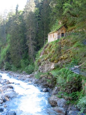
Bon-Nant, Mountain creek in Les Contamines-Montjoie, France
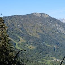
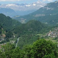
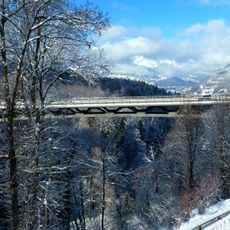
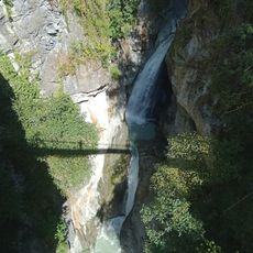
Bon-Nant is a mountain creek that originates from Col du Bonhomme and flows through the Montjoie Valley, carving natural gorges along its path. The waterway eventually merges with the Arve river near Saint-Gervais-les-Bains after passing through various points in the landscape.
The name 'Nant' comes from Savoie regional naming traditions where it refers to mountain torrents documented during geographical surveys. This naming convention shaped how water features in the Alps were identified and recorded across the region.
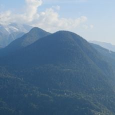
The creek marks a natural boundary between two mountain massifs and holds meaning for local communities who use its banks for daily walks and outdoor activities. The pedagogical trail with interpretive stations reflects how the place teaches visitors about the region's natural and cultural heritage.
Visitors can use wheelchair-accessible paths that run along the creek's left bank, with facilities including restrooms located near the tourist office in the area. Rest stops are spaced along the walking route, allowing people to take breaks comfortably.
The creek powers hydroelectric installations while also maintaining populations of Fario trout in its waters. This dual purpose shows how energy generation and natural ecosystems coexist in this location.
Location: Les Contamines-Montjoie
Location: Saint-Gervais-les-Bains
Location: Passy
GPS coordinates: 45.91222,6.70000
Latest update: December 14, 2025 16:46
Mont Blanc Tramway
5.1 km
Église Notre-Dame de Toute Grâce du Plateau d'Assy
3.1 km
Égratz Viaduct
2.4 km
Thermes de Saint Gervais Mont-Blanc
1.8 km
Sanatorium Martel de Janville
3.9 km
Église Saint-Nicolas de Combloux
4.8 km
Église Saint-Gervais de Saint-Gervais-les-Bains
2.4 km
Chapelle des Chattrix
3.5 km
Le Prarion
4.4 km
Hôtel du Mont-Joly
2 km
Petit Train du Parc Thermal
1.3 km
Inscription romaine du col de la Forclas
1.4 km
Tête Noire
3.4 km
Granges de Passy
2.3 km
Montagne des Gures
4 km
Église Saint-André de Domancy
4 km
Chapelle de Bay
2.8 km
Chapelle Saint-Guérin de Saint-Gervais-les-Bains
2.5 km
Ferme à Isidore de Combloux
4.6 km
Viaduc de Saint-Gervais
2.2 km
Cascade de Crépin
2.2 km
Église Saint-Joseph de Chedde
2.4 km
Temple de la Vignette
2.2 km
Chapelle de Vaudagne
4.8 km
Chapelle Notre-Dame-du-Mont-Carmel, Saint-Symphorien, Saint-Antoine-de-Padoue de la Combe
4.6 km
Maison forte de Hautetour
2.4 km
Chalets de Varan
3.8 km
Chemin du Désert de Platé
4.5 kmVisited this place? Tap the stars to rate it and share your experience / photos with the community! Try now! You can cancel it anytime.
Discover hidden gems everywhere you go!
From secret cafés to breathtaking viewpoints, skip the crowded tourist spots and find places that match your style. Our app makes it easy with voice search, smart filtering, route optimization, and insider tips from travelers worldwide. Download now for the complete mobile experience.
A unique approach to discovering new places❞
— Le Figaro
All the places worth exploring❞
— France Info
A tailor-made excursion in just a few clicks❞
— 20 Minutes