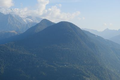
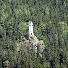
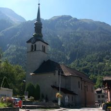
Tête Noire, Mountain summit in Passy and Les Houches, France.
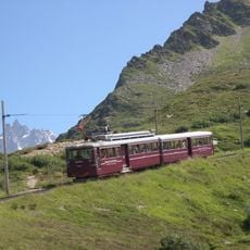
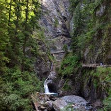
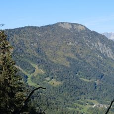
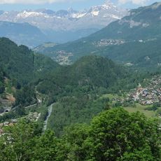
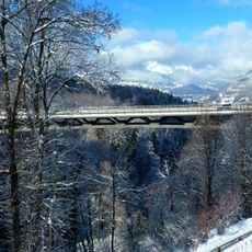
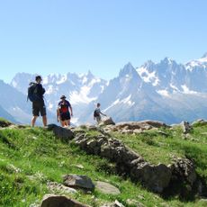
Tête Noire is a mountain summit in Passy and Les Houches that rises to 1,746 meters and offers views of the Mont Blanc massif and the Arve Valley below. Multiple marked trails cross the mountain's flanks, including the GRP Tour du Pays du Mont-Blanc, with access points available from both settlements.
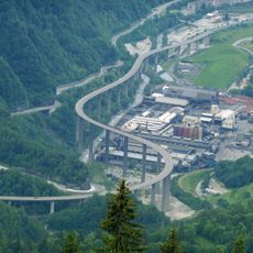
The mountain functioned as a natural boundary between valleys until roads connected the area during the 1800s. These transport improvements during the Second Empire period transformed how the two communities related to one another.
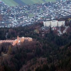
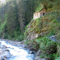
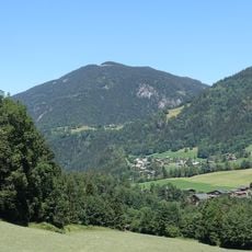
The forested slopes remain largely free of tourist facilities, keeping the area as a natural Alpine space. This preservation of the landscape reflects how locals value the mountain as part of their everyday environment rather than a destination.
The mountain is most accessible during warmer months when the marked trails are in good condition. Sturdy footwear and a hiking map are recommended since while trails are marked, they can be demanding in this Alpine setting.
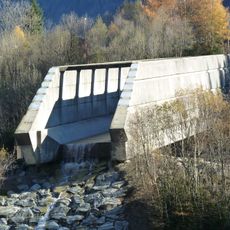
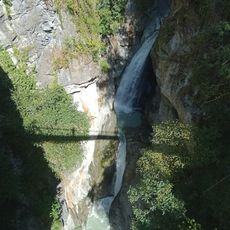
A hydroelectric pipeline runs through the mountain to supply a power plant at its base. This hidden system demonstrates how the region has used water power for generations without visibly transforming the landscape.
Location: Passy
Location: Les Houches
Elevation above the sea: 1,746 m
GPS coordinates: 45.90796,6.74330
Latest update: December 14, 2025 20:27
Mont Blanc Tramway
2.9 km
Église Notre-Dame de Toute Grâce du Plateau d'Assy
4.3 km
Lac Vert
4.7 km
Statue of Christ the King
4.6 km
Égratz Viaduct
1.8 km
Thermes de Saint Gervais Mont-Blanc
3.2 km
Sanatorium Martel de Janville
4.6 km
Bon-Nant
3.4 km
Gorges de la Diosaz
4.7 km
Église Saint-Gervais de Saint-Gervais-les-Bains
3 km
Chapelle des Chattrix
3.5 km
Le Prarion
1.6 km
Hôtel du Mont-Joly
2.8 km
Petit Train du Parc Thermal
3 km
Inscription romaine du col de la Forclas
2.1 km
River bridge of la Griaz
4.6 km
Montagne des Gures
2.6 km
Chapelle Saint-Guérin de Saint-Gervais-les-Bains
4 km
Tête de la Charme
3 km
Viaduc de Saint-Gervais
3.1 km
Cascade de Crépin
3.1 km
Tour Du Mont Blanc
4.8 km
Église Saint-Joseph de Chedde
2.7 km
Église Saint-Jean-Baptiste des Houches
4.7 km
Temple de la Vignette
2.7 km
Chapelle de Vaudagne
1.4 km
Chapelle Notre-Dame-du-Mont-Carmel, Saint-Symphorien, Saint-Antoine-de-Padoue de la Combe
5 km
Maison forte de Hautetour
2.9 kmVisited this place? Tap the stars to rate it and share your experience / photos with the community! Try now! You can cancel it anytime.
Discover hidden gems everywhere you go!
From secret cafés to breathtaking viewpoints, skip the crowded tourist spots and find places that match your style. Our app makes it easy with voice search, smart filtering, route optimization, and insider tips from travelers worldwide. Download now for the complete mobile experience.
A unique approach to discovering new places❞
— Le Figaro
All the places worth exploring❞
— France Info
A tailor-made excursion in just a few clicks❞
— 20 Minutes