Pierre Blanche, Mountain summit in Vercors region, France
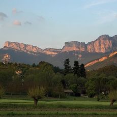
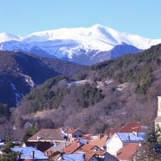
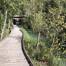
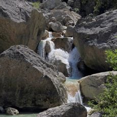
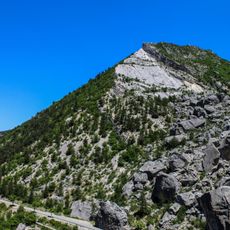
Pierre Blanche is a mountain summit in the Vercors massif standing at 1336 meters, rising above the southeastern mountain landscape of France. The terrain is shaped by limestone cliffs and alpine meadows that spread across multiple elevation zones.
The Vercors massif where Pierre Blanche stands became an important center for French Resistance operations during World War II. The mountain mass provided shelter and served as a base for underground activities against occupation.
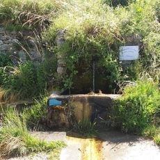
Traditional sheep grazing shapes the mountain landscape today, with local herders using seasonal pastures on the slopes.
Hiking to the summit requires proper mountain gear, water supplies, and checking weather conditions beforehand. Winter months bring snow and ice that make sections more difficult and require extra caution.
The white limestone formations at the summit created natural rock shelters that provide refuge for many alpine plants and rare species. These stone structures help adapted plants survive in this high-elevation environment.
Elevation above the sea: 1,336 m
GPS coordinates: 44.60444,5.58528
Latest update: December 15, 2025 13:23
Cirque d'Archiane
17 km
Jocou
14.2 km
Monastère de la Dormition-de-la-Mère-de-Dieu à La Faurie
12.7 km
Cadran solaire du col de Cabre
6.2 km
Le Marais des Bouligons
7.3 km
Église saints Pierre et Paul (Glandage)
9.3 km
Le Saut de la Drôme
9.8 km
Église Saints-Pierre-et-Paul de Saint-Pierre-d'Argençon
13 km
Église Saint-Pierre de Bellegarde-en-Diois
14.5 km
Église Saint-Pierre-aux-Liens-et-Notre-Dame d'Aspremont
17 km
Église de Montmorin
17.3 km
Église Saint-Géraud d'Aspres-sur-Buëch
15.9 km
Église Saint-Blaise de Saint-Julien-en-Beauchêne
10 km
Église Saint-Julien de Châtillon-en-Diois
12.8 km
Église Saint-Laurent de Miscon
5.6 km
Église Saint-Roman de Saint-Roman
15.5 km
Église Saint-André de Jonchères
14.8 km
Église Sainte-Anne de Montlaur-en-Diois
12.9 km
Église Saint-Jean-Baptiste de Grimone
11 km
Piscine municipale
12.6 km
Sources de la Drôme
11 km
Viaduc du Claps
10.2 km
Temple d'Establet
16.1 km
Église de la Sainte-Vierge de Luc-en-Diois
10.7 km
Pic de Luc
9.6 km
Temple de Luc-en-Diois
10.5 km
Temple de Poyols
13.1 km
Temple de Beaurières
4.1 kmVisited this place? Tap the stars to rate it and share your experience / photos with the community! Try now! You can cancel it anytime.
Discover hidden gems everywhere you go!
From secret cafés to breathtaking viewpoints, skip the crowded tourist spots and find places that match your style. Our app makes it easy with voice search, smart filtering, route optimization, and insider tips from travelers worldwide. Download now for the complete mobile experience.
A unique approach to discovering new places❞
— Le Figaro
All the places worth exploring❞
— France Info
A tailor-made excursion in just a few clicks❞
— 20 Minutes