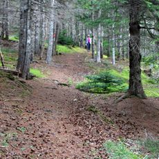
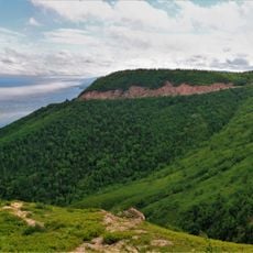
Skyline Trail, Hiking trail in Cape Breton Highlands National Park, Nova Scotia, Canada.
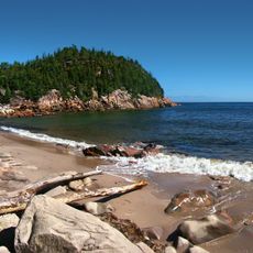
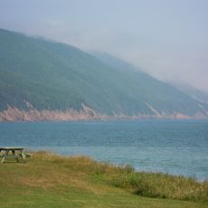
Skyline Trail runs roughly 7.5 kilometers through Cape Breton Highlands National Park, linking forested sections with open rock passages along the coast. The route ends at a viewing platform suspended above the Gulf of St. Lawrence, offering sightlines across the open water and surrounding mountain slopes.
The protected area formed in 1936 as one of Canada's first national parks, aiming to preserve the northern highlands wilderness. The hiking route was added later to give visitors access to the coastal cliffs without damaging the fragile plant cover.
Local visitors come during autumn when the hardwoods turn bright colors against the evergreens and the cooler air offers clear views across the water. Families often pause at the wooden platforms to watch seabirds circle below the cliffs and point out distant fishing boats crossing the gulf.
The route works best in dry weather, as wind and fog can reduce visibility and make the wooden walkways slippery. Hikers should start early to allow enough time for the return and take advantage of midday sun for clearer photos.
Whales pass close to shore during summer and can sometimes be seen from the viewpoint when they surface to breathe. Moose cross the path often in the early morning hours, searching for fresh shoots in the damp areas along the route.
The community of curious travelers
AroundUs brings together thousands of curated places, local tips, and hidden gems, enriched daily by 60,000 contributors worldwide.