Enable Location

We need your location to show you interesting places around you

Discover nearby places

Find interesting locations and hidden gems around you

Precise directions

Get accurate directions and distances to places

Your location is never shared with other users. It's only used when you tap the location button.

Strahlhorn

Log in to your account

Start exploring — it's free

Trusted by 61,905 travelers worldwide

Continue with Google
Continue with Apple
or

We will send you a code to connect

By continuing, you accept our Terms and Conditions and our Privacy Policy

Check your inbox

We've sent a pincode in your inbox. Please enter the code below.

Strahlhorn

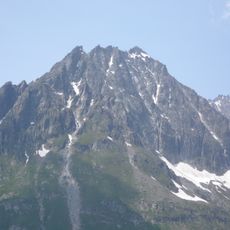
Strahlhorn, Alpine summit in Pennine Alps, Switzerland.

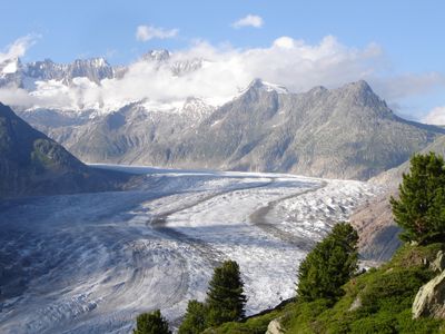
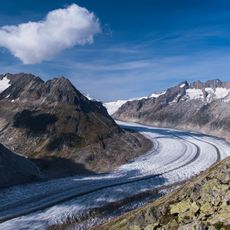
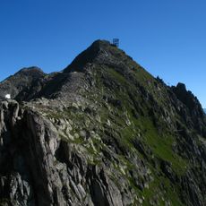
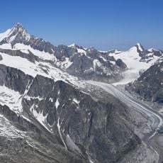
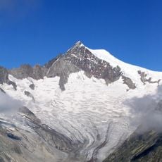
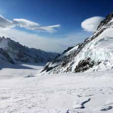
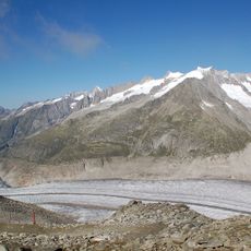
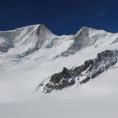
Strahlhorn is an alpine summit rising to 4,190 meters, situated between the Mattertal and Saastal valleys as part of the Mischabel group. The mountain features glaciated terrain and is approached from the Britannia hut, with routes crossing the Allalin Glacier toward the Adler Pass.

The first recorded ascent took place on August 15, 1854, when Edmund Smyth, Ulrich Lauener, and Franz-Josef Andenmatten reached the summit, establishing its mountaineering importance. This early climb marked a turning point in the exploration of this alpine region.

The name comes from the German word 'strahlen', meaning to shine, which describes how light plays across the snow-covered peak. For climbers in the region, this summit has long held importance in local mountaineering traditions.

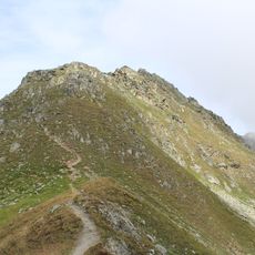
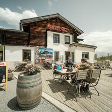
Climbers should carry ice axes and crampons as much of the route crosses glaciated terrain that demands careful movement. Access is through the Britannia hut, which serves as a base for day trips or longer climbing expeditions.

The Adler Pass near the summit served as a crossing point since the 16th century when local residents searched for valuable crystals in high mountain areas. This historical activity shaped the climbing routes used today.

The community of curious travelers

AroundUs brings together thousands of curated places, local tips, and hidden gems, enriched daily by 60,000 contributors worldwide.

Start exploring
GPS coordinates
46.45097,8.09521
Latest update
December 14, 2025 20:02
« Strahlhorn - Alpine summit in Pennine Alps, Switzerland » is provided by Around Us (aroundus.com). Images and texts are derived from Wikimedia project under a Creative Commons license. You are allowed to copy, distribute, and modify copies of this page, under the conditions set by the license, as long as this note is clearly visible.

Discover hidden gems everywhere you go!

From secret cafés to breathtaking viewpoints, skip the crowded tourist spots and find places that match your style. Our app makes it easy with voice search, smart filtering, route optimization, and insider tips from travelers worldwide. Download now for the complete mobile experience.

Around Us App Screenshot

A unique approach to discovering new places

Le Figaro

All the places worth exploring

France Info

A tailor-made excursion in just a few clicks

20 Minutes

Around Us
Travel Guide & Maps
Download

Send to your phone

QR Code
1

Open the camera app on your mobile.

2

Point at the QR code with your camera. A notification will appear.

3

Tap the notification to open the link.