Rosbach vor der Höhe, Urban municipality in Wetteraukreis, Germany
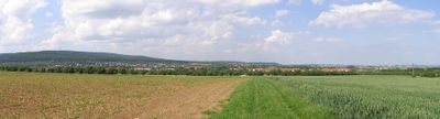
Rosbach vor der Höhe is a town situated between the Taunus mountains and open countryside, roughly 25 kilometers north of Frankfurt am Main. The area spreads across gently rolling terrain with fields and villages that shape its rural character.
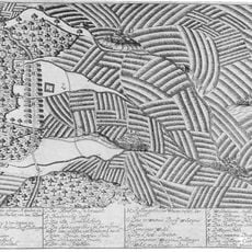
The settlement was first documented in 884 when Emperor Charles the Fat granted the territory to Fulda monastery. This made the place an important possession under monastic administration during the early medieval period.
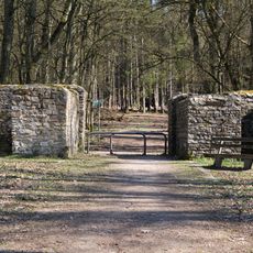
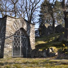
The reconstructed Kapersburg Roman fort, part of the UNESCO World Heritage Limes Germanicus, shows how this place served as a frontier post centuries ago. Visitors can walk through the remains and understand how soldiers once guarded this border between the Roman Empire and Germanic lands.
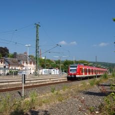
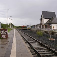
A weekly farmers market takes place on Fridays from 3 PM to 7 PM with products from local growers. The car is the most convenient way to reach the area, though rail connections also link it to Frankfurt and surrounding cities.
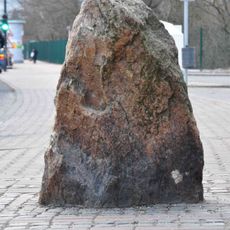
Between 1850 and 1926, manganese ore was mined and processed in this area, driving technological advancement in the region. This mining past has left traces in the landscape and local heritage that visitors can still discover today.
Location: Wetteraukreis
Inception: 1970
Elevation above the sea: 178 m
Shares border with: Karben, Wöllstadt
Website: https://rosbach-hessen.de
GPS coordinates: 50.29861,8.70056
Latest update: December 7, 2025 10:01
Frankfurt Germany Temple
6.2 km
Christoph 2
4.5 km
Castra of Kapersburg
4.8 km
Friedrichsdorf station
6.5 km
Waldfriedhof (Bad Homburg vor der Höhe)
8 km
Robert-Blum-Denkmal
5.9 km
Gedächtniskirche
9.4 km
Schnepfenburg
5.9 km
Rosbach vor der Höhe station
83 m
Wasserburg Nieder-Rosbach
663 m
Kriegerdenkmal am Rabenstein
9 km
Jüdischer Friedhof Seulberg
7.9 km
Brendelburg
6.5 km
Gluckenstein
9.7 km
Heimatmuseum Seulberg
7 km
Evangelische Kirche Rodheim
3.7 km
Am Schwesternhaus 2 (Kirdorf)
9.3 km
Saint Martin Church
6.2 km
Solmsscher Hof
6.2 km
Evangelische Pfarrkirche Seulberg
7.1 km
Ehemaliges Gemeindehaus (Petterweil)
6.2 km
Köpperner Straße 101
4.3 km
Kirdorfer Feld bei Bad Homburg
8.7 km
Evangelisches Pfarrhaus (Petterweil)
6.1 km
Naturschutzgebiet Quarzitbruch bei Rosbach
3.1 km
Kirdorfer Feld bei Bad Homburg
8.2 km
Wohnhaus Hugenottenstraße 95
6.2 km
Altes Postamt
6.5 kmVisited this place? Tap the stars to rate it and share your experience / photos with the community! Try now! You can cancel it anytime.
Discover hidden gems everywhere you go!
From secret cafés to breathtaking viewpoints, skip the crowded tourist spots and find places that match your style. Our app makes it easy with voice search, smart filtering, route optimization, and insider tips from travelers worldwide. Download now for the complete mobile experience.
A unique approach to discovering new places❞
— Le Figaro
All the places worth exploring❞
— France Info
A tailor-made excursion in just a few clicks❞
— 20 Minutes