Broich-Speldorfer Wald, Forest park in Mülheim an der Ruhr, Germany
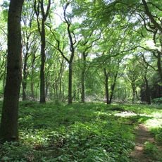
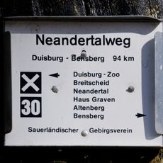
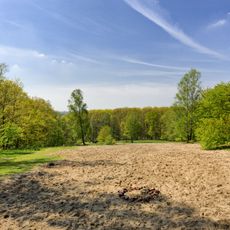
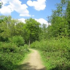
Broich-Speldorfer Wald is a large forest area that spreads across several cities, defined by dense tree coverage and varied terrain. A dense network of paths allows visitors to move through the woodland and reach different parts of the forest.
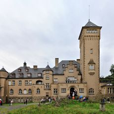
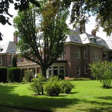
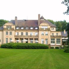
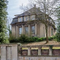
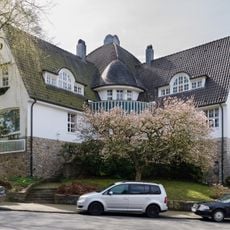
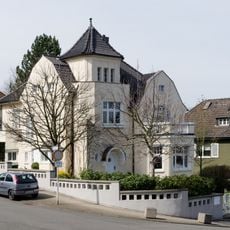
In the early 1900s, the area underwent transformation when wealthy industrial families built their homes here. This development turned the forest into a preferred residential location for those with economic power.
Historic villas scattered through the forest show how wealthy industrial families once lived here. These houses sit among the trees, offering visitors glimpses of how the area was shaped by the prosperity of the past.
The forest can be explored on many different paths that offer varying levels of difficulty and distance. Sturdy footwear and weather-appropriate clothing are practical choices, as the forest floor can be damp and conditions change quickly.
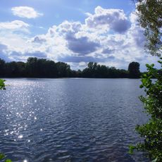
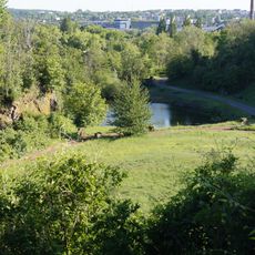
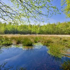
A small stream flows through the forest and creates an isolated water area along its path that many visitors miss. This quiet lake in the middle of the woodland offers an unexpected retreat from the surrounding landscape.
Location: Mülheim an der Ruhr
GPS coordinates: 51.40830,6.82833
Latest update: December 13, 2025 17:02
Haus Hartenfels
2 km
Duisburger Stadtwald
2 km
Wolfsburg
2.1 km
Villa Fritz Thyssen
1.7 km
Expo-Brücke
2.7 km
Haus Küchen
81 m
Fraunhofer Institute for Microelectronic Circuits and Systems
3.2 km
Rangierbahnhof Wedau
2.4 km
Eisenbahnausbesserungswerk Speldorf
3.3 km
Leder- und Gerbermuseum
2.9 km
Masurensee
3.1 km
Steinbruch Rauen
3.2 km
Neandertalweg
3.2 km
Evangelische Kirche an der Wilhelminenstraße
3.3 km
Lederfabrik Carl Abel
2.9 km
St. Gabriel
3.2 km
Lutherkirche (Speldorf)
2.5 km
St. Michael
2.1 km
Wambachtal und Oembergmoor
2.3 km
Hangquellen an der Tannenstraße
1.4 km
Brohler Villa
2.6 km
Prinzenhöhe 26, Mülheim
2.6 km
Prinzenhöhe 14, Mülheim
2.7 km
Hansastraße 19, Mülheim
2.7 km
Christuskirche Mülheim-Saarn
2 km
LSG-Nachtigallentat und Scheuerbachtal
1.2 km
Landschaftsschutzgebiet Duisburger Stadtwald mit den Bereichen Witzberg, Monning, Wolfsberg, Am Stein, Eselsbruch, Nachtigallental, Uhlenhorst
2 km
St. Joseph's Church
3.1 kmVisited this place? Tap the stars to rate it and share your experience / photos with the community! Try now! You can cancel it anytime.
Discover hidden gems everywhere you go!
From secret cafés to breathtaking viewpoints, skip the crowded tourist spots and find places that match your style. Our app makes it easy with voice search, smart filtering, route optimization, and insider tips from travelers worldwide. Download now for the complete mobile experience.
A unique approach to discovering new places❞
— Le Figaro
All the places worth exploring❞
— France Info
A tailor-made excursion in just a few clicks❞
— 20 Minutes