Chest opened
+${chestReward.xp} XP
Explorer
NOUVEAU ×${chestReward.collectible.quantity}
tapez pour fermer
Chest locked

Open chests in the app

Around Us is built for your phone — chests unlock when you walk, explore and capture nearby places.

Enable Location

We need your location to show you interesting places around you

Discover nearby places

Find interesting locations and hidden gems around you

Precise directions

Get accurate directions and distances to places

Your location is never shared with other users. It's only used when you tap the location button.

Log in to your account

Start exploring — it's free

Trusted by 72,939 travelers worldwide

Continue with Google
Continue with Apple
or

We will send you a code to connect

By continuing, you accept our Terms and Conditions and our Privacy Policy

Check your inbox

We've sent a pincode in your inbox. Please enter the code below.

The italian path
Discussion Reviews Photo
2.1k Popularity

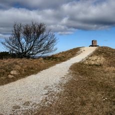
The italian path, Hiking trail in Femmøller, Syddjurs Municipality, Denmark.

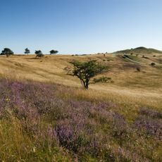
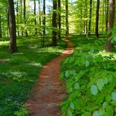
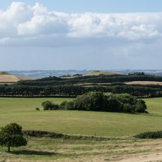
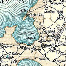
The Italian Path is a hiking trail through Mols Bjerge National Park that winds through valleys, hills, and meadows covered with juniper bushes. The route extends about 3.5 kilometers and connects diverse landscape features in an area known for its rolling terrain.

Karen Blixen, a Danish writer, named the path after perceiving similarities between the landscape and Italian Mediterranean scenes. The area later became a research site for the Natural History Museum of Aarhus, which has worked there since 1941.

The name comes from Karen Blixen, a renowned Danish author who noticed the resemblance between the juniper-covered slopes and Mediterranean coastal views. Visitors today experience the same landscape features that caught her attention.

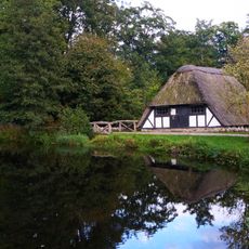
The trail has parking areas and information stations where visitors can get maps and details, along with rest spots distributed along the route. It is advisable to wear comfortable hiking boots and walk the route during daylight, as the hilly sections require some endurance.

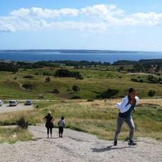
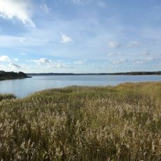
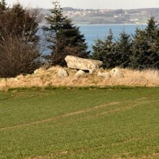
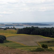
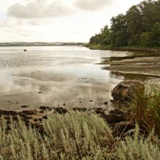
From elevated points like Trehøje and Agri Baunehøj at about 130 meters high, hikers can view the entire heathland and Ebeltoft Vig inlet below. These vantage points offer rare perspectives of the continuous heathland vegetation and coastline in a single view.

The community of curious travelers

AroundUs brings together thousands of curated places, local tips, and hidden gems, enriched daily by 60,000 contributors worldwide.

Start exploring
GPS coordinates
56.22780,10.57320
Latest update
December 14, 2025 09:45
Reviews
Share your experience

No review yet

Discussions
Start a discussion...

No discussion yet

« The italian path - Hiking trail in Femmøller, Syddjurs Municipality, Denmark » is provided by Around Us (aroundus.com). Images and texts are derived from Wikimedia project under a Creative Commons license. You are allowed to copy, distribute, and modify copies of this page, under the conditions set by the license, as long as this note is clearly visible.

Discover hidden gems everywhere you go!

From secret cafés to breathtaking viewpoints, skip the crowded tourist spots and find places that match your style. Our app makes it easy with voice search, smart filtering, route optimization, and insider tips from travelers worldwide. Download now for the complete mobile experience.

Around Us App Screenshot

A unique approach to discovering new places

Le Figaro

All the places worth exploring

France Info

A tailor-made excursion in just a few clicks

20 Minutes

Around Us
Travel Guide & Maps
Download

Send to your phone

QR Code
1

Open the camera app on your mobile.

2

Point at the QR code with your camera. A notification will appear.

3

Tap the notification to open the link.