Chest opened
+${chestReward.xp} XP
Explorer
NOUVEAU ×${chestReward.collectible.quantity}
tapez pour fermer
Chest locked

Open chests in the app

Around Us is built for your phone — chests unlock when you walk, explore and capture nearby places.

Enable Location

We need your location to show you interesting places around you

Discover nearby places

Find interesting locations and hidden gems around you

Precise directions

Get accurate directions and distances to places

Your location is never shared with other users. It's only used when you tap the location button.

Aïn M'lila

Log in to your account

Start exploring — it's free

Trusted by 72,923 travelers worldwide

Continue with Google
Continue with Apple
or

We will send you a code to connect

By continuing, you accept our Terms and Conditions and our Privacy Policy

Check your inbox

We've sent a pincode in your inbox. Please enter the code below.

Aïn M'lila
Discussion Reviews 1 Photos
16.5k Popularity

Aïn M'lila, municipality of Algeria

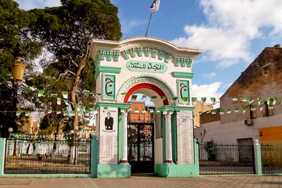
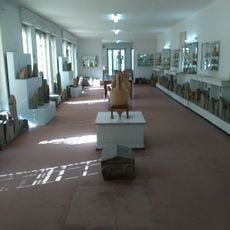
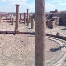
Aïn M'lila is a town in Algeria located in the Oum El Bouaghi region with a long history of settlement. The streetscape features simple buildings made from local materials, with old and new structures standing side by side and reflecting different periods.

The region was once home to the Zemouls, a strong cavalry group who settled here long ago. The town developed into a strategic point between Constantine and Batna and later played a role in the world wars, particularly through a United States military airfield during World War II.

The name means 'the white source' in Arabic, referring to the town's historical connection to water. The community gathers regularly at markets and mosques, where traditions remain active through celebrations, storytelling, and shared daily routines.

The roads and access routes to town are typically in good condition, making it easy to explore by car or bus. The dry landscape with flat terrain offers clear visibility, though summer heat is intense and visitors should bring light clothing and water.

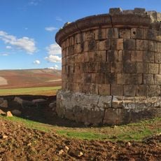
A former United States military airfield was built on a dry, flat lakebed during World War II to support North African campaigns. This unexpected military history in a remote desert region reveals the geopolitical importance of the location over several decades.

The community of curious travelers

AroundUs brings together thousands of curated places, local tips, and hidden gems, enriched daily by 60,000 contributors worldwide.

Start exploring
Elevation above the sea
771 m
GPS coordinates
36.03667,6.57194
Latest update
February 17, 2026 02:00
Reviews
Share your experience

No review yet

Discussions
Start a discussion...

No discussion yet

« Aïn M'lila - municipality of Algeria » is provided by Around Us (aroundus.com). Images and texts are derived from Wikimedia project under a Creative Commons license. You are allowed to copy, distribute, and modify copies of this page, under the conditions set by the license, as long as this note is clearly visible.

Discover hidden gems everywhere you go!

From secret cafés to breathtaking viewpoints, skip the crowded tourist spots and find places that match your style. Our app makes it easy with voice search, smart filtering, route optimization, and insider tips from travelers worldwide. Download now for the complete mobile experience.

Around Us App Screenshot

A unique approach to discovering new places

Le Figaro

All the places worth exploring

France Info

A tailor-made excursion in just a few clicks

20 Minutes

Around Us
Travel Guide & Maps
Download

Send to your phone

QR Code
1

Open the camera app on your mobile.

2

Point at the QR code with your camera. A notification will appear.

3

Tap the notification to open the link.