Tavernes de la Valldigna
Tavernes de la Valldigna, municipality in the Valencian Community
Tavernes de la Valldigna is a municipality in the Province of Valencia, located in the Safor region. It is an administrative unit of the Valencian Community with a compact settlement center that developed in a valley in this part of Mediterranean Spain.
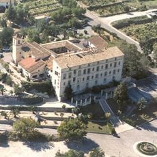
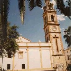
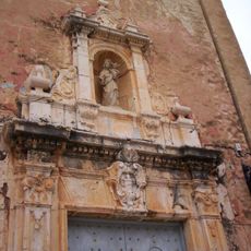
The municipality emerged under the strong influence of the Valldigna monastery, founded in the medieval period nearby, which guided the economic and social development of the region. This heritage shaped the settlement over centuries and remains visible in its basic structure today.
The name comes from the nearby Valldigna monastery and its historical influence on the region. The settlement reflects this monastic connection in its organized layout and shows how deeply religious communities shaped daily life and settlement patterns here.
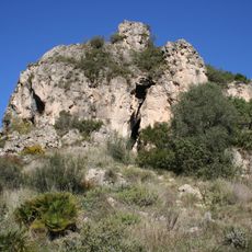
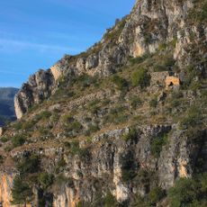
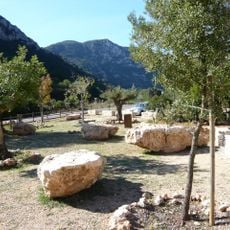
The place is easiest to reach via roads through the Safor valley and offers access to walking routes and the nearby monastery complex. Visitors should bring comfortable footwear, as the area is hilly both within the municipality and on the surrounding slopes.
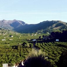
The valley where the municipality sits is known for its orange groves and agricultural traditions that continue to shape the landscape and economic activity today. This rural identity sets it apart clearly from the more touristy coastal towns in the same region.
Location: Province of Valencia
Location: Safor
Capital city: Tavernes de la Valldigna
Elevation above the sea: 15 m
Shares border with: Cullera, Favara, Xeraco, Benifairó de la Valldigna, Alzira
Website: http://tavernes.es
GPS coordinates: 39.07222,-0.26583
Latest update: December 14, 2025 17:21
Monastery of Santa María de la Valldigna
4.8 km
Cova del Parpalló
7.6 km
Cueva de Bolomor
1.9 km
La Murta i la Casella
5.2 km
Monestir de Santa Maria d'Aigües Vives
7.9 km
Restaurante Museo Moto Moto Tapas
9.8 km
Castle of Alfàndec
2.8 km
Marenyet Tower
8.2 km
Platja de l'Auir
8.9 km
Torre de la Vall
4.4 km
Watchtower Xeraco
6.3 km
Platja de Xeraco
6.9 km
La Galiana Campo de Golf
7.8 km
Centre d'interpretació paratge natural Parpalló-Borrell
7.6 km
Chapel of Christ in Calvary
431 m
Castell de Tavernes
822 m
Braç treballador
277 m
Parpalló-Borrell
8.9 km
Mosque of La Xara
4.5 km
Church of Our Lady of the Incarnation
6.2 km
Church of Saint Peter
135 m
Church of Saint John the Evangelist
3.9 km
Church of Saint Anthony the Great
6.4 km
Town hall of Tavernes de la Valldigna
179 m
Church of Saint Vincent of Saragossa
9.9 km
Ermita de la Mare de Déu de Gràcia
4.8 km
Biblioteca Pública Municipal de Cullera
10 km
Biblioteca Pública Municipal de Xeraco
6.1 kmVisited this place? Tap the stars to rate it and share your experience / photos with the community! Try now! You can cancel it anytime.
Discover hidden gems everywhere you go!
From secret cafés to breathtaking viewpoints, skip the crowded tourist spots and find places that match your style. Our app makes it easy with voice search, smart filtering, route optimization, and insider tips from travelers worldwide. Download now for the complete mobile experience.
A unique approach to discovering new places❞
— Le Figaro
All the places worth exploring❞
— France Info
A tailor-made excursion in just a few clicks❞
— 20 Minutes