Tolfa, Mountain commune in Metropolitan City of Rome, Italy
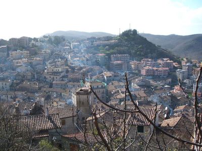
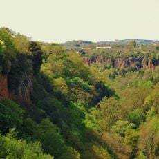
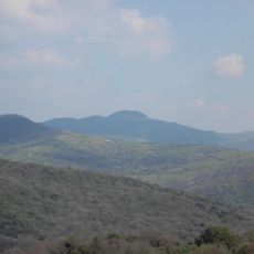
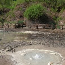
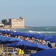
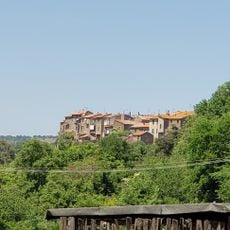
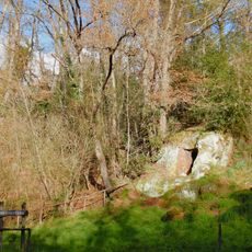
Tolfa is a mountain commune in the Metropolitan City of Rome, situated at about 484 meters in elevation across a series of hills within an extinct volcanic group. The settlement lies between Civitavecchia and Lake Bracciano in a geologically diverse landscape.
The discovery of alunite deposits in 1461 transformed the settlement into an economic hub, as the mineral provided alum essential for the textile industry. This resource became a significant asset for the Papal States.
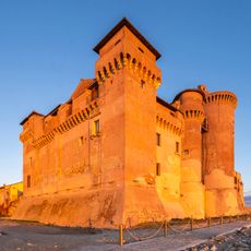
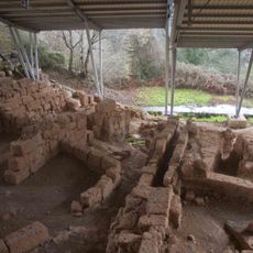
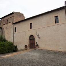
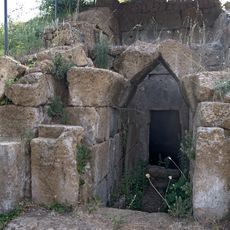
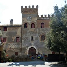
The Town Hall displays collections of Etruscan and Roman antiquities discovered during local archaeological excavations, offering insights into ancient civilizations that once flourished in this region.
Regular bus connections link the town with Civitavecchia and Rome, providing easy access for visitors interested in exploring the mountainous area. The best time to visit is during warmer months when roads and paths are in good condition.
The mineral deposits allowed the Papal States to hold a monopoly on alum production, breaking the Ottoman Empire's control over this valuable resource. This raw material was so sought-after that it shaped the economy of the entire region.
Location: Metropolitan City of Rome
Capital city: Tolfa
Elevation above the sea: 484 m
Shares border with: Allumiere, Blera, Bracciano, Canale Monterano, Cerveteri, Monte Romano, Santa Marinella, Tarquinia, Vejano, Manziana
Website: http://comuneditolfa.it
GPS coordinates: 42.15000,11.93333
Latest update: December 6, 2025 22:04
Santa Severa Castle
15 km
Riserva parziale naturale Monterano
11.8 km
Cencelle
8 km
Luni sul Mignone
8.4 km
Parco regionale Marturanum
15.2 km
Terme Taurine (Civitavecchia)
9.2 km
Palazzo Altieri
16.9 km
San Giovenale
9.9 km
Chiesa di Sant'Egidio
857 m
Tolfaccia
3.6 km
Stigliano botanical gardens
9.6 km
Orioloromano Observatory
17 km
Museo Civico
15 km
Museum of Santa Severa Castle
15.1 km
Monte Elceto
2.6 km
San Lorenzo
18.8 km
Torre Europa
13 km
Antiquitates Centro di Archeologia Sperimentale
10.2 km
Caldara di Manziana
15.3 km
Chiesa di San Giovanni Battista
16.6 km
Frassino meridionale
13.7 km
Parco Kennedy
15 km
Parco di via delle Camelie
13 km
Parco del Pincio
13.1 km
Necropolis of San Giovenale
10.1 km
Castello del Sasso
14.1 km
Castello Torlonia
10.4 km
Necropolis of Grottini di Rota
8.6 kmVisited this place? Tap the stars to rate it and share your experience / photos with the community! Try now! You can cancel it anytime.
Discover hidden gems everywhere you go!
From secret cafés to breathtaking viewpoints, skip the crowded tourist spots and find places that match your style. Our app makes it easy with voice search, smart filtering, route optimization, and insider tips from travelers worldwide. Download now for the complete mobile experience.
A unique approach to discovering new places❞
— Le Figaro
All the places worth exploring❞
— France Info
A tailor-made excursion in just a few clicks❞
— 20 Minutes