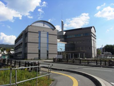
Kumano, town in Aki district, Hiroshima prefecture, Japan
Location: Hiroshima Prefecture
Location: Aki district
Inception: April 1, 1889
Website: https://www.town.kumano.hiroshima.jp/
Shares border with: Hiroshima, Higashihiroshima, Kure, Kaita
Website: https://town.kumano.hiroshima.jp
GPS coordinates: 34.33581,132.58467
Latest update: April 10, 2025 12:34
Skyrail Midorizaka Line
10.3 km
JMSDF Kure Museum
10.8 km
Fudō-in
14.6 km
Kure Portopia Park
8.3 km
灰ヶ峰
7.3 km
廣島單車館
11 km
廣島大學附屬東雲小學、中學
9.5 km
Take-jinja
9.6 km
Irifuneyama Memorial Museum
10.8 km
Kaita Ohashi Bridge
7.6 km
邇保姫神社
10 km
Japan Maritime Self-Defense Force
10.8 km
野呂山スピードパーク
11.2 km
Hijiyama Army Cemetery
11.5 km
中國電力坂運動場
7.5 km
Fudenosato Kōbō
1.2 km
Nagasako Park
9.8 km
坂町立町民交流センター
6.3 km
廣島大橋
8.3 km
Agekurayama Park
8.6 km
Ujina Ōhashi Bridge
9.9 km
Hijiyama Shell Mound
11.3 km
府中出張城
9.4 km
東大橋 (広島市)
10.8 km
Heiwa Bridge
11.1 km
仁保橋 (広島市)
8.9 km
Iwahana Railway bridge
10.6 km
Niko Bridge
10.1 kmReviews
Visited this place? Tap the stars to rate it and share your experience / photos with the community! Try now! You can cancel it anytime.
Discover hidden gems everywhere you go!
From secret cafés to breathtaking viewpoints, skip the crowded tourist spots and find places that match your style. Our app makes it easy with voice search, smart filtering, route optimization, and insider tips from travelers worldwide. Download now for the complete mobile experience.
A unique approach to discovering new places❞
— Le Figaro
All the places worth exploring❞
— France Info
A tailor-made excursion in just a few clicks❞
— 20 Minutes