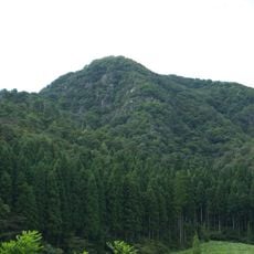
Mount Kanmuri, Mountain on border of Gifu and Fukui Prefectures, Japan.
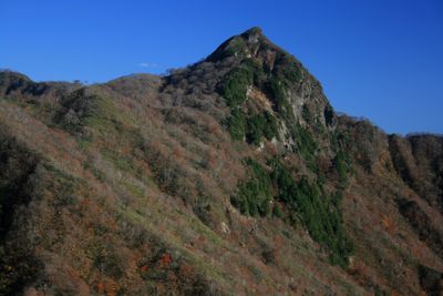
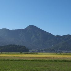
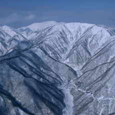
Mount Kanmuri is a mountain on the border between Gifu and Fukui prefectures in Japan, rising to about 1,260 meters (4,130 feet). Dense forest covers both sides of the slopes, which grow steeper as you approach the summit.
A triangulation point was placed on the summit to help define the geographic boundary between the two prefectures. This kind of surveying marker was part of Japan's broader effort to map its regional boundaries during the Meiji era.
The name Kanmuri means ceremonial crown in Japanese, and the shape of the summit is said to resemble that kind of headwear when seen from the valleys below. Hikers who reach the top often take a moment to look back at the landscape and understand why locals chose that name.
The main hiking trail leads to the summit in about two hours and splits near the top into two routes, one toward Kanmuri Flats and one to the peak itself. Sturdy footwear is a good idea, since the path passes through forested terrain with some steep sections.
The summit platform is small enough to fit only around ten people at once, yet it opens up a full 360-degree view over the Ryohaku mountain range. On quieter days, visitors can have this viewpoint almost entirely to themselves.
The community of curious travelers
AroundUs brings together thousands of curated places, local tips, and hidden gems, enriched daily by 60,000 contributors worldwide.