Chest opened
+${chestReward.xp} XP
Explorer
NOUVEAU ×${chestReward.collectible.quantity}
tapez pour fermer

See the monuments around you in AR Open chests in the app

Around Us is built for your phone — point your camera at the streets and discover the monuments and places around you in augmented reality. Around Us is built for your phone — chests unlock when you walk, explore and capture nearby places.

•

Enable Location

We need your location to show you interesting places around you

Discover nearby places

Find interesting locations and hidden gems around you

Precise directions

Get accurate directions and distances to places

Your location is never shared with other users. It's only used when you tap the location button.

Mount Yakeishi

Log in to your account

Start exploring — it's free

Trusted by 93,565 travelers worldwide

Continue with Google
Continue with Apple
or

We will send you a code to connect

By continuing, you accept our Terms and Conditions and our Privacy Policy

Check your inbox

We've sent a pincode in your inbox. Please enter the code below.

Mount Yakeishi, Volcano in Ōshū and Nishiwaga, Iwate, Japan

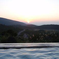
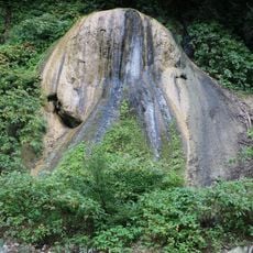
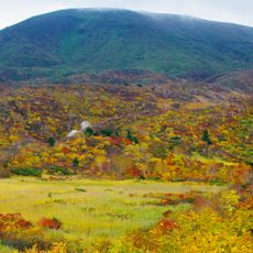
Mount Yakeishi is a 1,548 m volcano on the border of Oshu and Nishiwaga in Iwate Prefecture, the main peak of the Yakeishi Range in the Ōu Mountains and part of Kurikoma Quasi-National Park. Its summit area is covered in dense low green vegetation, with a band of dark grey exposed rock breaking through the middle slope. The mountain body consists of pyroxene andesite, and a first-order triangulation point at the summit marks 1,547.28 m.

Mount Yakeishi is a Quaternary volcano built mainly of pyroxene andesite, the highest point of the Yakeishi Range that also includes Ushigatayama and Komagatake. It has shown no notable activity in recent times. Its summit area holds a first-order triangulation point at 1,547.28 m, and cattle grazing with rainbow trout stocking took place around Yakeishi Pond until about 1993.

The name Yakeishi comes from the burnt-looking stones found near the summit, a reference to the andesite rock that forms the mountain. Cattle were grazed around Yakeishi Pond until about 1993, with up to 140 head at a time, and the herders released rainbow trout into the pond for food; the trout still live there wild.

Trails start from the Ishibuchi Dam side at the Nakanuma trailhead, passing Nakanuma and Uwanuma ponds before the summit; other routes come from Yumoto Onsen via Keizukayama (1,373 m) and Kanmyosui, from Nishiwaga, from the Omoriyama tunnel, and from the third station in Higashinaruse, Akita, which is the shortest approach. The mountain holds heavy lingering snow, so the flower fields below the summit at Ubaishidaira are usually walked from early June into late summer.

The name Yakeishi means something close to burned stone in Japanese, a direct reference to the volcanic origin of the peak that is still readable in its rock formations today. This makes it one of the few mountains in Japan where the name itself tells the story of how it was formed.

The community of curious travelers

AroundUs brings together thousands of curated places, local tips, and hidden gems, enriched daily by 93,565 contributors worldwide.

Start exploring
Location
Location
Elevation above the sea
1,547.7 m
GPS coordinates
39.16370,140.82882
Latest update
October 31, 2026 09:55
Reviews
Share your experience

No review yet

Discussions
Start a discussion...

No discussion yet

« Mount Yakeishi - Volcano in Ōshū and Nishiwaga, Iwate, Japan » is provided by Around Us (aroundus.com). Images and texts are derived from Wikimedia project under a Creative Commons license. You are allowed to copy, distribute, and modify copies of this page, under the conditions set by the license, as long as this note is clearly visible.

Discover hidden gems everywhere you go!

From secret cafés to breathtaking viewpoints, skip the crowded tourist spots and find places that match your style. Our app makes it easy with voice search, smart filtering, route optimization, and insider tips from travelers worldwide. Download now for the complete mobile experience.

Around Us App Screenshot
❝

A unique approach to discovering new places❞

— Le Figaro

❝

All the places worth exploring❞

— France Info

❝

A tailor-made excursion in just a few clicks❞

— 20 Minutes

Around Us
Travel Guide & Maps
Download

Send to your phone

QR Code
1

Open the camera app on your mobile.

2

Point at the QR code with your camera. A notification will appear.

3

Tap the notification to open the link.