Enable Location

We need your location to show you interesting places around you

Discover nearby places

Find interesting locations and hidden gems around you

Precise directions

Get accurate directions and distances to places

Your location is never shared with other users. It's only used when you tap the location button.

Log in to your account

Start exploring — it's free

Trusted by 62,125 travelers worldwide

Continue with Google
Continue with Apple
or

We will send you a code to connect

By continuing, you accept our Terms and Conditions and our Privacy Policy

Check your inbox

We've sent a pincode in your inbox. Please enter the code below.

田蓑橋

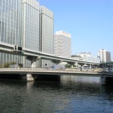
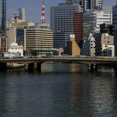
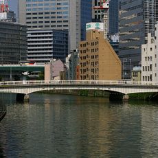
田蓑橋, Steel girder bridge in Kita-ku, Japan.

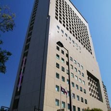
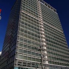
Tamino Bridge is a steel girder structure spanning 82.3 meters in length and 14.7 meters in width across the Dojima River in Osaka's business district. The structure was built with steel deck girders to reduce overall weight while maintaining long-term stability.

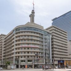
Built in 1965, it replaced an earlier Romanesque structure that had suffered from ground subsidence during the post-war development period. This reconstruction reflects Osaka's modernization after World War II.

The bridge takes its name from the ancient Yasoshima district of Osaka and belongs to a series of five historical bridges crossing the Dojima River. This name ties the current infrastructure to the long-vanished past of the area.

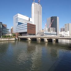
The bridge sits at the intersection of three waterways: the Dojima River, Tosabori River, and the canal system of northern Osaka. This location makes it a useful vantage point for exploring the river landscape in the area.

The structure stands where urban infrastructure meets a complex waterway network that fundamentally shaped Osaka's city layout. This location made it a test case for city planning in an area with historical ground subsidence challenges.

The community of curious travelers

AroundUs brings together thousands of curated places, local tips, and hidden gems, enriched daily by 60,000 contributors worldwide.

Start exploring
Location
Inception
1965
Length
82.3 m
Width
14.7 m
GPS coordinates
34.69372,135.49117
Latest update
December 14, 2025 13:01
« 田蓑橋 - Steel girder bridge in Kita-ku, Japan » is provided by Around Us (aroundus.com). Images and texts are derived from Wikimedia project under a Creative Commons license. You are allowed to copy, distribute, and modify copies of this page, under the conditions set by the license, as long as this note is clearly visible.

Discover hidden gems everywhere you go!

From secret cafés to breathtaking viewpoints, skip the crowded tourist spots and find places that match your style. Our app makes it easy with voice search, smart filtering, route optimization, and insider tips from travelers worldwide. Download now for the complete mobile experience.

Around Us App Screenshot

A unique approach to discovering new places

Le Figaro

All the places worth exploring

France Info

A tailor-made excursion in just a few clicks

20 Minutes

Around Us
Travel Guide & Maps
Download

Send to your phone

QR Code
1

Open the camera app on your mobile.

2

Point at the QR code with your camera. A notification will appear.

3

Tap the notification to open the link.