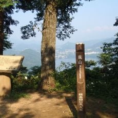
Mt. Rengyo, Mountain summit in Hinode Village, Japan
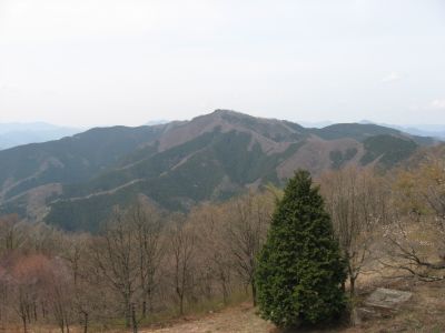
Mt. Rengyo is a mountain summit standing at 1,016 meters (3,333 feet) where three Japanese prefectures meet in central Japan. The peak sits at the convergence of Tokyo, Kanagawa, and Yamanashi, creating a distinctive geographical point.
The summit earned recognition as one of the Tama Hundred Mountains, a collection of peaks that reflects the natural heritage of the Okutama region. This designation highlights how important the mountain landscape is to the area's identity.
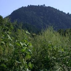
The place is known among hikers for the well-maintained paths that lead to the summit, where visitors encounter traditional tea houses. These establishments are part of the local hiking culture and show how the region has welcomed travelers for generations.
The hike starts in Hinode, where visitors take the train to Fujino Station and then a bus to the Wada stop to reach the trailhead. From there, the climb to the peak takes roughly 2 hours on a marked trail.
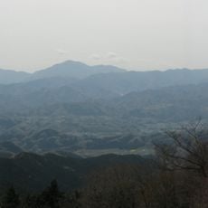
From the peak, hikers can see Mount Fuji on clear days while standing at a point where three prefectures converge. This combination makes the spot memorable for photographers and visitors hoping to experience multiple boundaries in one moment.
The community of curious travelers
AroundUs brings together thousands of curated places, local tips, and hidden gems, enriched daily by 60,000 contributors worldwide.