Chest opened
+${chestReward.xp} XP
Explorer
NOUVEAU ×${chestReward.collectible.quantity}
tapez pour fermer

See the monuments around you in AR Open chests in the app

Around Us is built for your phone — point your camera at the streets and discover the monuments and places around you in augmented reality. Around Us is built for your phone — chests unlock when you walk, explore and capture nearby places.

•

Enable Location

We need your location to show you interesting places around you

Discover nearby places

Find interesting locations and hidden gems around you

Precise directions

Get accurate directions and distances to places

Your location is never shared with other users. It's only used when you tap the location button.

青海橋

Log in to your account

Start exploring — it's free

Trusted by 93,483 travelers worldwide

Continue with Google
Continue with Apple
or

We will send you a code to connect

By continuing, you accept our Terms and Conditions and our Privacy Policy

Check your inbox

We've sent a pincode in your inbox. Please enter the code below.

青海橋

青海橋, Road bridge in Koto, Japan

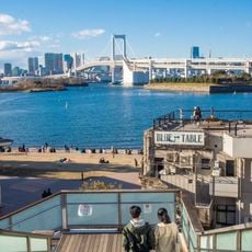
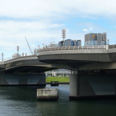
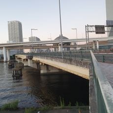
Aomi Bridge is a 240-meter pedestrian bridge over the Ariake-nishi Canal, linking Aomi 1-chome and Ariake 3-chome in Koto ward, Tokyo. Completed in 1986 and erected in March 1987, it has five spans, a maximum span of 55.45 meters, and a width of 14.5 meters. It is closed to all traffic and slated for demolition.

Opened in March 1987 as a construction road linking the No. 10 and No. 13 reclaimed lands, it became a public road in 1991. It was closed in 1994 when the planned World City Expo was to use it as an access route, then reopened in 1997 for pedestrians only. It closed again for 2020 Olympic works and was decommissioned; demolition of the superstructure began in December 2025.

The bridge's name, Aomi, comes from the Aomi district it linked to Ariake. It appeared in the 1991 TV drama 'Fusoroi no Ringo-tachi III' and later in 'Odoru Daisosasen'. Since its closure, the structure has stood unused over the Ariake-nishi Canal, awaiting demolition.

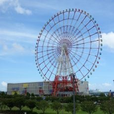
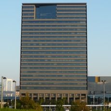
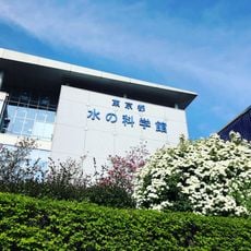
The bridge is closed and cannot be crossed; its deck is scheduled for demolition from December 2025 to March 2027. The nearest station is Tokyo Teleport on the Rinkai Line, about five minutes on foot. The Water Plaza Park, the Tokyo Water Science Museum and the Musashino University Ariake Campus stand nearby.

The structure appeared in the 1991 television drama 'Fusoroi no Ringo-tachi III', becoming part of the visual record of Tokyo's waterfront transformation. It later closed in 2020 in connection with Olympic Games preparations.

The community of curious travelers

AroundUs brings together thousands of curated places, local tips, and hidden gems, enriched daily by 93,483 contributors worldwide.

Start exploring
Location
GPS coordinates
35.62933,139.78372
Latest update
November 1, 2026 04:24
Reviews
Share your experience

No review yet

Discussions
Start a discussion...

No discussion yet

« 青海橋 - Road bridge in Koto, Japan » is provided by Around Us (aroundus.com). Images and texts are derived from Wikimedia project under a Creative Commons license. You are allowed to copy, distribute, and modify copies of this page, under the conditions set by the license, as long as this note is clearly visible.

Discover hidden gems everywhere you go!

From secret cafés to breathtaking viewpoints, skip the crowded tourist spots and find places that match your style. Our app makes it easy with voice search, smart filtering, route optimization, and insider tips from travelers worldwide. Download now for the complete mobile experience.
Around Us App Screenshot
❝

A unique approach to discovering new places❞

— Le Figaro

❝

All the places worth exploring❞

— France Info

❝

A tailor-made excursion in just a few clicks❞

— 20 Minutes

Around Us
Travel Guide & Maps
Download

Send to your phone

QR Code
1

Open the camera app on your mobile.

2

Point at the QR code with your camera. A notification will appear.

3

Tap the notification to open the link.