Chest opened
+${chestReward.xp} XP
Explorer
NOUVEAU ×${chestReward.collectible.quantity}
tapez pour fermer

See the monuments around you in AR Open chests in the app

Around Us is built for your phone — point your camera at the streets and discover the monuments and places around you in augmented reality. Around Us is built for your phone — chests unlock when you walk, explore and capture nearby places.

•

Enable Location

We need your location to show you interesting places around you

Discover nearby places

Find interesting locations and hidden gems around you

Precise directions

Get accurate directions and distances to places

Your location is never shared with other users. It's only used when you tap the location button.

Kōrankei

Log in to your account

Start exploring — it's free

Trusted by 94,490 travelers worldwide

Continue with Google
Continue with Apple
or

We will send you a code to connect

By continuing, you accept our Terms and Conditions and our Privacy Policy

Check your inbox

We've sent a pincode in your inbox. Please enter the code below.

Kōrankei

Kōrankei, Natural canyon in Toyota, Japan

Kōrankei is a river canyon in Aichi Prefecture with around 4,000 maple trees lining the banks of the Tomoe River. The trees reflect in the water below, creating natural color patterns that shift with the seasons, especially as autumn leaves change.

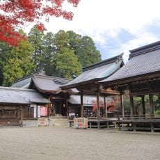
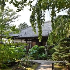
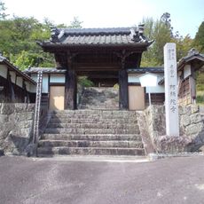
Kōrankei's maples trace back to 1634, when Kazuhisa Sanei, 11th head priest of Kōjakuji Temple, is said to have planted maples and cedars along the approach from the Tomoe River to the temple. Residents later added many more trees, and a walking path was built along the north side of the valley. The Taigetsukyō bridge, named in 1953, was rebuilt three times before the current span was completed in 2007.

The site holds an annual maple festival each November that brings together traditional ceremonies and local performances for visitors to experience. These celebrations show how deeply the region connects its identity with the autumn foliage.

Access is by Meitetsu bus from Higashi-Okazaki Station (about 65–70 minutes) or Toyotashi Station (about 50 minutes), or by car via the Chikaraishi Interchange on Route 153. During the November Momiji Festival, heavy traffic builds on National Route 153 through central Asuke, especially on Sundays and holidays; the Asuke Bypass, partly opened in 2008, lets cars skirt the centre.

The maple trees are said to have been planted in 1634 by Kazuhisa Sanei, the 11th head priest of Kōjakuji Temple, along the approach from the Tomoe River; residents later added many more, and 11 different maple varieties are said to grow here.

The community of curious travelers

AroundUs brings together thousands of curated places, local tips, and hidden gems, enriched daily by 94,490 contributors worldwide.

Start exploring
GPS coordinates
35.13184,137.31337
Latest update
November 1, 2026 05:14
Reviews
Share your experience

No review yet

Discussions
Start a discussion...

No discussion yet

« Kōrankei - Natural canyon in Toyota, Japan » is provided by Around Us (aroundus.com). Images and texts are derived from Wikimedia project under a Creative Commons license. You are allowed to copy, distribute, and modify copies of this page, under the conditions set by the license, as long as this note is clearly visible.

Discover hidden gems everywhere you go!

From secret cafés to breathtaking viewpoints, skip the crowded tourist spots and find places that match your style. Our app makes it easy with voice search, smart filtering, route optimization, and insider tips from travelers worldwide. Download now for the complete mobile experience.

Around Us App Screenshot
❝

A unique approach to discovering new places❞

— Le Figaro

❝

All the places worth exploring❞

— France Info

❝

A tailor-made excursion in just a few clicks❞

— 20 Minutes

Around Us
Travel Guide & Maps
Download

Send to your phone

QR Code
1

Open the camera app on your mobile.

2

Point at the QR code with your camera. A notification will appear.

3

Tap the notification to open the link.