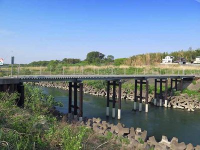
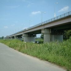
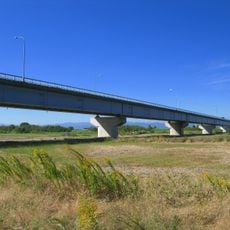
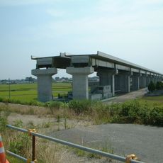
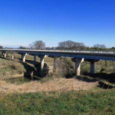
高尾橋, Concrete bridge in Fukaya, Japan.
Takaohashi Bridge is a concrete structure in Fukaya that crosses a waterway to connect both sides of the local area. It features separate lanes for vehicles and pedestrians, handling daily traffic between residential neighborhoods and nearby industrial zones.
The bridge was built in the late 20th century to handle growing transportation demands in Fukaya's industrial area. It became part of the infrastructure expansion that modernized the city and supported its economic development.
The bridge represents Japanese engineering principles of functionality and simplicity, integrating with the surrounding industrial landscape of Fukaya.
The bridge is easily accessible from both sides as it connects directly to local roads. Pedestrians should use the designated pathways, especially during busy hours when vehicle traffic is heavy.
The bridge structure incorporates specific reinforcement techniques developed for the soil conditions of the Saitama Prefecture region.
The community of curious travelers
AroundUs brings together thousands of curated places, local tips, and hidden gems, enriched daily by 60,000 contributors worldwide.