Chest opened
+${chestReward.xp} XP
Explorer
NOUVEAU ×${chestReward.collectible.quantity}
tapez pour fermer
Chest locked

Open chests in the app

Around Us is built for your phone — chests unlock when you walk, explore and capture nearby places.

Enable Location

We need your location to show you interesting places around you

Discover nearby places

Find interesting locations and hidden gems around you

Precise directions

Get accurate directions and distances to places

Your location is never shared with other users. It's only used when you tap the location button.

Zheleznogorsk-Ilimsky

Log in to your account

Start exploring — it's free

Trusted by 73,051 travelers worldwide

Continue with Google
Continue with Apple
or

We will send you a code to connect

By continuing, you accept our Terms and Conditions and our Privacy Policy

Check your inbox

We've sent a pincode in your inbox. Please enter the code below.

Zheleznogorsk-Ilimsky
Discussion Reviews 1 Photos
27.6k Popularity

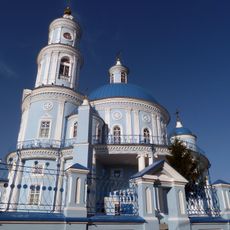
Zheleznogorsk-Ilimsky, Mining settlement in Nizhneilimsky District, Russia.

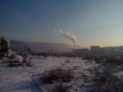
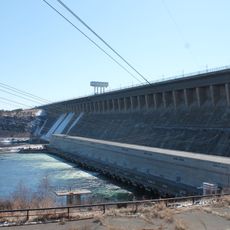
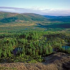
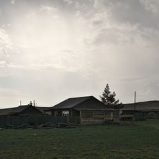
Zheleznogorsk-Ilimsky is a mining town in Irkutsk Oblast in southern Siberia, located on a plateau surrounded by taiga forest. The town developed around a large iron ore processing facility that remains the core of the local economy.

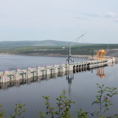
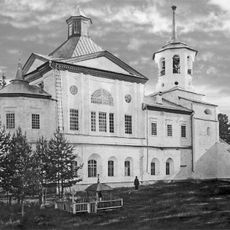
The settlement began in 1948 following the discovery of iron ore deposits at Zheleznaya Gora and was initially called Korshunikha after a prospector. Industrial development brought the construction of the ore processing facility and eventually the name change.

The name Zheleznogorsk comes from the town's iron mining heritage, with the suffix Ilimsky added to distinguish it from other Russian towns. Visitors can still see how the community developed around this mining industry and how it shaped the town's identity.

The town connects to rail networks through Korshunikha-Angarskaya station on the Baikal-Amur Mainline and has road connections to nearby cities. Visitors should be prepared for a harsh climate and the remoteness from major urban centers.

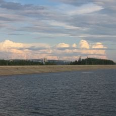
The town sits on the Baikal-Amur Mainline, one of the world's longest railway routes running through some of Siberia's wildest regions. This rail junction became a key supply hub for remote areas of northern Siberia.

The community of curious travelers

AroundUs brings together thousands of curated places, local tips, and hidden gems, enriched daily by 60,000 contributors worldwide.

Start exploring
Location
Железногорское муниципальное образование
Inception
1948
Elevation above the sea
430 m
GPS coordinates
56.58333,104.11667
Latest update
December 20, 2025 13:29
Around this place
Lake Baikal
Russian Federation

Lake Baikal

441.6 km
Barguzin Nature Reserve
Russian Federation

Barguzin Nature Reserve

428.9 km
Bratsk Hydroelectric Power Station
Russian Federation

Bratsk Hydroelectric Power Station

147.2 km
Bratsk Reservoir
Russian Federation

Bratsk Reservoir

150.4 km
Baikal-Lena nature reserve
Russian Federation

Baikal-Lena nature reserve

354.6 km
Venus figurines of Mal'ta
Russian Federation

Venus figurines of Mal'ta

419.2 km
Alexandrovsky Central
Russian Federation

Alexandrovsky Central

421.7 km
Church of the Theotokos of Kazan
Russian Federation

Church of the Theotokos of Kazan

433.4 km
Ust-Ilimsk Reservoir
Russian Federation

Ust-Ilimsk Reservoir

143.9 km
Boguchanskoye Reservoir
Russian Federation

Boguchanskoye Reservoir

377.9 km
Мемориал Славы (Братск)
Russian Federation

Мемориал Славы (Братск)

159.5 km
Troitsky monastery
Russian Federation

Troitsky monastery

275.4 km
Frolikha Adventure Coastline Track
Russian Federation

Frolikha Adventure Coastline Track

380.2 km
Hanhoi
Russian Federation

Hanhoi

429 km
Russian Federation

Бурински Дача

306.1 km
Ice cave on Olkhon island
Russian Federation

Ice cave on Olkhon island

429.2 km
Воскресенский собор (Верхоленск)
Russian Federation

Воскресенский собор (Верхоленск)

291.7 km
Большелихачевски
Russian Federation

Большелихачевски

307.4 km
Большерастягаевски
Russian Federation

Большерастягаевски

321 km
Улан-Нур
Russian Federation

Улан-Нур

445.9 km
Памятник политкаторжанам в Ангарске
Russian Federation

Памятник политкаторжанам в Ангарске

450 km
Верхнеокинский
Russian Federation

Верхнеокинский

390.3 km
Борови
Russian Federation

Борови

328 km
Бахвалово
Russian Federation

Бахвалово

399.8 km
Вантеевская
Russian Federation

Вантеевская

386.7 km
Участок Благодатний
Russian Federation

Участок Благодатний

369.1 km
Oktyabrisky
Russian Federation

Oktyabrisky

317.9 km
Верхний
Russian Federation

Верхний

374.5 km
Show the full map
Reviews
Share your experience

No review yet

Discussions
Start a discussion...

No discussion yet

« Zheleznogorsk-Ilimsky - Mining settlement in Nizhneilimsky District, Russia » is provided by Around Us (aroundus.com). Images and texts are derived from Wikimedia project under a Creative Commons license. You are allowed to copy, distribute, and modify copies of this page, under the conditions set by the license, as long as this note is clearly visible.

Discover hidden gems everywhere you go!

From secret cafés to breathtaking viewpoints, skip the crowded tourist spots and find places that match your style. Our app makes it easy with voice search, smart filtering, route optimization, and insider tips from travelers worldwide. Download now for the complete mobile experience.

Around Us App Screenshot

A unique approach to discovering new places

Le Figaro

All the places worth exploring

France Info

A tailor-made excursion in just a few clicks

20 Minutes

Around Us
Travel Guide & Maps
Download

Send to your phone

QR Code
1

Open the camera app on your mobile.

2

Point at the QR code with your camera. A notification will appear.

3

Tap the notification to open the link.